J
Seller's Agent in 2024
Jessica Nettleton
By the Bay Realty
(715) 682-7337
31 Total Sales
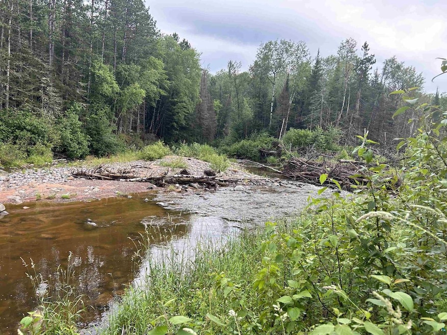
Perfect get-a-way or building site! Building site had a cabin that was torn down. There is septic, electricity and a well at site. DNR owns the land to the east.
| Date | Type | Sale Price | Title Company |
|---|---|---|---|
| Warranty Deed | $55,000 | Choice Title |
| Date | Event | Price | Change | Sq Ft Price |
|---|---|---|---|---|
| 09/06/2024 09/06/24 | Sold | $55,000 | -8.8% | -- |
| 08/21/2024 08/21/24 | Pending | -- | -- | -- |
| 07/07/2024 07/07/24 | For Sale | $60,300 | -- | -- |
| Year | Tax Paid | Tax Assessment Tax Assessment Total Assessment is a certain percentage of the fair market value that is determined by local assessors to be the total taxable value of land and additions on the property. | Land | Improvement |
|---|---|---|---|---|
| 2024 | $223 | $12,900 | $6,900 | $6,000 |
| 2023 | $623 | $34,600 | $6,900 | $27,700 |
| 2022 | $520 | $34,600 | $6,900 | $27,700 |
| 2021 | $550 | $34,600 | $6,900 | $27,700 |
| 2020 | $541 | $34,600 | $6,900 | $27,700 |
| 2019 | $546 | $34,600 | $6,900 | $27,700 |
| 2018 | $528 | $34,600 | $6,900 | $27,700 |
| 2017 | $539 | $34,600 | $6,900 | $27,700 |
| 2016 | $671 | $34,600 | $6,900 | $27,700 |
| 2015 | $589 | $34,600 | $6,900 | $27,700 |
| 2013 | $613 | $34,600 | $6,900 | $27,700 |
J
Seller's Agent in 2024
Jessica Nettleton
By the Bay Realty
(715) 682-7337
31 Total Sales
M
Buyer's Agent in 2024
Martin Hoglund
By the Bay Realty
(715) 292-2870
101 Total Sales
Source: Lake Superior Area REALTORS®
MLS Number: 6114791
APN: 04-028-2-47-06-21-3 03-000-30000
