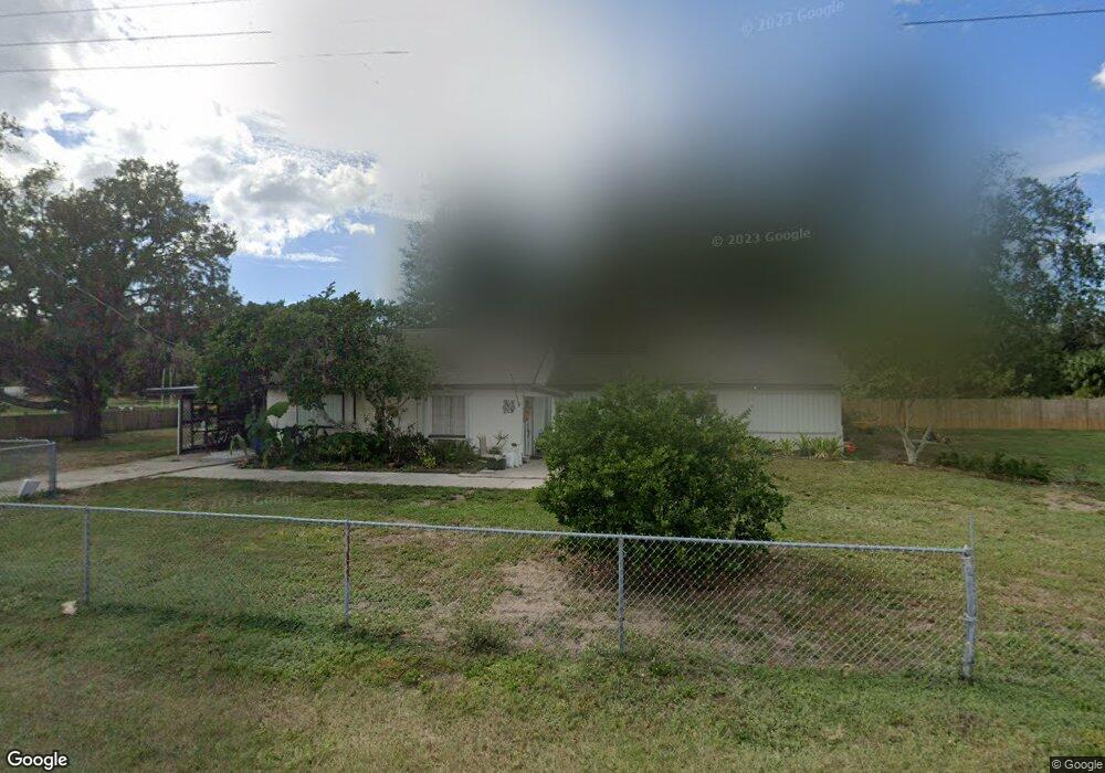
6605 121st Ave E Parrish, FL 34219
Estimated Value: $248,027 - $308,000
2
Beds
1
Bath
1,421
Sq Ft
$196/Sq Ft
Est. Value
About This Home
This home is located at 6605 121st Ave E, Parrish, FL 34219 and is currently estimated at $278,757, approximately $196 per square foot. 6605 121st Ave E is a home located in Manatee County with nearby schools including Barbara A. Harvey Elementary School, Buffalo Creek Middle School, and Parrish Community High School.
Ownership History
Date
Name
Owned For
Owner Type
Purchase Details
Closed on
Dec 29, 2023
Sold by
Cook Sarah Marie
Bought by
Nimeth Amy Cook and Nimeth Randy Kyle
Current Estimated Value
Purchase Details
Closed on
Jan 31, 2017
Sold by
Keisacker David
Bought by
Cook Sarah Marie
Purchase Details
Closed on
Apr 2, 2003
Sold by
Keisacker Audrey S
Bought by
Keisacker David C
Create a Home Valuation Report for This Property
The Home Valuation Report is an in-depth analysis detailing your home's value as well as a comparison with similar homes in the area
Home Values in the Area
Average Home Value in this Area
Purchase History
| Date | Buyer | Sale Price | Title Company |
|---|---|---|---|
| Nimeth Amy Cook | $100 | None Listed On Document | |
| Cook Sarah Marie | -- | None Available | |
| Keisacker David C | -- | -- |
Source: Public Records
Tax History
| Year | Tax Paid | Tax Assessment Tax Assessment Total Assessment is a certain percentage of the fair market value that is determined by local assessors to be the total taxable value of land and additions on the property. | Land | Improvement |
|---|---|---|---|---|
| 2025 | $2,168 | $155,290 | $85,000 | $70,290 |
| 2023 | $2,168 | $151,006 | $59,925 | $91,081 |
| 2022 | $1,902 | $122,840 | $40,000 | $82,840 |
| 2021 | $1,657 | $101,304 | $35,000 | $66,304 |
| 2020 | $1,531 | $91,430 | $24,168 | $67,262 |
| 2019 | $1,415 | $83,179 | $24,168 | $59,011 |
| 2018 | $1,333 | $77,156 | $24,168 | $52,988 |
| 2017 | $1,201 | $75,600 | $0 | $0 |
| 2016 | $1,155 | $73,170 | $0 | $0 |
Source: Public Records
Map
Nearby Homes
- 7121 122nd Ave E
- 11880 Us Highway 301 N
- 12300 Parrish Cemetary Rd
- 6927 Indus Valley Cir
- 7107 Indus Valley Cir
- 12355 Doris Rd
- 12345 Parrish Cemetary Rd
- 6209 116th Ave E
- 6306 115th Ave E
- 5405 120th Ave E
- 11452 64th St E
- 5319 120th Ave E
- 6203 115th Ave E
- 5315 119th Terrace E
- 11814 53rd Ct E
- 11742 Hidden Forest Loop
- 11415 61st St E
- 5220 119th Terrace E
- 12346 U S 301
- 12310 Oak Hill Way
- 6611 121st Ave E
- 6521 121st Ave E
- 6703 121st Ave E
- 6430 121st Ave E
- 6425 121st Ave E
- 6424 121st Ave E
- 6421 121st Ave E
- 6815 121st Ave E
- 6419 121st Ave E
- 6415 121st Ave E
- 12158 Us Highway 301 N
- 11827 69th St E
- 6821 121st Ave E
- 12154 Us Highway 301 N
- 12150 Us Highway 301 N
- 11915 69th St E
- 6328 121st Ave E
- 12115 69th St E
- 6322 121st Ave E
- 6907 121st Ave E
Your Personal Tour Guide
Ask me questions while you tour the home.