Estimated Value: $415,346 - $508,000
6
Beds
1
Bath
3,240
Sq Ft
$144/Sq Ft
Est. Value
About This Home
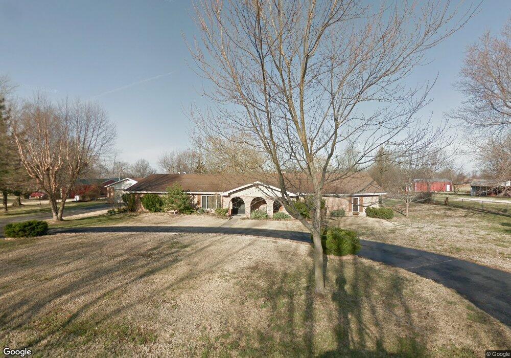
This home is located at 6605 N 26th St, Ozark, MO 65721 and is currently estimated at $465,837, approximately $143 per square foot. 6605 N 26th St is a home with nearby schools including West Elementary School, Ozark Middle School, and Ozark Junior High School.
Ownership History
Date
Name
Owned For
Owner Type
Purchase Details
Closed on
Nov 21, 2018
Sold by
Social Living Properties Llc
Bought by
Rlt Victoria Lynn Thornton Karlovich
Current Estimated Value
Purchase Details
Closed on
Sep 9, 2016
Sold by
Karlovich Victoria Lynn Thornton
Bought by
Social Living Properties Llc
Home Financials for this Owner
Home Financials are based on the most recent Mortgage that was taken out on this home.
Original Mortgage
$196,000
Interest Rate
3.48%
Mortgage Type
Future Advance Clause Open End Mortgage
Purchase Details
Closed on
Jul 7, 2010
Sold by
Karlovich Victoria L Thornton and Karlovich Richard Allen
Bought by
Karlovich Victoria Lynn Thornton and Victoria Lynn Thornton Karlovich Trust
Purchase Details
Closed on
Jan 3, 2005
Sold by
Karlovich Victoria Lynn and Karlovich Richard Allen
Bought by
Karlovich Victoria Lynn Thornton and Victoria Lynn Thornton Karlovich Trust
Create a Home Valuation Report for This Property
The Home Valuation Report is an in-depth analysis detailing your home's value as well as a comparison with similar homes in the area
Home Values in the Area
Average Home Value in this Area
Purchase History
| Date | Buyer | Sale Price | Title Company |
|---|---|---|---|
| Rlt Victoria Lynn Thornton Karlovich | -- | Hogan Land Title Company | |
| Social Living Properties Llc | -- | Hogan Land Title Company | |
| Karlovich Victoria Lynn Thornton | -- | Lincoln Land Title | |
| Karlovich Victoria L Thornton | -- | Lincoln Land Title | |
| Karlovich Victoria Lynn Thornton | -- | None Available |
Source: Public Records
Mortgage History
| Date | Status | Borrower | Loan Amount |
|---|---|---|---|
| Previous Owner | Social Living Properties Llc | $196,000 |
Source: Public Records
Tax History
| Year | Tax Paid | Tax Assessment Tax Assessment Total Assessment is a certain percentage of the fair market value that is determined by local assessors to be the total taxable value of land and additions on the property. | Land | Improvement |
|---|---|---|---|---|
| 2025 | $2,501 | $44,610 | -- | -- |
| 2024 | $2,497 | $41,760 | -- | -- |
| 2023 | $2,497 | $41,760 | $0 | $0 |
| 2022 | $2,343 | $39,120 | $0 | $0 |
| 2021 | $2,265 | $39,120 | $0 | $0 |
| 2020 | $2,032 | $35,590 | $0 | $0 |
| 2019 | $2,032 | $35,590 | $0 | $0 |
| 2018 | $1,658 | $29,240 | $0 | $0 |
| 2017 | $1,658 | $29,240 | $0 | $0 |
| 2016 | $1,630 | $29,240 | $0 | $0 |
| 2015 | $1,629 | $29,240 | $29,240 | $0 |
| 2014 | $1,610 | $29,260 | $0 | $0 |
| 2013 | $15 | $29,260 | $0 | $0 |
| 2011 | $15 | $58,520 | $0 | $0 |
Source: Public Records
Map
Nearby Homes
- 1099 N Farmer Branch Rd
- 105 Penick Ln
- 2488 W State Highway Cc
- 2497 E Farm Road 194
- 6016 Copper Ridge St
- 6307 S Meadowview Dr
- 3318 Winged Foot Dr
- 4725 Florence Ave
- 6235 S Bluff Ridge Rd
- 4210 Greenbriar Dr
- 4608 Venice Ave
- 3464 E Bluff Point Dr
- 2538 E Farm Road 188
- Lot 19 Lakepointe Reserve
- 4483 Siena Ave
- 4807 Rolling Hills Dr
- 4334 Rome Ave
- 4105 N Thistle Dr
- 3811 San Poppi Ct
- 2915 E Chinkapin Ln
- 6606 N 26th St
- 6606 Avis Ln
- 6703 N 26th St
- 2651 Westwind Dr
- 6602 N 26th St
- 6710 Avis Ln
- 2725 Westwind Dr
- 2725 Westwind Dr
- 2602 W Sharon Dr
- 6514 N Martingale Cir
- 2704 W Sharon Dr
- 6515 N Martingale Cir
- 2801 Westwind Dr
- 6510 N Martingale Cir
- 6507 N 25th St
- 6800 N 26th St
- 6800 Avis Ln
- 2603 W Sharon Dr
- 2409 Westwind Dr
- 2708 W Sharon Dr
Your Personal Tour Guide
Ask me questions while you tour the home.