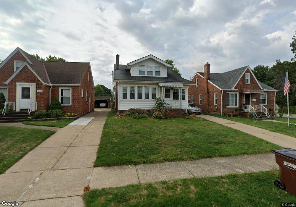
6607 Hampstead Ave Cleveland, OH 44129
Estimated Value: $204,966 - $254,000
3
Beds
3
Baths
1,449
Sq Ft
$156/Sq Ft
Est. Value
About This Home
This home is located at 6607 Hampstead Ave, Cleveland, OH 44129 and is currently estimated at $225,742, approximately $155 per square foot. 6607 Hampstead Ave is a home located in Cuyahoga County with nearby schools including Thoreau Park Elementary School, Shiloh Middle School, and Valley Forge High School.
Ownership History
Date
Name
Owned For
Owner Type
Purchase Details
Closed on
May 8, 2024
Sold by
Slywczuk Stephen and Slywczuk Elaine M
Bought by
Stephen And Elaine Slywczuk Revocable Trust and Slywczuk
Current Estimated Value
Purchase Details
Closed on
Jun 22, 1987
Sold by
Roth Norbert F
Bought by
Slywczuk Stephen
Purchase Details
Closed on
Mar 4, 1976
Sold by
Roth Norbert F and Roth Louise
Bought by
Roth Norbert F
Purchase Details
Closed on
Jan 1, 1975
Bought by
Roth Norbert F and Roth Louise
Create a Home Valuation Report for This Property
The Home Valuation Report is an in-depth analysis detailing your home's value as well as a comparison with similar homes in the area
Home Values in the Area
Average Home Value in this Area
Purchase History
| Date | Buyer | Sale Price | Title Company |
|---|---|---|---|
| Stephen And Elaine Slywczuk Revocable Trust | -- | None Listed On Document | |
| Slywczuk Stephen | $60,000 | -- | |
| Roth Norbert F | -- | -- | |
| Roth Norbert F | -- | -- |
Source: Public Records
Tax History
| Year | Tax Paid | Tax Assessment Tax Assessment Total Assessment is a certain percentage of the fair market value that is determined by local assessors to be the total taxable value of land and additions on the property. | Land | Improvement |
|---|---|---|---|---|
| 2024 | $3,699 | $61,250 | $10,430 | $50,820 |
| 2023 | $3,114 | $43,960 | $9,240 | $34,720 |
| 2022 | $3,084 | $43,960 | $9,240 | $34,720 |
| 2021 | $3,173 | $43,960 | $9,240 | $34,720 |
| 2020 | $2,777 | $33,810 | $7,110 | $26,710 |
| 2019 | $2,659 | $96,600 | $20,300 | $76,300 |
| 2018 | $2,494 | $33,810 | $7,110 | $26,710 |
| 2017 | $2,477 | $29,090 | $5,500 | $23,590 |
| 2016 | $2,461 | $29,090 | $5,500 | $23,590 |
| 2015 | $2,351 | $29,090 | $5,500 | $23,590 |
| 2014 | $2,351 | $29,680 | $5,600 | $24,080 |
Source: Public Records
Map
Nearby Homes
- 6707 Thornton Dr
- 6800 Wilber Ave
- 7111 Hampstead Ave
- 7115 Hampstead Ave
- 6714 Alber Ave
- 6914 Alber Ave
- 5603 Allanwood Dr
- 5502 Hampstead Ave
- 5706 Alber Ave
- 7107 Gerald Ave
- 5916 W 54th St
- 5619 Snow Rd
- 5615 Snow Rd
- 7503 Essen Ave
- 5610 Renwood Dr
- 0 Forest Ave Unit 5178492
- 6502 Farnsworth Dr
- 8012 Spring Garden Rd
- 8011 Bertha Ave
- 7915 Renwood Dr
- 6603 Hampstead Ave
- 6611 Hampstead Ave
- 6515 Hampstead Ave
- 5951 Wareham Dr
- 3283 Wareham Dr
- 6511 Hampstead Ave
- 5955 Wareham Dr
- 6703 Hampstead Ave
- 6507 Hampstead Ave
- 5961 Wareham Dr
- 6606 Hampstead Ave
- 6610 Hampstead Ave
- 6602 Hampstead Ave
- 6514 Hampstead Ave
- 6503 Hampstead Ave
- 5965 Wareham Dr
- 6711 Hampstead Ave
- 6510 Hampstead Ave
- 6702 Hampstead Ave
- 5956 Wareham Dr
Your Personal Tour Guide
Ask me questions while you tour the home.