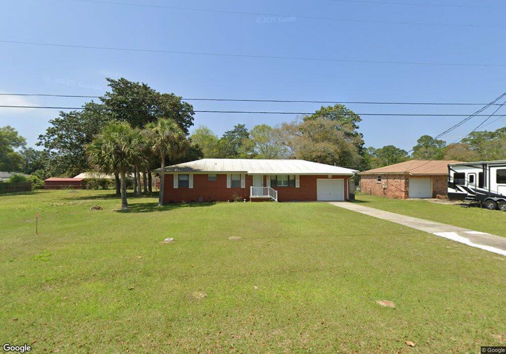
661 Paulding Ave Pensacola, FL 32507
Warrington NeighborhoodEstimated Value: $193,000 - $193,336
3
Beds
2
Baths
1,125
Sq Ft
$172/Sq Ft
Est. Value
About This Home
This home is located at 661 Paulding Ave, Pensacola, FL 32507 and is currently estimated at $193,084, approximately $171 per square foot. 661 Paulding Ave is a home located in Escambia County with nearby schools including Navy Point Elementary School, Jim C. Bailey Middle School, and Escambia High School.
Ownership History
Date
Name
Owned For
Owner Type
Purchase Details
Closed on
Dec 21, 2021
Sold by
Owens Darlene Williamson and Lynn Kelly A
Bought by
Loupe Lyn Dale
Current Estimated Value
Home Financials for this Owner
Home Financials are based on the most recent Mortgage that was taken out on this home.
Original Mortgage
$155,400
Outstanding Balance
$142,677
Interest Rate
2.98%
Mortgage Type
New Conventional
Estimated Equity
$50,407
Purchase Details
Closed on
Sep 20, 2002
Sold by
Owens Darlene and Owens Darlene Williamson
Bought by
Owens Darlene Williamson and Lynn Kelly A
Create a Home Valuation Report for This Property
The Home Valuation Report is an in-depth analysis detailing your home's value as well as a comparison with similar homes in the area
Home Values in the Area
Average Home Value in this Area
Purchase History
| Date | Buyer | Sale Price | Title Company |
|---|---|---|---|
| Loupe Lyn Dale | $150,000 | Attorney | |
| Owens Darlene Williamson | -- | -- | |
| Owens Darlene Williamson | -- | -- |
Source: Public Records
Mortgage History
| Date | Status | Borrower | Loan Amount |
|---|---|---|---|
| Open | Loupe Lyn Dale | $155,400 |
Source: Public Records
Tax History Compared to Growth
Tax History
| Year | Tax Paid | Tax Assessment Tax Assessment Total Assessment is a certain percentage of the fair market value that is determined by local assessors to be the total taxable value of land and additions on the property. | Land | Improvement |
|---|---|---|---|---|
| 2024 | $2,133 | $175,127 | $45,000 | $130,127 |
| 2023 | $2,133 | $150,111 | $0 | $0 |
| 2022 | $1,954 | $136,465 | $25,875 | $110,590 |
| 2021 | $409 | $76,051 | $0 | $0 |
| 2020 | $417 | $75,001 | $0 | $0 |
| 2019 | $412 | $73,315 | $0 | $0 |
| 2018 | $417 | $71,948 | $0 | $0 |
| 2017 | $421 | $70,469 | $0 | $0 |
| 2016 | $422 | $69,020 | $0 | $0 |
| 2015 | $404 | $68,541 | $0 | $0 |
| 2014 | $393 | $67,998 | $0 | $0 |
Source: Public Records
Map
Nearby Homes
- 714 Paulding Ave
- 729 Lownde Ave
- 507 Polk Ave
- 1804 Grundy St
- 700 Mills Ave
- 1310 Leeway Dr
- 1308 Leeway Dr
- 1306 Leeway Dr
- 1304 Leeway Dr
- 1302 Leeway Dr
- 1300 Leeway Dr
- Palm A Exterior Plan at Ellie's Cove
- 1400 Maritime Dr
- Palm B Interior Plan at Ellie's Cove
- 409 Decatur Ave
- 601 W Sunset Ave
- 110 Cousineau Rd
- 902 Decatur Ave
- 406 NW Syrcle Dr
- 1002 Polk Ave
- 663 Paulding Ave
- 644 Polk Ave
- 648 Polk Ave
- 689 Paulding Ave
- 610 Paulding Ave
- 608 Paulding Ave
- 1798 Heinrich St
- 612 Paulding Ave
- 660 Polk Ave
- 616 Paulding Ave
- 1616 Heinrich St
- 691 Paulding Ave
- 662 Polk Ave
- 1700 Heinrich St
- 645 Polk Ave
- 1799 Heinrich St
- 643 Polk Ave
- 620 Paulding Ave
- 647 Polk Ave
- 601 Wayne Ave