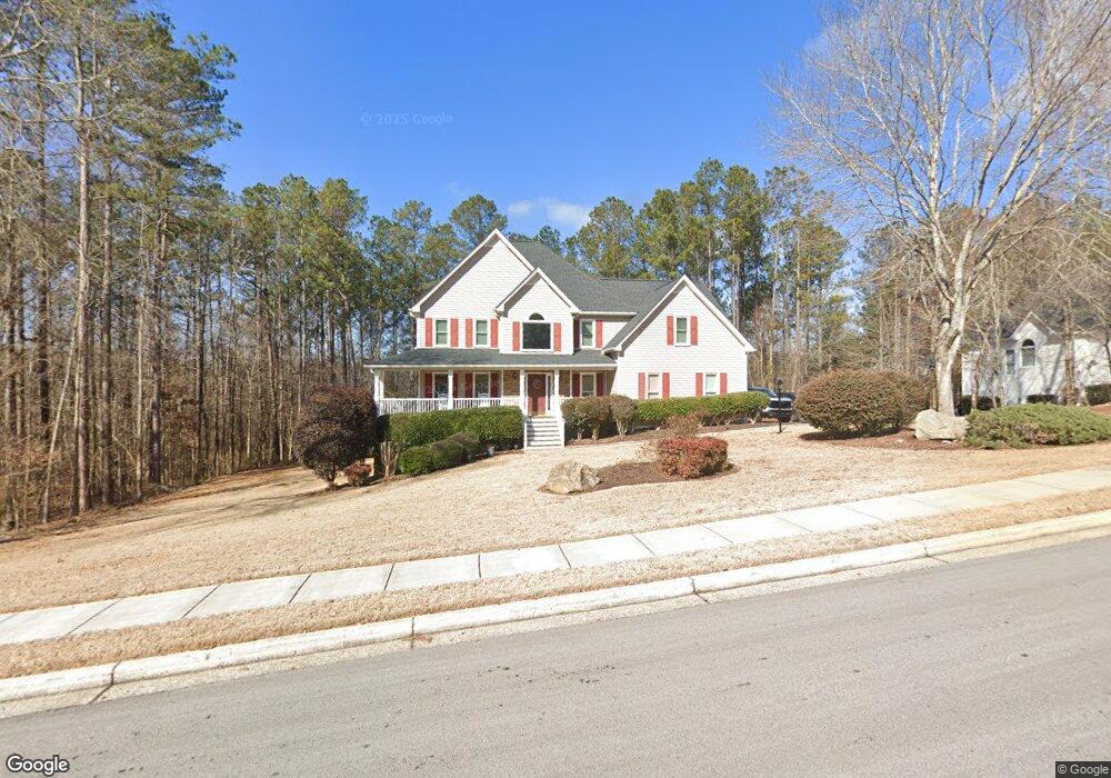
661 Tynsdale Dr Unit 27 Douglasville, GA 30134
Estimated Value: $372,000 - $446,000
4
Beds
3
Baths
3,567
Sq Ft
$112/Sq Ft
Est. Value
About This Home
This home is located at 661 Tynsdale Dr Unit 27, Douglasville, GA 30134 and is currently estimated at $399,238, approximately $111 per square foot. 661 Tynsdale Dr Unit 27 is a home located in Paulding County with nearby schools including Connie Dugan Elementary School, Irma C. Austin Middle School, and South Paulding High School.
Ownership History
Date
Name
Owned For
Owner Type
Purchase Details
Closed on
Jun 30, 2016
Sold by
Leon
Bought by
Murphy Shawn P and Murphy Jennifer L
Current Estimated Value
Home Financials for this Owner
Home Financials are based on the most recent Mortgage that was taken out on this home.
Original Mortgage
$196,650
Outstanding Balance
$157,390
Interest Rate
3.66%
Mortgage Type
New Conventional
Estimated Equity
$241,848
Purchase Details
Closed on
Jun 13, 2014
Sold by
Morris Michael S
Bought by
Rowe Leon
Home Financials for this Owner
Home Financials are based on the most recent Mortgage that was taken out on this home.
Original Mortgage
$148,000
Interest Rate
4.23%
Mortgage Type
New Conventional
Purchase Details
Closed on
May 13, 1999
Sold by
Cody Enterprises Inc
Bought by
Morris Michael S and Morris Amber C
Home Financials for this Owner
Home Financials are based on the most recent Mortgage that was taken out on this home.
Original Mortgage
$172,400
Interest Rate
6.87%
Mortgage Type
New Conventional
Create a Home Valuation Report for This Property
The Home Valuation Report is an in-depth analysis detailing your home's value as well as a comparison with similar homes in the area
Home Values in the Area
Average Home Value in this Area
Purchase History
| Date | Buyer | Sale Price | Title Company |
|---|---|---|---|
| Murphy Shawn P | $207,000 | -- | |
| Rowe Leon | $185,000 | -- | |
| Morris Michael S | $181,500 | -- |
Source: Public Records
Mortgage History
| Date | Status | Borrower | Loan Amount |
|---|---|---|---|
| Open | Murphy Shawn P | $196,650 | |
| Previous Owner | Rowe Leon | $148,000 | |
| Previous Owner | Morris Michael S | $172,400 |
Source: Public Records
Tax History Compared to Growth
Tax History
| Year | Tax Paid | Tax Assessment Tax Assessment Total Assessment is a certain percentage of the fair market value that is determined by local assessors to be the total taxable value of land and additions on the property. | Land | Improvement |
|---|---|---|---|---|
| 2024 | $3,760 | $154,412 | $12,000 | $142,412 |
| 2023 | $3,714 | $144,976 | $12,000 | $132,976 |
| 2022 | $3,059 | $119,220 | $12,000 | $107,220 |
| 2021 | $3,032 | $106,200 | $12,000 | $94,200 |
| 2020 | $2,624 | $90,196 | $12,000 | $78,196 |
| 2019 | $2,459 | $83,480 | $12,000 | $71,480 |
| 2018 | $2,491 | $84,548 | $12,000 | $72,548 |
| 2017 | $2,310 | $77,472 | $12,000 | $65,472 |
| 2016 | $2,221 | $73,448 | $12,000 | $61,448 |
| 2015 | $2,107 | $68,452 | $12,000 | $56,452 |
| 2014 | $1,722 | $56,400 | $12,000 | $44,400 |
| 2013 | -- | $53,840 | $12,000 | $41,840 |
Source: Public Records
Map
Nearby Homes
- 661 Tynsdale Dr
- 683 Tynsdale Dr
- 619 Tynsdale Dr
- 18 Flanders Ct
- 680 Tynsdale Dr
- 697 Tynsdale Dr
- 0 Flanders Ct
- 711 Tynsdale Dr
- 608 Tynsdale Dr
- 589 Tynsdale Dr
- 42 Flanders Ct
- 720 Tynsdale Dr
- 21 Vestry Walk
- 729 Tynsdale Dr
- 17 Flanders Ct
- 565 Tynsdale Dr
- 64 Flanders Ct
- 49 Vestry Walk
- 71 Flanders Ct
- 0 Vestry Walk