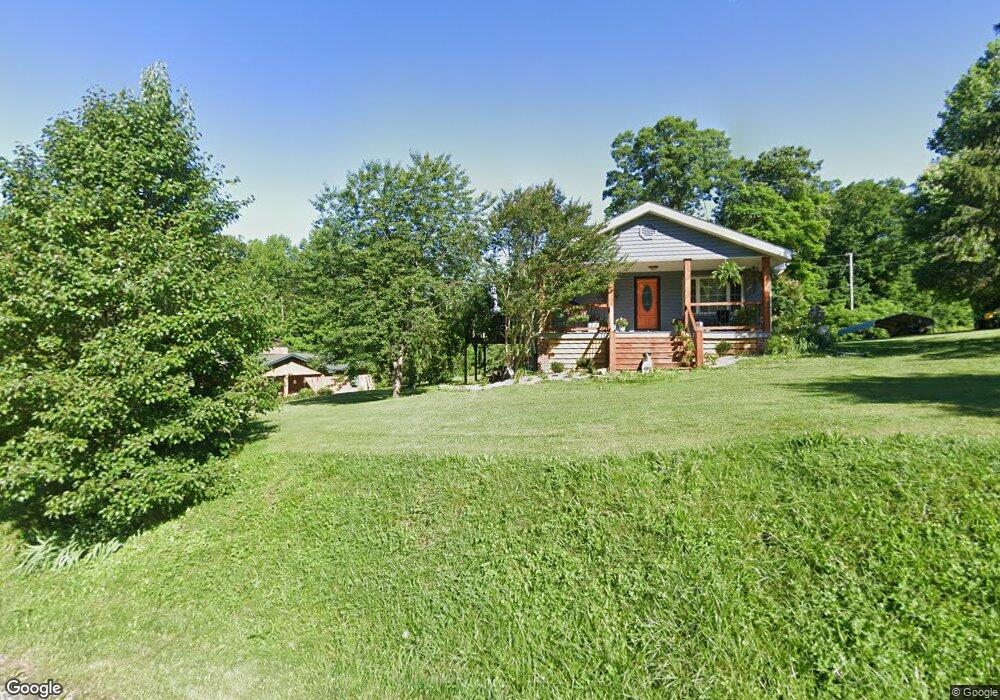
661 Walden Ln Pioneer, TN 37847
Estimated Value: $119,072 - $277,000
--
Bed
1
Bath
1,148
Sq Ft
$180/Sq Ft
Est. Value
About This Home
This home is located at 661 Walden Ln, Pioneer, TN 37847 and is currently estimated at $206,768, approximately $180 per square foot. 661 Walden Ln is a home located in Campbell County.
Ownership History
Date
Name
Owned For
Owner Type
Purchase Details
Closed on
Aug 23, 2024
Sold by
Roberts Larry and Roberts Pauline
Bought by
Sparks Angela and Sparks Olivia
Current Estimated Value
Purchase Details
Closed on
Jul 24, 2015
Sold by
0955615 Us Inc
Bought by
Green Pilgrim Llc
Purchase Details
Closed on
Dec 31, 2012
Bought by
0955615 Us Inc
Purchase Details
Closed on
Dec 14, 1999
Sold by
Day Mary Lou
Bought by
Day Robert
Purchase Details
Closed on
Jan 1, 1992
Bought by
Lafollette Enterprises Inc Lp
Create a Home Valuation Report for This Property
The Home Valuation Report is an in-depth analysis detailing your home's value as well as a comparison with similar homes in the area
Home Values in the Area
Average Home Value in this Area
Purchase History
| Date | Buyer | Sale Price | Title Company |
|---|---|---|---|
| Sparks Angela | -- | None Listed On Document | |
| Sparks Angela | -- | None Listed On Document | |
| Green Pilgrim Llc | $2,300,000 | -- | |
| 0955615 Us Inc | $2,648,400 | -- | |
| Day Robert | $8,200 | -- | |
| Lafollette Enterprises Inc Lp | -- | -- |
Source: Public Records
Tax History Compared to Growth
Tax History
| Year | Tax Paid | Tax Assessment Tax Assessment Total Assessment is a certain percentage of the fair market value that is determined by local assessors to be the total taxable value of land and additions on the property. | Land | Improvement |
|---|---|---|---|---|
| 2025 | $314 | $25,800 | $0 | $0 |
| 2024 | $314 | $25,800 | $3,850 | $21,950 |
| 2023 | $262 | $12,675 | $925 | $11,750 |
| 2022 | $262 | $12,675 | $925 | $11,750 |
| 2021 | $262 | $12,675 | $925 | $11,750 |
| 2020 | $257 | $12,675 | $925 | $11,750 |
| 2019 | $262 | $12,675 | $925 | $11,750 |
| 2018 | $224 | $9,950 | $575 | $9,375 |
| 2017 | $224 | $9,950 | $575 | $9,375 |
| 2016 | $224 | $9,950 | $575 | $9,375 |
| 2015 | $198 | $9,950 | $575 | $9,375 |
| 2014 | -- | $9,950 | $575 | $9,375 |
| 2013 | -- | $9,950 | $575 | $9,375 |
Source: Public Records
Map
Nearby Homes
- 150 Timber Oaks Ln
- 3329 Stinking Creek Rd
- 0 Stinking Creek Rd
- 142 Wagon Wheel Ln
- 976 Lone Rd
- 0 Lone Rd
- 143 Elk Ridge Ln
- 739 Rock Creek Ln
- 0 Melvin Hollow Rd Unit LotWP001 23933593
- 0 Melvin Hollow Rd Unit LotWP003 23933595
- 0 Melvin Hollow Rd Unit 1305423
- 0 Melvin Hollow Rd Unit 1305420
- 0 Melvin Hollow Rd Unit 1271460
- 137 Summerset Ln
- 130 Lowwood Ln
- 2506 Little Elk Creek Rd
- 3866 Highway 297
- 936 Stinking Creek Rd
- 580 Elk Fork Rd
- 1055 Big 4 Rd
- 637 Walden Ln
- 642 Walden Ln
- 688 Walden Ln
- 877 Walden Ln
- 722 Walden Ln
- 0 Jim Baird Ln Unit 605659
- 0 Jim Baird Ln Unit 605653
- 0 Jim Baird Ln Unit 638018
- 0 Jim Baird Ln Unit 638014
- 0 Jim Baird Ln Unit 677428
- 0 Jim Baird Ln Unit 677440
- 0 Jim Baird Ln Unit 700015
- 0 Jim Baird Ln Unit 700007
- 763 Walden Ln
- 832 Walden Ln
- 0 Stephen Ln Unit 1217536
- 0 Stephen Ln Unit 926424
- 817 Walden Ln
- 523 Adam Hollow Ln
- 501 Adam Hollow Ln