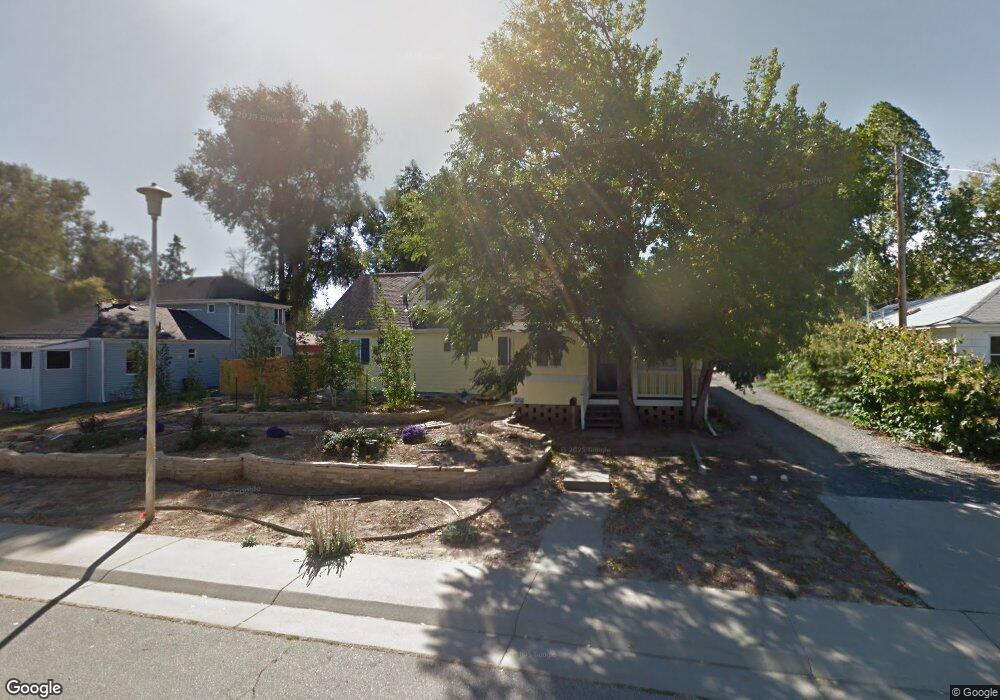
6610 Ralston Rd Arvada, CO 80002
Olde Town Arvada NeighborhoodEstimated Value: $568,812 - $732,000
1
Bed
1
Bath
1,680
Sq Ft
$402/Sq Ft
Est. Value
About This Home
This home is located at 6610 Ralston Rd, Arvada, CO 80002 and is currently estimated at $674,953, approximately $401 per square foot. 6610 Ralston Rd is a home located in Jefferson County with nearby schools including Secrest Elementary School, North Arvada Middle School, and Arvada High School.
Ownership History
Date
Name
Owned For
Owner Type
Purchase Details
Closed on
Oct 31, 1997
Sold by
Mondragon Mondragon Jose C Jose C and Mondragon Antonia
Bought by
Kennedy Lance Andrew
Current Estimated Value
Home Financials for this Owner
Home Financials are based on the most recent Mortgage that was taken out on this home.
Original Mortgage
$101,200
Outstanding Balance
$12,210
Interest Rate
7.12%
Estimated Equity
$662,743
Create a Home Valuation Report for This Property
The Home Valuation Report is an in-depth analysis detailing your home's value as well as a comparison with similar homes in the area
Home Values in the Area
Average Home Value in this Area
Purchase History
We collect this data history from publicly available records. To have your information removed, we recommend requesting removal directly through your county’s website.
| Date | Buyer | Sale Price | Title Company |
|---|---|---|---|
| Kennedy Lance Andrew | $126,500 | Stewart Title |
Source: Public Records
Mortgage History
We collect this data history from publicly available records. To have your information removed, we recommend requesting removal directly through your county’s website.
| Date | Status | Borrower | Loan Amount |
|---|---|---|---|
| Open | Kennedy Lance Andrew | $101,200 |
Source: Public Records
Tax History
| Year | Tax Paid | Tax Assessment Tax Assessment Total Assessment is a certain percentage of the fair market value that is determined by local assessors to be the total taxable value of land and additions on the property. | Land | Improvement |
|---|---|---|---|---|
| 2025 | $3,891 | $37,736 | $16,419 | $21,317 |
| 2024 | $4,338 | $44,720 | $22,010 | $22,710 |
| 2023 | $4,338 | $44,720 | $22,010 | $22,710 |
| 2022 | $3,795 | $38,756 | $22,343 | $16,413 |
| 2021 | $3,858 | $39,870 | $22,985 | $16,885 |
| 2020 | $3,315 | $34,349 | $18,310 | $16,039 |
| 2019 | $3,270 | $34,349 | $18,310 | $16,039 |
| 2018 | $3,376 | $34,475 | $17,920 | $16,555 |
| 2017 | $3,090 | $34,475 | $17,920 | $16,555 |
| 2016 | $2,821 | $29,651 | $13,190 | $16,461 |
| 2015 | $2,187 | $29,651 | $13,190 | $16,461 |
| 2014 | $2,187 | $21,604 | $8,820 | $12,784 |
Source: Public Records
Map
Nearby Homes
- 7000 Ralston Rd
- 5975 Newland St
- 6840 W 60th Ave
- 6910 Reno Dr
- 6865 W 55th Place
- 5525 Pierce Ct
- 6065 Pierce St
- 6040 Marshall Ct
- 6935 W 55th Place
- 6900 W 55th Place
- 6940 W 55th Place
- 6617 W 61st Ave
- 6990 W 61st Ave
- 7303 W 59th Ave
- 7357 Grandview Ave Unit 200
- 7357 Grandview Ave Unit 202
- 7357 Grandview Ave Unit 203
- 7313 W 60th Ave
- 7235 W 61st Ave
- 7365 W 61st Ave
- 6606 Ralston Rd
- 6702 Ralston Rd
- 6604 Ralston Rd
- 6704 Ralston Rd
- 6704 Ralston Rd Unit D
- 6704 Ralston Rd Unit A
- 6602 Ralston Rd
- 6706 Ralston Rd
- 6708 Ralston Rd
- 6703 Grandview Ave
- 6530 Ralston Rd
- 6607 Grandview Ave
- 6607 Grandview Ave Unit A
- 6601 Grandview Ave
- 6701 Grandview Ave
- 6800 Ralston Rd
- 6605 Grandview Ave
- 6509 Grandview Ave
- 6707 Grandview Ave
- 6510 Ralston Rd
Your Personal Tour Guide
Ask me questions while you tour the home.