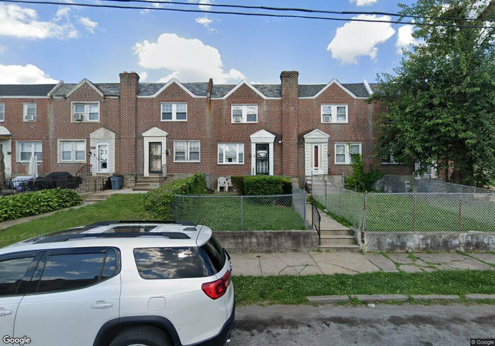
6615 N 21st St Philadelphia, PA 19138
West Oak Lane NeighborhoodEstimated Value: $186,536 - $206,000
3
Beds
1
Bath
1,188
Sq Ft
$167/Sq Ft
Est. Value
About This Home
This home is located at 6615 N 21st St, Philadelphia, PA 19138 and is currently estimated at $197,884, approximately $166 per square foot. 6615 N 21st St is a home located in Philadelphia County with nearby schools including William Rowen School, Gen. Louis Wagner Middle School, and Martin Luther King High School.
Ownership History
Date
Name
Owned For
Owner Type
Purchase Details
Closed on
Aug 6, 2007
Sold by
Rolling Brad and Benford Barbara
Bought by
Rolling Nancy M
Current Estimated Value
Home Financials for this Owner
Home Financials are based on the most recent Mortgage that was taken out on this home.
Original Mortgage
$80,000
Interest Rate
6.39%
Mortgage Type
New Conventional
Purchase Details
Closed on
Jun 21, 2007
Sold by
Rolling Brad and Benford Barbara
Bought by
Rolling Nancy M
Home Financials for this Owner
Home Financials are based on the most recent Mortgage that was taken out on this home.
Original Mortgage
$80,000
Interest Rate
6.39%
Mortgage Type
New Conventional
Purchase Details
Closed on
Nov 22, 1997
Sold by
Rolling Anna
Bought by
Rolling Anna and Rolling Nancy M
Create a Home Valuation Report for This Property
The Home Valuation Report is an in-depth analysis detailing your home's value as well as a comparison with similar homes in the area
Home Values in the Area
Average Home Value in this Area
Purchase History
| Date | Buyer | Sale Price | Title Company |
|---|---|---|---|
| Rolling Nancy M | -- | None Available | |
| Rolling Nancy M | -- | None Available | |
| Rolling Anna | -- | Security Search & Abstract C |
Source: Public Records
Mortgage History
| Date | Status | Borrower | Loan Amount |
|---|---|---|---|
| Closed | Rolling Nancy M | $80,000 |
Source: Public Records
Tax History Compared to Growth
Tax History
| Year | Tax Paid | Tax Assessment Tax Assessment Total Assessment is a certain percentage of the fair market value that is determined by local assessors to be the total taxable value of land and additions on the property. | Land | Improvement |
|---|---|---|---|---|
| 2025 | $2,042 | $174,300 | $34,860 | $139,440 |
| 2024 | $2,042 | $174,300 | $34,860 | $139,440 |
| 2023 | $2,042 | $145,900 | $29,180 | $116,720 |
| 2022 | $939 | $100,900 | $29,180 | $71,720 |
| 2021 | $1,569 | $0 | $0 | $0 |
| 2020 | $1,569 | $0 | $0 | $0 |
| 2019 | $1,638 | $0 | $0 | $0 |
| 2018 | $1,432 | $0 | $0 | $0 |
| 2017 | $1,432 | $0 | $0 | $0 |
| 2016 | $1,012 | $0 | $0 | $0 |
| 2015 | $906 | $0 | $0 | $0 |
| 2014 | -- | $97,600 | $10,169 | $87,431 |
| 2012 | -- | $12,512 | $2,267 | $10,245 |
Source: Public Records
Map
Nearby Homes
- 6603 N 21st St
- 2061 Independence St
- 2120 66th Ave
- 2105 Stenton Ave
- 2115 Stenton Ave
- 2125 Stenton Ave
- 6534 N Lambert St
- 6824 Rodney St
- 6558 Limekiln Pike
- 6731 N Woodstock St
- 6531 N Beechwood St
- 6733 N Woodstock St
- 2152 Stenton Ave
- 2070 E Haines St
- 6600 N Opal St
- 6332 E Wister St
- 2056 Eastburn Ave
- 2022 66th Ave
- 1914 W 65th Ave
- 6421 N 21st St
- 6613 N 21st St
- 6617 N 21st St
- 6611 N 21st St
- 6619 N 21st St
- 6609 N 21st St
- 6621 N 21st St
- 6607 N 21st St
- 6605 N 21st St
- 2094 Independence St
- 2090 Independence St
- 2092 Independence St
- 2088 Independence St
- 2086 Independence St
- 6601 N 21st St
- 2084 Independence St
- 6616 N 21st St
- 6610 N 21st St
- 2101 66th Ave
- 6614 N 21st St
- 6618 N 21st St