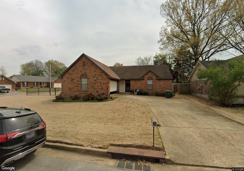
6617 Waders Ridge Dr Memphis, TN 38141
Hickory Hill NeighborhoodEstimated Value: $195,000 - $232,000
3
Beds
2
Baths
1,474
Sq Ft
$144/Sq Ft
Est. Value
About This Home
This home is located at 6617 Waders Ridge Dr, Memphis, TN 38141 and is currently estimated at $211,694, approximately $143 per square foot. 6617 Waders Ridge Dr is a home located in Shelby County with nearby schools including Ross Elementary School, Kirby High School, and Memphis Business Academy Hickory Hill Middle School.
Ownership History
Date
Name
Owned For
Owner Type
Purchase Details
Closed on
Jan 24, 1997
Sold by
Selby Carl B and Selby Linda D
Bought by
James W Anthony and James Tanja D
Current Estimated Value
Home Financials for this Owner
Home Financials are based on the most recent Mortgage that was taken out on this home.
Original Mortgage
$87,169
Outstanding Balance
$10,042
Interest Rate
7.77%
Mortgage Type
FHA
Estimated Equity
$201,652
Create a Home Valuation Report for This Property
The Home Valuation Report is an in-depth analysis detailing your home's value as well as a comparison with similar homes in the area
Home Values in the Area
Average Home Value in this Area
Purchase History
| Date | Buyer | Sale Price | Title Company |
|---|---|---|---|
| James W Anthony | $87,500 | -- |
Source: Public Records
Mortgage History
| Date | Status | Borrower | Loan Amount |
|---|---|---|---|
| Open | James W Anthony | $87,169 |
Source: Public Records
Tax History
| Year | Tax Paid | Tax Assessment Tax Assessment Total Assessment is a certain percentage of the fair market value that is determined by local assessors to be the total taxable value of land and additions on the property. | Land | Improvement |
|---|---|---|---|---|
| 2025 | $1,017 | $51,225 | $10,825 | $40,400 |
| 2024 | $1,017 | $30,000 | $5,775 | $24,225 |
| 2023 | $1,828 | $30,000 | $5,775 | $24,225 |
| 2022 | $1,828 | $30,000 | $5,775 | $24,225 |
| 2021 | $1,849 | $30,000 | $5,775 | $24,225 |
| 2020 | $1,764 | $24,350 | $5,775 | $18,575 |
| 2019 | $1,764 | $24,350 | $5,775 | $18,575 |
| 2018 | $1,764 | $24,350 | $5,775 | $18,575 |
| 2017 | $1,001 | $24,350 | $5,775 | $18,575 |
| 2016 | $925 | $21,175 | $0 | $0 |
| 2014 | $925 | $21,175 | $0 | $0 |
Source: Public Records
Map
Nearby Homes
- 4741 Ross Creek Dr
- 6732 Henredon Dr
- 6781 Henredon Dr
- 5136 Barkshire Dr
- 6459 Summer Creek E
- 4585 S Berrypick Ln
- 6830 Clearwater Cove
- 6379 S Fawn Hollow Cir
- 5180 Water Point Dr
- 6846 Gilford Dr
- 6767 Smokey Ln
- 6577 Chauncey
- 4418 Spring Park Dr
- 7105 Cutter Mill Rd
- 5088 S Germantown Rd
- 5088 S Germantown Rd Unit 2
- 4395 Cedar Park Dr
- 4463 Sandy Park Dr
- 6767 Castlegate Cove
- 7164 Germantown Trails Rd
- 4865 Water Fowl Ln
- 6609 Waders Ridge Dr
- 4854 Water Fowl Ln
- 4873 Water Fowl Ln
- 6618 Waders Ridge Dr
- 6603 Waders Ridge Dr
- 4860 Water Fowl Ln
- 6610 Waders Ridge Dr
- 6622 Waders Ridge Dr
- 4846 Water Fowl Ln
- 6604 Waders Ridge Dr
- 6595 Waders Ridge Dr
- 4879 Water Fowl Ln
- 6626 Waders Ridge Dr
- 6600 Old Squaw Cove
- 4876 Water Fowl Ln
- 6598 Waders Ridge Dr
- 4828 Mallard Nest Dr
- 4885 Water Fowl Ln
- 4824 Mallard Nest Dr
Your Personal Tour Guide
Ask me questions while you tour the home.