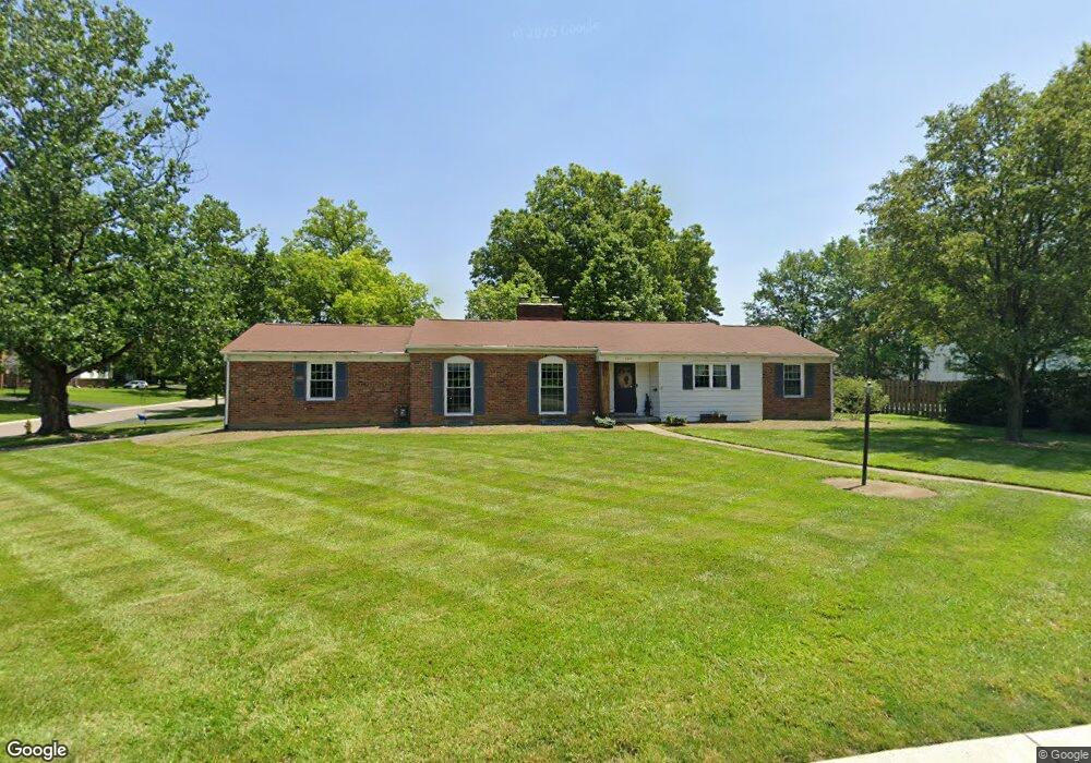
6619 Michael Dr Cincinnati, OH 45243
Estimated Value: $379,000 - $462,000
3
Beds
2
Baths
1,610
Sq Ft
$249/Sq Ft
Est. Value
About This Home
This home is located at 6619 Michael Dr, Cincinnati, OH 45243 and is currently estimated at $400,631, approximately $248 per square foot. 6619 Michael Dr is a home located in Hamilton County with nearby schools including Indian Hill Primary School, Indian Hill Elementary School, and Indian Hill Middle School.
Ownership History
Date
Name
Owned For
Owner Type
Purchase Details
Closed on
May 12, 1999
Sold by
Dickenherr Loraine M
Bought by
Kimes Donald F and Kimes Ann M
Current Estimated Value
Home Financials for this Owner
Home Financials are based on the most recent Mortgage that was taken out on this home.
Original Mortgage
$76,500
Interest Rate
7.04%
Create a Home Valuation Report for This Property
The Home Valuation Report is an in-depth analysis detailing your home's value as well as a comparison with similar homes in the area
Home Values in the Area
Average Home Value in this Area
Purchase History
| Date | Buyer | Sale Price | Title Company |
|---|---|---|---|
| Kimes Donald F | $154,000 | United Title Agency Of Cinci |
Source: Public Records
Mortgage History
| Date | Status | Borrower | Loan Amount |
|---|---|---|---|
| Closed | Kimes Donald F | $76,500 |
Source: Public Records
Tax History
| Year | Tax Paid | Tax Assessment Tax Assessment Total Assessment is a certain percentage of the fair market value that is determined by local assessors to be the total taxable value of land and additions on the property. | Land | Improvement |
|---|---|---|---|---|
| 2025 | $3,756 | $93,450 | $33,999 | $59,451 |
| 2023 | $3,678 | $93,450 | $33,999 | $59,451 |
| 2022 | $4,067 | $93,437 | $23,258 | $70,179 |
| 2021 | $3,953 | $93,437 | $23,258 | $70,179 |
| 2020 | $3,536 | $93,437 | $23,258 | $70,179 |
| 2019 | $3,276 | $81,964 | $20,402 | $61,562 |
| 2018 | $3,283 | $81,964 | $20,402 | $61,562 |
| 2017 | $3,125 | $81,964 | $20,402 | $61,562 |
| 2016 | $2,738 | $72,429 | $18,564 | $53,865 |
| 2015 | $2,764 | $72,429 | $18,564 | $53,865 |
| 2014 | $2,747 | $72,429 | $18,564 | $53,865 |
| 2013 | $2,693 | $68,979 | $17,679 | $51,300 |
Source: Public Records
Map
Nearby Homes
- 6008 Winnetka Dr
- 6752 Rose Crest Ave
- 6495 Dawson Rd
- 7390 Hosbrook Rd
- 7220 Mar Del Dr
- 7406 Dawson Rd
- 7317 Euclid Ave
- 7800 Hosbrook Rd
- 7300 N Mingo Ln
- 7025 Wallace Ave
- 5635 Euclid Rd
- 7474 Dawson Rd
- 7097 Shawnee Hills Dr
- 4248 South Ave
- 6876 Esther Ln
- 7437 Madeira Pines Dr
- 4106 Orchard Ln
- 6705 Elwynne Dr
- 7231 Berwood Dr
- 7834 Laurel Ave
- 6631 Michael Dr
- 6565 Michael Dr
- 6643 Michael Dr
- 6536 Lisa Ln
- 6584 Michael Dr
- 6596 Michael Dr
- 6620 Michael Dr
- 6572 Michael Dr
- 6634 Michael Dr
- 6608 Michael Dr
- 6544 Lisa Ln
- 6560 Michael Dr
- 6655 Michael Dr
- 6648 Michael Dr
- 6552 Lisa Ln
- 7311 Vinnedge Ct
- 6548 Michael Dr
- 7122 Kenwood Rd
- 6667 Michael Dr
- 6536 Michael Dr
Your Personal Tour Guide
Ask me questions while you tour the home.