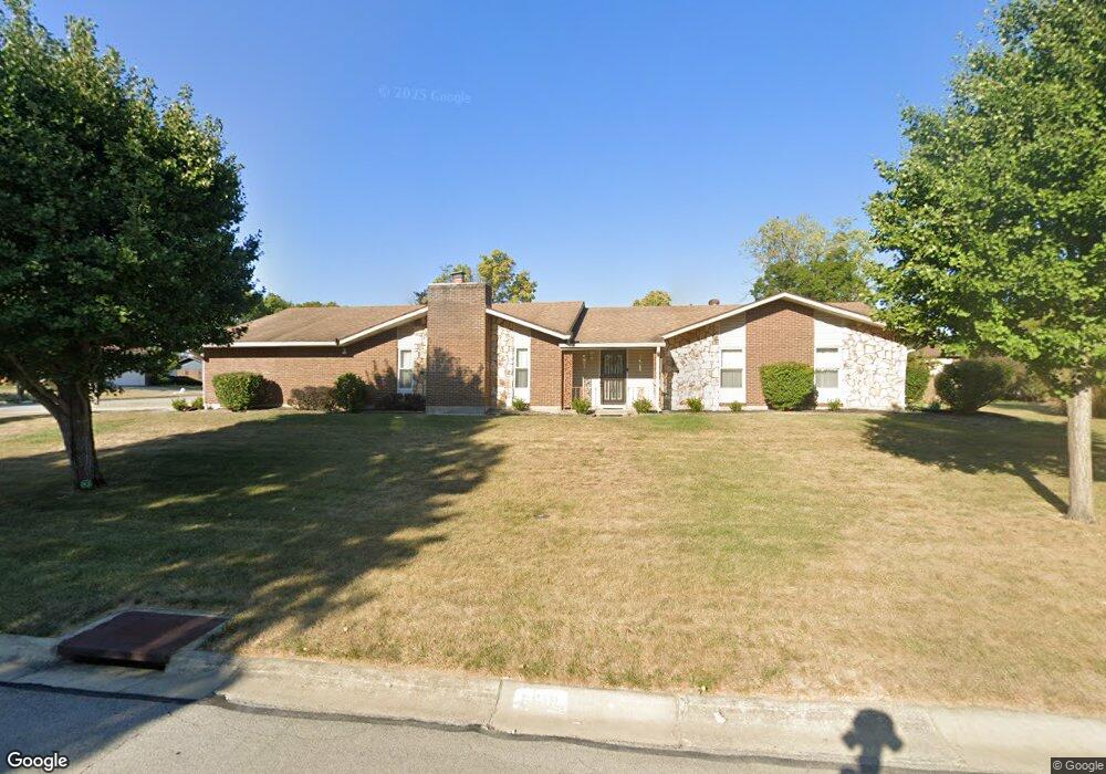
6619 Portrait Dr Dayton, OH 45415
Estimated Value: $281,000 - $339,000
3
Beds
2
Baths
2,865
Sq Ft
$109/Sq Ft
Est. Value
About This Home
This home is located at 6619 Portrait Dr, Dayton, OH 45415 and is currently estimated at $310,894, approximately $108 per square foot. 6619 Portrait Dr is a home located in Montgomery County with nearby schools including Northwood Elementary School, Northmont High School, and Trotwood Preparatory & Fitness Academy.
Ownership History
Date
Name
Owned For
Owner Type
Purchase Details
Closed on
Sep 13, 2000
Sold by
Nichols Robert R
Bought by
Dejoie Gwendolyn M Allen
Current Estimated Value
Home Financials for this Owner
Home Financials are based on the most recent Mortgage that was taken out on this home.
Original Mortgage
$122,320
Outstanding Balance
$44,234
Interest Rate
7.99%
Mortgage Type
Purchase Money Mortgage
Estimated Equity
$266,660
Create a Home Valuation Report for This Property
The Home Valuation Report is an in-depth analysis detailing your home's value as well as a comparison with similar homes in the area
Home Values in the Area
Average Home Value in this Area
Purchase History
| Date | Buyer | Sale Price | Title Company |
|---|---|---|---|
| Dejoie Gwendolyn M Allen | $152,900 | -- |
Source: Public Records
Mortgage History
| Date | Status | Borrower | Loan Amount |
|---|---|---|---|
| Open | Dejoie Gwendolyn M Allen | $122,320 |
Source: Public Records
Tax History Compared to Growth
Tax History
| Year | Tax Paid | Tax Assessment Tax Assessment Total Assessment is a certain percentage of the fair market value that is determined by local assessors to be the total taxable value of land and additions on the property. | Land | Improvement |
|---|---|---|---|---|
| 2024 | $4,771 | $84,520 | $15,230 | $69,290 |
| 2023 | $4,771 | $91,100 | $15,230 | $75,870 |
| 2022 | $4,108 | $62,820 | $10,500 | $52,320 |
| 2021 | $4,130 | $62,820 | $10,500 | $52,320 |
| 2020 | $4,128 | $62,820 | $10,500 | $52,320 |
| 2019 | $4,354 | $60,170 | $10,500 | $49,670 |
| 2018 | $4,366 | $60,170 | $10,500 | $49,670 |
| 2017 | $4,344 | $60,170 | $10,500 | $49,670 |
| 2016 | $4,122 | $56,480 | $10,500 | $45,980 |
| 2015 | $3,792 | $56,480 | $10,500 | $45,980 |
| 2014 | $3,792 | $56,480 | $10,500 | $45,980 |
| 2012 | -- | $53,750 | $12,320 | $41,430 |
Source: Public Records
Map
Nearby Homes
- 3324 Northfield Rd
- 6600 Afton Dr
- 6885 Garber Rd
- 4250 Willow Creek Dr
- 4310 Corydale Ct
- 7182 Pugliese Place
- 4311 Reeves Ct
- 7116 Dominican Dr
- 6229 Cheri Lynne Dr
- 1264 Westbrook Rd
- 6781 Taywood Rd
- 164 Copperfield Dr
- 173 Copperfield Dr
- 133 Copperfield Dr
- 6624 Stranwood Dr
- 5420 Savina Ave
- 14 Dorchester Dr
- 23 Glenhaven Rd
- 4515 River Ridge Rd
- 8175 Inwood Ave
- 3615 Laurel Fork Dr
- 6625 Portrait Dr
- 6618 Portrait Dr
- 6624 Portrait Dr
- 6607 Portrait Dr
- 6631 Portrait Dr
- 6700 Oakfield Dr
- 3610 Laurel Fork Dr
- 6612 Portrait Dr
- 6710 Oakfield Dr
- 6630 Portrait Dr
- 3620 Laurel Fork Dr
- 6606 Portrait Dr
- 6720 Oakfield Dr
- 6637 Portrait Dr
- 6636 Portrait Dr
- 3630 Laurel Fork Dr
- 3630 Laurel Fork Rd
- 6625 Morrow Dr
- 6631 Morrow Dr