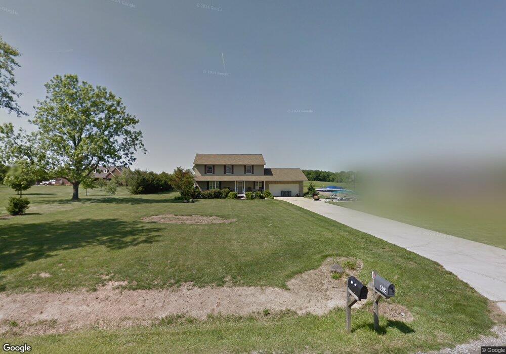
662 Carroll Eastern Rd NW Baltimore, OH 43105
Estimated Value: $463,861 - $569,000
4
Beds
3
Baths
2,240
Sq Ft
$227/Sq Ft
Est. Value
About This Home
This home is located at 662 Carroll Eastern Rd NW, Baltimore, OH 43105 and is currently estimated at $508,215, approximately $226 per square foot. 662 Carroll Eastern Rd NW is a home located in Fairfield County with nearby schools including Bloom Carroll Primary School, Bloom Carroll Intermediate School, and Bloom-Carroll Middle School.
Ownership History
Date
Name
Owned For
Owner Type
Purchase Details
Closed on
May 20, 2004
Sold by
Berger Philip D and Shoewalter Berger Lisa
Bought by
Perdue Brent D and Perdue Karla M
Current Estimated Value
Home Financials for this Owner
Home Financials are based on the most recent Mortgage that was taken out on this home.
Original Mortgage
$207,740
Outstanding Balance
$98,968
Interest Rate
6.17%
Mortgage Type
FHA
Estimated Equity
$409,247
Purchase Details
Closed on
Jun 17, 1999
Sold by
R L Phillips Enterprises
Bought by
Shoewalter
Home Financials for this Owner
Home Financials are based on the most recent Mortgage that was taken out on this home.
Original Mortgage
$176,400
Interest Rate
7.06%
Mortgage Type
New Conventional
Purchase Details
Closed on
Jun 16, 1998
Sold by
Dozer David L
Bought by
R L Phillips Enterprises Inc
Create a Home Valuation Report for This Property
The Home Valuation Report is an in-depth analysis detailing your home's value as well as a comparison with similar homes in the area
Purchase History
| Date | Buyer | Sale Price | Title Company |
|---|---|---|---|
| Perdue Brent D | $211,000 | -- | |
| Shoewalter | $196,000 | -- | |
| R L Phillips Enterprises Inc | $32,000 | -- |
Source: Public Records
Mortgage History
| Date | Status | Borrower | Loan Amount |
|---|---|---|---|
| Open | Perdue Brent D | $207,740 | |
| Closed | Shoewalter | $176,400 |
Source: Public Records
Tax History
| Year | Tax Paid | Tax Assessment Tax Assessment Total Assessment is a certain percentage of the fair market value that is determined by local assessors to be the total taxable value of land and additions on the property. | Land | Improvement |
|---|---|---|---|---|
| 2025 | $8,768 | $134,460 | $36,400 | $98,060 |
| 2024 | $8,768 | $108,650 | $25,200 | $83,450 |
| 2023 | $4,747 | $108,650 | $25,200 | $83,450 |
| 2022 | $4,781 | $108,650 | $25,200 | $83,450 |
| 2021 | $3,711 | $82,710 | $21,000 | $61,710 |
| 2020 | $3,755 | $82,710 | $21,000 | $61,710 |
| 2019 | $3,771 | $82,710 | $21,000 | $61,710 |
| 2018 | $2,974 | $67,000 | $16,800 | $50,200 |
| 2017 | $2,791 | $67,000 | $16,800 | $50,200 |
| 2016 | $2,707 | $67,000 | $16,800 | $50,200 |
| 2015 | $2,598 | $62,600 | $16,800 | $45,800 |
| 2014 | $2,483 | $62,600 | $16,800 | $45,800 |
| 2013 | $2,483 | $62,600 | $16,800 | $45,800 |
Source: Public Records
Map
Nearby Homes
- 1577 Winding Oak Dr NW
- 5870 Brook Rd NW
- 4315 Brook Rd NW
- 3485 Lancaster-Kirkersville Rd NW
- 0 Fremar Rd NE Unit Lot1 225007256
- 1800 Ginder Rd NW
- 1295 Ginder Rd NW
- 4840 Tschopp Rd NE
- 850 Marquette Dr NE
- 0 Marquette Dr NE Unit Lot 16 225027323
- 0 Marquette Dr NE Unit Lot 5
- 0 Marquette Dr NE Unit Lot 4 225007276
- 5505 Tschopp Rd NE
- 4070 Tschopp Rd NE
- 2270 Ginder Rd NW
- 2927 Lancaster-Kirkersville Rd NW
- 112 N Creekview Ct
- 0 Tschopp Rd NE Unit Lot 17 225027320
- 0 Tschopp Rd NE Unit Lot 33 225027324
- 7836 Basil Rd NW
- 640 Carroll Eastern Rd NW
- 671 Carroll Eastern Rd NW
- 645 Carroll Eastern Rd NW
- 699 Carroll Eastern Rd NW
- 700 Carroll Eastern Rd NW
- 615 Carroll Eastern Rd NW
- 610 Carroll Eastern Rd NW
- 729 Carroll Eastern Rd NW
- 661 Carroll Eastern Rd NW
- 740 Carroll Eastern Rd NW
- 587 Carroll Eastern Rd NW
- 870 Carroll Eastern Rd NW
- 875 Carroll Eastern Rd NW
- 561 Carroll Eastern Rd NW
- 529 Carroll Eastern Rd NW
- 505 Carroll Eastern Rd NW
- 890 Carroll Eastern Rd NW
- 490 Carroll Eastern Rd NW
- 920 Carroll Eastern Rd NW
- 440 Carroll Eastern Rd NW
Your Personal Tour Guide
Ask me questions while you tour the home.