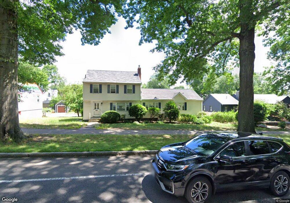
662 Vfw Pkwy West Roxbury, MA 02132
West Roxbury NeighborhoodEstimated Value: $963,464 - $1,132,000
4
Beds
3
Baths
2,056
Sq Ft
$510/Sq Ft
Est. Value
About This Home
This home is located at 662 Vfw Pkwy, West Roxbury, MA 02132 and is currently estimated at $1,048,866, approximately $510 per square foot. 662 Vfw Pkwy is a home located in Suffolk County with nearby schools including Holy Name Parish School, St Theresa School, and The Roxbury Latin School.
Create a Home Valuation Report for This Property
The Home Valuation Report is an in-depth analysis detailing your home's value as well as a comparison with similar homes in the area
Home Values in the Area
Average Home Value in this Area
Tax History Compared to Growth
Tax History
| Year | Tax Paid | Tax Assessment Tax Assessment Total Assessment is a certain percentage of the fair market value that is determined by local assessors to be the total taxable value of land and additions on the property. | Land | Improvement |
|---|---|---|---|---|
| 2025 | $10,065 | $869,200 | $211,400 | $657,800 |
| 2024 | $10,075 | $924,300 | $225,300 | $699,000 |
| 2023 | $9,362 | $871,700 | $212,400 | $659,300 |
| 2022 | $8,621 | $792,400 | $193,100 | $599,300 |
| 2021 | $7,956 | $745,600 | $185,700 | $559,900 |
| 2020 | $7,206 | $682,400 | $170,200 | $512,200 |
| 2019 | $6,723 | $637,900 | $145,000 | $492,900 |
| 2018 | $6,429 | $613,500 | $145,000 | $468,500 |
| 2017 | $6,430 | $607,200 | $145,000 | $462,200 |
| 2016 | $6,243 | $567,500 | $145,000 | $422,500 |
| 2015 | $6,397 | $528,200 | $170,200 | $358,000 |
| 2014 | $6,269 | $498,300 | $170,200 | $328,100 |
Source: Public Records
Map
Nearby Homes
- 701 Vfw Pkwy
- 168 Maple St
- 19 Pomfret St
- 37 Pomfret St
- 76 Vermont St
- 865 Lagrange St Unit 5
- 139 Newfield St
- 37 Hastings St Unit 103
- 23 Westgate Rd Unit 6
- 931 Lagrange St
- 55 Redlands Rd
- 9 Carroll St
- 1789 Centre St Unit 202
- 42 Bryon Rd Unit 6
- 21 Westgate Rd Unit 6
- 50-56 Broadlawn Park Unit 221
- 76 Potomac St
- 10 Burwell Rd
- 539 Lagrange St
- 79 Potomac St