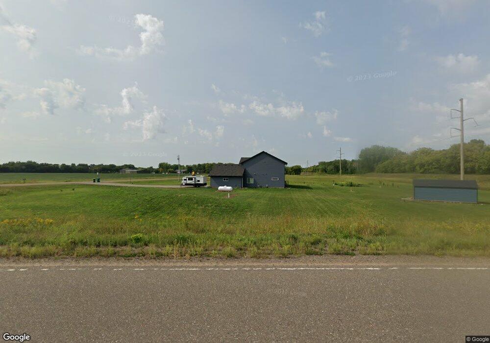
6625 30th St NE Sauk Rapids, MN 56379
Estimated Value: $340,000 - $641,805
4
Beds
3
Baths
2,916
Sq Ft
$176/Sq Ft
Est. Value
About This Home
This home is located at 6625 30th St NE, Sauk Rapids, MN 56379 and is currently estimated at $512,268, approximately $175 per square foot. 6625 30th St NE is a home located in Benton County with nearby schools including Foley Elementary School, Foley Intermediate Elementary School, and Foley Senior High School.
Ownership History
Date
Name
Owned For
Owner Type
Purchase Details
Closed on
Jun 25, 2020
Sold by
Tomford Andrew and Tomford Lisa
Bought by
Hauber Bryan and Hauber Michelle
Current Estimated Value
Purchase Details
Closed on
Nov 23, 2018
Sold by
Bauerly Brian and Bauerly Marjorie A
Bought by
Tomford Andrew and Tomford Lisa
Home Financials for this Owner
Home Financials are based on the most recent Mortgage that was taken out on this home.
Original Mortgage
$23,000
Interest Rate
4.9%
Mortgage Type
Commercial
Create a Home Valuation Report for This Property
The Home Valuation Report is an in-depth analysis detailing your home's value as well as a comparison with similar homes in the area
Home Values in the Area
Average Home Value in this Area
Purchase History
| Date | Buyer | Sale Price | Title Company |
|---|---|---|---|
| Hauber Bryan | $40,000 | None Available | |
| Tomford Andrew | $30,000 | Burnet Title |
Source: Public Records
Mortgage History
| Date | Status | Borrower | Loan Amount |
|---|---|---|---|
| Previous Owner | Tomford Andrew | $23,000 |
Source: Public Records
Tax History Compared to Growth
Tax History
| Year | Tax Paid | Tax Assessment Tax Assessment Total Assessment is a certain percentage of the fair market value that is determined by local assessors to be the total taxable value of land and additions on the property. | Land | Improvement |
|---|---|---|---|---|
| 2025 | $5,430 | $586,200 | $64,800 | $521,400 |
| 2024 | $4,928 | $568,300 | $64,700 | $503,600 |
| 2023 | $388 | $569,500 | $63,400 | $506,100 |
| 2022 | $628 | $62,500 | $18,700 | $43,800 |
| 2021 | $232 | $59,600 | $18,200 | $41,400 |
| 2018 | $194 | $14,700 | $14,700 | $0 |
| 2017 | $194 | $14,700 | $14,700 | $0 |
| 2016 | $196 | $17,700 | $17,700 | $0 |
| 2015 | $204 | $14,700 | $14,700 | $0 |
| 2014 | -- | $13,400 | $13,400 | $0 |
| 2013 | -- | $11,900 | $11,900 | $0 |
Source: Public Records
Map
Nearby Homes
- Lot B 75th Ave NE
- 4860 15th St NE
- 4820 15th St NE
- 4195 25th St NE
- 1108 45th Ave NE
- 1106 45th Ave NE
- 1104 45th Ave NE
- 1102 45th Ave NE
- 977 45th Ave NE
- 971 45th Ave NE
- 4771 8th Street Loop NE
- 4745 8th Street Loop NE
- 4739 8th Street Loop NE
- 4631 9th St NE
- 5901 Rub-Of-the-green St
- 4634 9th St NE
- 4653 8th St NE
- 4724 5th St NE
- 4629 8th St NE
- 5916 Stadium St
- xxx 30th St NE
- 6470 Highway 23 NE
- 2883 65th Ave NE
- 6493 Highway 23 NE
- 6493 Highway 23 NE
- 6495 Highway 23 NE
- 6477 Highway 23 NE
- 2792 65th Ave NE
- 2819 65th Ave NE
- 2711 65th Ave NE
- 2660 65th Ave NE
- xxxx Hwy 23 E
- 2596 65th Ave NE
- 6939 30th St NE
- 2547 65th Ave NE
- 2500 65th Ave NE
- 6251 Highway 23 NE
- 6251 Highway 23 NE
- 6327 35th St NE
- 6327 35th St NE