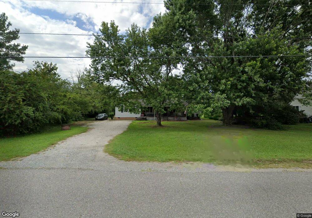
6626 Belroi Rd Gloucester, VA 23061
Gloucester South NeighborhoodEstimated Value: $277,944 - $297,000
3
Beds
2
Baths
1,456
Sq Ft
$196/Sq Ft
Est. Value
About This Home
This home is located at 6626 Belroi Rd, Gloucester, VA 23061 and is currently estimated at $285,486, approximately $196 per square foot. 6626 Belroi Rd is a home located in Gloucester County with nearby schools including Bethel Elementary School, Peasley Middle School, and Gloucester High School.
Ownership History
Date
Name
Owned For
Owner Type
Purchase Details
Closed on
Sep 26, 2005
Sold by
Currence Jeffrey W and Currence Karen M
Bought by
Forst Jack R
Current Estimated Value
Home Financials for this Owner
Home Financials are based on the most recent Mortgage that was taken out on this home.
Original Mortgage
$152,100
Outstanding Balance
$82,248
Interest Rate
6.12%
Mortgage Type
New Conventional
Estimated Equity
$203,238
Create a Home Valuation Report for This Property
The Home Valuation Report is an in-depth analysis detailing your home's value as well as a comparison with similar homes in the area
Home Values in the Area
Average Home Value in this Area
Purchase History
| Date | Buyer | Sale Price | Title Company |
|---|---|---|---|
| Forst Jack R | $152,100 | None Available |
Source: Public Records
Mortgage History
| Date | Status | Borrower | Loan Amount |
|---|---|---|---|
| Open | Forst Jack R | $152,100 |
Source: Public Records
Tax History
| Year | Tax Paid | Tax Assessment Tax Assessment Total Assessment is a certain percentage of the fair market value that is determined by local assessors to be the total taxable value of land and additions on the property. | Land | Improvement |
|---|---|---|---|---|
| 2025 | $1,412 | $230,030 | $55,760 | $174,270 |
| 2024 | $1,412 | $230,030 | $55,760 | $174,270 |
| 2023 | $1,341 | $230,030 | $55,760 | $174,270 |
| 2022 | $1,376 | $189,790 | $59,400 | $130,390 |
| 2021 | $919 | $189,790 | $59,400 | $130,390 |
| 2020 | $1,319 | $189,790 | $59,400 | $130,390 |
| 2019 | $1,203 | $173,090 | $58,550 | $114,540 |
| 2017 | $1,203 | $173,090 | $58,550 | $114,540 |
| 2016 | $1,185 | $170,530 | $60,900 | $109,630 |
| 2015 | $1,160 | $181,600 | $48,000 | $133,600 |
| 2014 | $1,180 | $181,600 | $48,000 | $133,600 |
Source: Public Records
Map
Nearby Homes
- 6916 Deerfield Ln
- 00 Chestnut Fork Rd
- 4783 Stephens Way
- 4805 Stephens Way
- Lot 8 Stephens Way
- Lot 4 Stephens Way
- Lot 3 Stephens Way
- 4871 Stephens Way
- 4152 Hickory Fork Rd
- 7056 Hunters Pointe Dr
- 6663 Hickory Fork Rd
- 5731 Kings Ridge Rd
- 6493 Walter Reed Dr
- 6381 Bolling Brook Ln
- 5403 Jonquil Ln
- 3346 Hickory Fork Rd
- .51+AC Ark Rd
- 000 Ark Rd
- 7397 Sinclair Way Unit 4-A-1
- 6223 Ruth Dr
- 6636 Belroi Rd
- 6616 Belroi Rd
- 6727 Harvest Cir
- 0 Johnny Walker Ln
- 6719 Harvest Cir
- 6646 Belroi Rd
- 5364 Chestnut Fork Rd
- 5364 Chestnut Fork Rd
- 6739 Harvest Cir
- 6656 Belroi Rd
- 5354 Chestnut Fork Rd
- 6605 Belroi Rd
- 5342 Chestnut Fork Rd
- 6732 Harvest Cir
- 6712 Greenfield Ln
- 6729 Greenfield Ln
- 5332 Chestnut Fork Rd
- 6722 Greenfield Ln
- 5383 Chestnut Fork Rd
- 5383 Chestnut Fork Rd
Your Personal Tour Guide
Ask me questions while you tour the home.