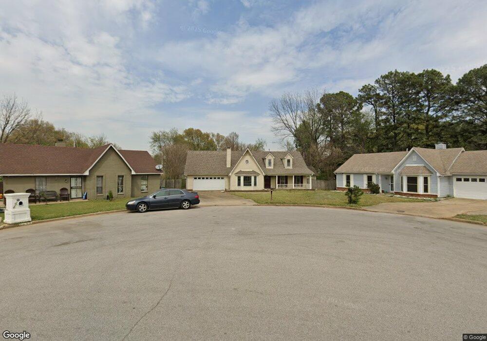
6626 Waders Ridge Dr Memphis, TN 38141
Hickory Hill NeighborhoodEstimated Value: $258,000 - $283,491
3
Beds
2
Baths
3,394
Sq Ft
$79/Sq Ft
Est. Value
About This Home
This home is located at 6626 Waders Ridge Dr, Memphis, TN 38141 and is currently estimated at $266,873, approximately $78 per square foot. 6626 Waders Ridge Dr is a home located in Shelby County with nearby schools including Ross Elementary School, Kirby High School, and Memphis Business Academy Hickory Hill Middle School.
Ownership History
Date
Name
Owned For
Owner Type
Purchase Details
Closed on
Sep 29, 2000
Sold by
Tomar Enterprises
Bought by
Woods Patsy E
Current Estimated Value
Home Financials for this Owner
Home Financials are based on the most recent Mortgage that was taken out on this home.
Original Mortgage
$100,174
Outstanding Balance
$36,637
Interest Rate
7.96%
Mortgage Type
FHA
Estimated Equity
$230,236
Purchase Details
Closed on
Dec 8, 1999
Sold by
Bennett Forrest A and Bennett Theresa A
Bought by
Hud
Create a Home Valuation Report for This Property
The Home Valuation Report is an in-depth analysis detailing your home's value as well as a comparison with similar homes in the area
Home Values in the Area
Average Home Value in this Area
Purchase History
| Date | Buyer | Sale Price | Title Company |
|---|---|---|---|
| Woods Patsy E | $101,000 | -- | |
| Hud | $106,354 | -- |
Source: Public Records
Mortgage History
| Date | Status | Borrower | Loan Amount |
|---|---|---|---|
| Open | Woods Patsy E | $100,174 | |
| Closed | Woods Patsy E | $5,315 |
Source: Public Records
Tax History Compared to Growth
Tax History
| Year | Tax Paid | Tax Assessment Tax Assessment Total Assessment is a certain percentage of the fair market value that is determined by local assessors to be the total taxable value of land and additions on the property. | Land | Improvement |
|---|---|---|---|---|
| 2025 | $1,251 | $77,450 | $11,000 | $66,450 |
| 2024 | $1,251 | $36,900 | $5,875 | $31,025 |
| 2023 | $2,248 | $36,900 | $5,875 | $31,025 |
| 2022 | $2,248 | $36,900 | $5,875 | $31,025 |
| 2021 | $2,274 | $36,900 | $5,875 | $31,025 |
| 2020 | $2,554 | $35,250 | $5,875 | $29,375 |
| 2019 | $2,554 | $35,250 | $5,875 | $29,375 |
| 2018 | $2,554 | $35,250 | $5,875 | $29,375 |
| 2017 | $1,449 | $35,250 | $5,875 | $29,375 |
| 2016 | $1,348 | $30,850 | $0 | $0 |
| 2014 | $1,348 | $30,850 | $0 | $0 |
Source: Public Records
Map
Nearby Homes
- 4868 Water Fowl Ln
- 6732 Henredon Dr
- 4821 Blue Wing St
- 6788 Burlingame Dr
- 6623 Cherry Bark Dr
- 6623 Quail Covey Dr
- 6493 Summer Creek E
- 4935 Woodberry Cove
- 4529 Quail Ridge Trail
- 6941 Bennington Cir
- 6770 Seven Valley Dr
- 6842 Rockbrook Dr
- 6716 Shoreline Cir
- 6543 Stockport Dr
- 4585 S Berrypick Ln
- 6744 Shoreline Cir
- 6770 Shoreline Cir
- 4447 Ross Rd
- 6846 Gilford Dr
- 6879 Gilford Dr
- 4846 Water Fowl Ln
- 6622 Waders Ridge Dr
- 4816 Mallard Nest Dr
- 4820 Mallard Nest Dr
- 6618 Waders Ridge Dr
- 4854 Water Fowl Ln
- 4824 Mallard Nest Dr
- 4814 Mallard Nest Dr
- 6648 Malej Rd
- 4828 Mallard Nest Dr
- 6617 Waders Ridge Dr
- 6610 Waders Ridge Dr
- 4860 Water Fowl Ln
- 4810 Mallard Nest Dr
- 4832 Mallard Nest Dr
- 4815 Mallard Nest Dr
- 6604 Waders Ridge Dr
- 6609 Waders Ridge Dr
- 6645 Malej Rd
- 4865 Water Fowl Ln