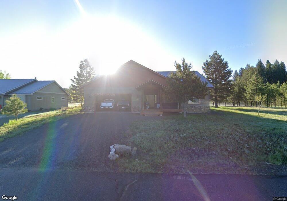
663 Fox Ridge Rd McCall, ID 83638
Estimated Value: $738,314 - $860,000
3
Beds
1
Bath
1,639
Sq Ft
$477/Sq Ft
Est. Value
About This Home
This home is located at 663 Fox Ridge Rd, McCall, ID 83638 and is currently estimated at $781,329, approximately $476 per square foot. 663 Fox Ridge Rd is a home with nearby schools including McCall-Donnelly High School, Mountain Life Education, and The North Fork School.
Ownership History
Date
Name
Owned For
Owner Type
Purchase Details
Closed on
Sep 25, 2018
Sold by
Mcmanus John T and Lojeck Margaret E
Bought by
Walters Shawn M and Walters Wendy M
Current Estimated Value
Home Financials for this Owner
Home Financials are based on the most recent Mortgage that was taken out on this home.
Original Mortgage
$341,525
Outstanding Balance
$298,464
Interest Rate
4.6%
Mortgage Type
New Conventional
Estimated Equity
$482,865
Purchase Details
Closed on
Aug 24, 2010
Sold by
Schreiber Deborah E
Bought by
Mcmanus John T and Lojek Margaret E
Purchase Details
Closed on
May 13, 2009
Sold by
Meltzer Harold
Bought by
Deutsche Bank National Trust Co
Create a Home Valuation Report for This Property
The Home Valuation Report is an in-depth analysis detailing your home's value as well as a comparison with similar homes in the area
Home Values in the Area
Average Home Value in this Area
Purchase History
| Date | Buyer | Sale Price | Title Company |
|---|---|---|---|
| Walters Shawn M | -- | First American Title Mccall | |
| Walters Shawn M | -- | First American Title Mccall | |
| Mcmanus John T | -- | -- | |
| Deutsche Bank National Trust Co | $49,802 | -- |
Source: Public Records
Mortgage History
| Date | Status | Borrower | Loan Amount |
|---|---|---|---|
| Open | Walters Shawn M | $341,525 | |
| Closed | Walters Shawn M | $341,525 |
Source: Public Records
Tax History Compared to Growth
Tax History
| Year | Tax Paid | Tax Assessment Tax Assessment Total Assessment is a certain percentage of the fair market value that is determined by local assessors to be the total taxable value of land and additions on the property. | Land | Improvement |
|---|---|---|---|---|
| 2025 | $2,467 | $732,841 | $171,832 | $561,009 |
| 2023 | $2,467 | $683,616 | $190,925 | $492,691 |
| 2022 | $2,342 | $578,311 | $176,749 | $401,562 |
| 2021 | $2,102 | $391,934 | $64,064 | $327,870 |
| 2020 | $2,103 | $333,653 | $49,201 | $284,452 |
| 2019 | $2,212 | $326,083 | $53,318 | $272,765 |
| 2018 | $1,767 | $264,725 | $46,066 | $218,659 |
| 2017 | $3,072 | $268,854 | $46,354 | $222,500 |
| 2016 | $357 | $34,406 | $34,406 | $0 |
| 2015 | $154 | $28,435 | $0 | $0 |
| 2013 | -- | $43,530 | $0 | $0 |
Source: Public Records
Map
Nearby Homes
- 663 Fox Ridge Ln
- 293 May Rd
- 649 Brady Dr
- 644 Woodlands Dr
- 668 Koski Dr
- 571 Krahn Ln
- TBD Krahn Ln
- 505 Willie Ln
- 441 Floyde St
- 881 Sheila Ln
- 413 S 3rd St
- Lot B Krahn Ln
- Lot A Krahn Ln
- 762 Deer Forest Dr
- 503 S Third St
- 413 Floyde St
- 408 Floyde St
- 417 Mcginnis St
- 304 Mcbride St Unit 301
- 615 Syringa Dr Unit 27