Estimated Value: $330,842 - $371,000
--
Bed
2
Baths
1,404
Sq Ft
$247/Sq Ft
Est. Value
About This Home
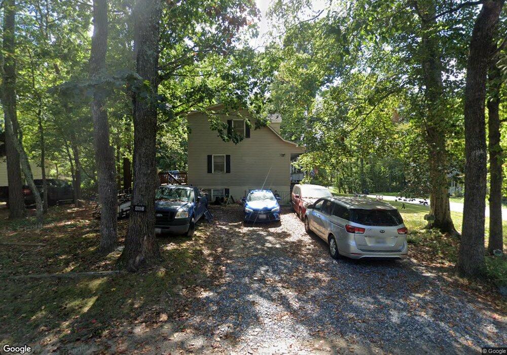
This home is located at 663 White Rock Rd, Lusby, MD 20657 and is currently estimated at $346,461, approximately $246 per square foot. 663 White Rock Rd is a home located in Calvert County with nearby schools including Patuxent Appeal Elementary Campus, Southern Middle School, and Patuxent High School.
Ownership History
Date
Name
Owned For
Owner Type
Purchase Details
Closed on
Oct 29, 1992
Sold by
H W Miller & Sons Inc
Bought by
Boschert Matthew J and Robin Ann Coralie
Current Estimated Value
Home Financials for this Owner
Home Financials are based on the most recent Mortgage that was taken out on this home.
Original Mortgage
$111,250
Interest Rate
8.23%
Purchase Details
Closed on
Jul 15, 1991
Sold by
Swisher Real Estate Services Pc
Bought by
H W Miller & Sons Inc
Purchase Details
Closed on
Jan 3, 1989
Sold by
Lang Michael W
Bought by
Swisher Real Estate Services Pc
Create a Home Valuation Report for This Property
The Home Valuation Report is an in-depth analysis detailing your home's value as well as a comparison with similar homes in the area
Home Values in the Area
Average Home Value in this Area
Purchase History
| Date | Buyer | Sale Price | Title Company |
|---|---|---|---|
| Boschert Matthew J | $109,900 | -- | |
| H W Miller & Sons Inc | $8,500 | -- | |
| Swisher Real Estate Services Pc | $3,800 | -- |
Source: Public Records
Mortgage History
| Date | Status | Borrower | Loan Amount |
|---|---|---|---|
| Closed | Boschert Matthew J | $111,250 |
Source: Public Records
Tax History Compared to Growth
Tax History
| Year | Tax Paid | Tax Assessment Tax Assessment Total Assessment is a certain percentage of the fair market value that is determined by local assessors to be the total taxable value of land and additions on the property. | Land | Improvement |
|---|---|---|---|---|
| 2025 | $3,006 | $262,567 | $0 | $0 |
| 2024 | $3,006 | $238,533 | $0 | $0 |
| 2023 | $2,383 | $214,500 | $55,200 | $159,300 |
| 2022 | $2,167 | $208,567 | $0 | $0 |
| 2021 | $5,186 | $202,633 | $0 | $0 |
| 2020 | $2,474 | $196,700 | $55,200 | $141,500 |
| 2019 | $2,024 | $192,933 | $0 | $0 |
| 2018 | $1,984 | $189,167 | $0 | $0 |
| 2017 | $2,346 | $185,400 | $0 | $0 |
| 2016 | -- | $185,400 | $0 | $0 |
| 2015 | $2,767 | $185,400 | $0 | $0 |
| 2014 | $2,767 | $187,700 | $0 | $0 |
Source: Public Records
Map
Nearby Homes
- 646 White Rock Rd
- 11609 Deadwood Dr
- 11540 Senora Ln
- 11616 Deadwood Dr
- 11525 Senora Ln
- 11543 Wolf Howl Ln
- 11722 Big Bear Ln
- 12361 Silver Rock Cir
- 11503 Ventura Trail
- 513 Bridle Ct
- 11428 Redlands Rd
- 11590 Durango Dr
- 634 Silver Rock Rd
- 11615 Big Bear Ln
- 383 Red Cloud Rd
- 11554 Durango Dr
- 285 Red Cloud Rd
- 12284 Bandera Ln
- 291 Red Cloud Rd
- 12407 Tahoe Ct
- 667 White Rock Rd
- 650 Grenada Ln
- 659 White Rock Rd
- 654 Grenada Ln
- 671 White Rock Rd
- 11562 Deadwood Dr
- 11613 Deadwood Dr
- 11573 Deadwood Dr
- 658 Grenada Ln
- 670 White Rock Rd
- 658 White Rock Rd
- 11558 Deadwood Dr
- 662 Grenada Ln
- 11577 Deadwood Dr
- 679 White Rock Rd
- 11557 Deadwood Dr
- 651 White Rock Rd
- 11569 Senora Ln
- 653 Grenada Ln
- 678 White Rock Rd