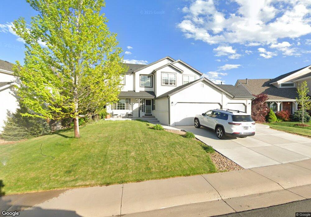
6632 Tiger Tooth Lone Tree, CO 80124
Southridge NeighborhoodEstimated Value: $691,000 - $739,838
4
Beds
3
Baths
3,855
Sq Ft
$186/Sq Ft
Est. Value
About This Home
This home is located at 6632 Tiger Tooth, Lone Tree, CO 80124 and is currently estimated at $715,419, approximately $185 per square foot. 6632 Tiger Tooth is a home located in Douglas County with nearby schools including Wildcat Mountain Elementary School, Rocky Heights Middle School, and Rock Canyon High School.
Ownership History
Date
Name
Owned For
Owner Type
Purchase Details
Closed on
Aug 31, 2015
Sold by
Nauman Stanley
Bought by
Carlson Jonathan M and Carlson Brandi N
Current Estimated Value
Home Financials for this Owner
Home Financials are based on the most recent Mortgage that was taken out on this home.
Original Mortgage
$364,000
Outstanding Balance
$285,208
Interest Rate
4.08%
Mortgage Type
New Conventional
Estimated Equity
$430,211
Purchase Details
Closed on
Oct 16, 2007
Sold by
Wilson Teresa M and Blake Wilson R
Bought by
Nauman Stanley
Home Financials for this Owner
Home Financials are based on the most recent Mortgage that was taken out on this home.
Original Mortgage
$276,800
Interest Rate
6.47%
Mortgage Type
Unknown
Purchase Details
Closed on
Oct 31, 2003
Sold by
Ellis Roy K and Ellis Luanne H
Bought by
Wilson Teresa M and Blake Wilson R
Home Financials for this Owner
Home Financials are based on the most recent Mortgage that was taken out on this home.
Original Mortgage
$277,600
Interest Rate
5.96%
Mortgage Type
Unknown
Purchase Details
Closed on
Apr 7, 2000
Sold by
Rice David A and Rice Kimberly J
Bought by
Ellis Roy K and Ellis Luanne H
Home Financials for this Owner
Home Financials are based on the most recent Mortgage that was taken out on this home.
Original Mortgage
$251,750
Interest Rate
7.75%
Purchase Details
Closed on
Aug 25, 1999
Sold by
Campbell Ronald G and Campbell Janet E
Bought by
Rice David A and Rice Kimberly J
Home Financials for this Owner
Home Financials are based on the most recent Mortgage that was taken out on this home.
Original Mortgage
$198,500
Interest Rate
7.68%
Purchase Details
Closed on
Jul 24, 1997
Sold by
Kdb Homes Inc
Bought by
Campbell Ronald G and Campbell Janet E
Home Financials for this Owner
Home Financials are based on the most recent Mortgage that was taken out on this home.
Original Mortgage
$135,500
Interest Rate
7.72%
Create a Home Valuation Report for This Property
The Home Valuation Report is an in-depth analysis detailing your home's value as well as a comparison with similar homes in the area
Home Values in the Area
Average Home Value in this Area
Purchase History
| Date | Buyer | Sale Price | Title Company |
|---|---|---|---|
| Carlson Jonathan M | $455,000 | Fidelity National Title | |
| Nauman Stanley | $346,000 | Fahtco | |
| Wilson Teresa M | $347,000 | North American Title | |
| Ellis Roy K | $274,000 | -- | |
| Rice David A | $253,500 | -- | |
| Campbell Ronald G | $205,041 | First American Heritage Titl |
Source: Public Records
Mortgage History
| Date | Status | Borrower | Loan Amount |
|---|---|---|---|
| Open | Carlson Jonathan M | $364,000 | |
| Previous Owner | Nauman Stanley | $276,800 | |
| Previous Owner | Wilson Teresa M | $277,600 | |
| Previous Owner | Ellis Roy K | $251,750 | |
| Previous Owner | Rice David A | $198,500 | |
| Previous Owner | Campbell Ronald G | $135,500 | |
| Closed | Wilson Teresa M | $52,050 |
Source: Public Records
Tax History
| Year | Tax Paid | Tax Assessment Tax Assessment Total Assessment is a certain percentage of the fair market value that is determined by local assessors to be the total taxable value of land and additions on the property. | Land | Improvement |
|---|---|---|---|---|
| 2025 | $5,267 | $45,980 | $8,730 | $37,250 |
| 2024 | $5,267 | $54,270 | $10,260 | $44,010 |
| 2023 | $5,316 | $54,270 | $10,260 | $44,010 |
| 2022 | $3,793 | $37,410 | $7,000 | $30,410 |
| 2021 | $3,940 | $37,410 | $7,000 | $30,410 |
| 2020 | $3,755 | $36,550 | $6,680 | $29,870 |
| 2019 | $3,767 | $36,550 | $6,680 | $29,870 |
| 2018 | $3,209 | $33,080 | $5,850 | $27,230 |
| 2017 | $3,255 | $33,080 | $5,850 | $27,230 |
| 2016 | $3,139 | $31,300 | $5,510 | $25,790 |
| 2015 | $3,198 | $31,300 | $5,510 | $25,790 |
| 2014 | $2,877 | $26,570 | $5,250 | $21,320 |
Source: Public Records
Map
Nearby Homes
- 10330 Lions Path
- 7053 Leopard Dr
- 10541 Jaguar Glen
- 7085 Leopard Gate
- 10146 Jill Ave
- 10292 Nickolas Ave
- 10439 Cheetah Winds
- 10445 Cheetah Winds
- 10232 Nickolas Ave
- 10653 Lieter Place
- 5639 Jaguar Way
- 5875 Cheetah Chase
- 10155 Joseph Dr
- 10899 Bobcat Terrace
- 10456 Carriage Club Dr
- 10660 Jewelberry Cir
- 10102 Glenstone Cir
- 10524 Applebrook Cir
- 5341 Windflower Ln
- 6098 Puma Ridge
- 6642 Tiger Tooth
- 6622 Tiger Tooth
- 6653 Tiger Paw
- 6652 Tiger Tooth
- 6644 Tiger Paw
- 6612 Tiger Tooth
- 6631 Tiger Tooth
- 6641 Tiger Tooth
- 6672 Tiger Tooth
- 6621 Tiger Tooth
- 6602 Tiger Tooth
- 6651 Tiger Tooth
- 6611 Tiger Tooth
- 6654 Tiger Paw
- 6683 Tiger Paw
- 6661 Tiger Tooth
- 6692 Tiger Tooth
- 6671 Tiger Tooth
- 6674 Tiger Paw
- 6681 Tiger Tooth
Your Personal Tour Guide
Ask me questions while you tour the home.