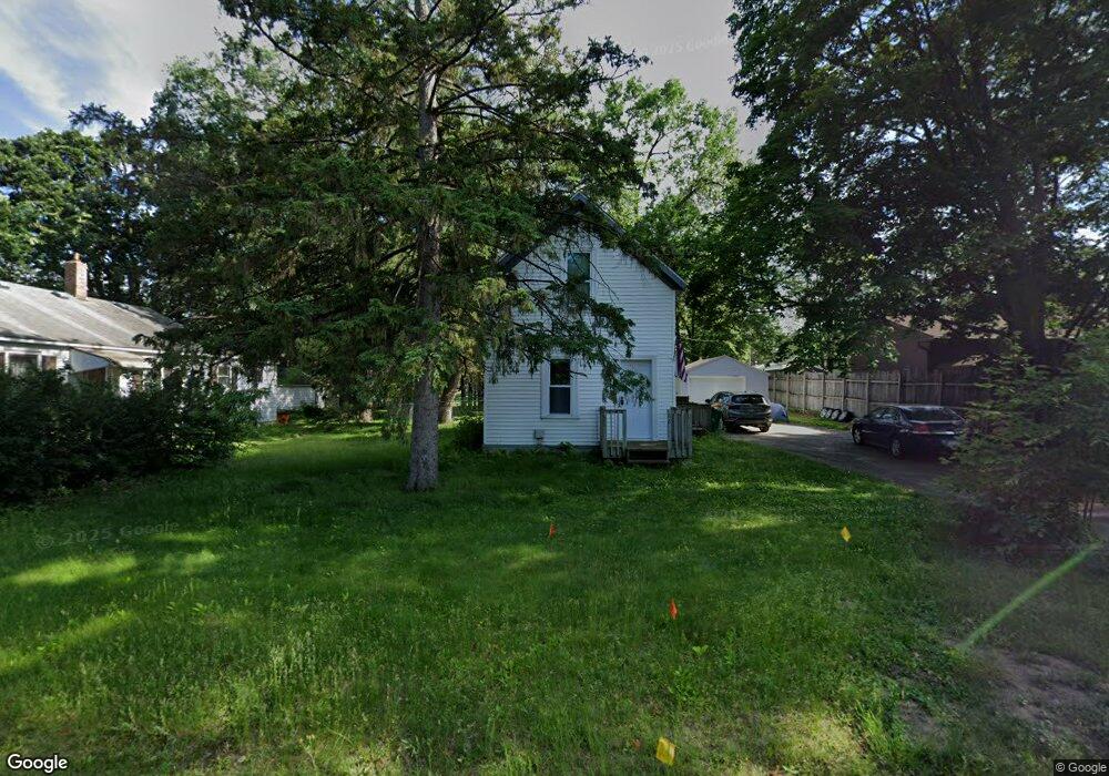
6633 Cedar St North Branch, MN 55056
Estimated Value: $212,000 - $265,000
2
Beds
1
Bath
1,159
Sq Ft
$208/Sq Ft
Est. Value
About This Home
This home is located at 6633 Cedar St, North Branch, MN 55056 and is currently estimated at $240,941, approximately $207 per square foot. 6633 Cedar St is a home located in Chisago County with nearby schools including North Branch Middle School, Sunrise River Elementary School, and North Branch Senior High School.
Ownership History
Date
Name
Owned For
Owner Type
Purchase Details
Closed on
Mar 31, 2022
Sold by
Ctw Group Incorporated
Bought by
Peterson Jacob
Current Estimated Value
Home Financials for this Owner
Home Financials are based on the most recent Mortgage that was taken out on this home.
Original Mortgage
$200,000
Outstanding Balance
$186,529
Interest Rate
3.92%
Mortgage Type
New Conventional
Estimated Equity
$54,412
Purchase Details
Closed on
Sep 27, 2021
Sold by
Biron Anthony Anthony
Home Financials for this Owner
Home Financials are based on the most recent Mortgage that was taken out on this home.
Original Mortgage
$70,549
Interest Rate
2.88%
Purchase Details
Closed on
Jul 31, 2018
Sold by
Liescke Janice C
Bought by
Biron Anthony D
Create a Home Valuation Report for This Property
The Home Valuation Report is an in-depth analysis detailing your home's value as well as a comparison with similar homes in the area
Home Values in the Area
Average Home Value in this Area
Purchase History
| Date | Buyer | Sale Price | Title Company |
|---|---|---|---|
| Peterson Jacob | $200,000 | -- | |
| -- | $82,700 | -- | |
| Biron Anthony D | $80,000 | -- | |
| -- | $82,700 | -- |
Source: Public Records
Mortgage History
| Date | Status | Borrower | Loan Amount |
|---|---|---|---|
| Open | Peterson Jacob | $200,000 | |
| Previous Owner | -- | $70,549 | |
| Previous Owner | -- | -- | |
| Closed | -- | $70,549 |
Source: Public Records
Tax History Compared to Growth
Tax History
| Year | Tax Paid | Tax Assessment Tax Assessment Total Assessment is a certain percentage of the fair market value that is determined by local assessors to be the total taxable value of land and additions on the property. | Land | Improvement |
|---|---|---|---|---|
| 2024 | $1,880 | $143,700 | $0 | $0 |
| 2023 | $1,880 | $133,100 | $0 | $0 |
| 2022 | $1,640 | $104,100 | $0 | $0 |
| 2021 | $1,216 | $78,200 | $0 | $0 |
| 2020 | $1,166 | $102,700 | $40,000 | $62,700 |
| 2019 | $1,056 | $0 | $0 | $0 |
| 2018 | $942 | $0 | $0 | $0 |
| 2017 | $934 | $0 | $0 | $0 |
| 2016 | $884 | $0 | $0 | $0 |
| 2015 | $834 | $0 | $0 | $0 |
| 2014 | -- | $59,700 | $0 | $0 |
Source: Public Records
Map
Nearby Homes
- 38958 Elm Ct
- 38946 7th Ave
- 36XXX Forest Blvd
- 39183 Grand Ave
- XXXXX Maple St
- 38558 Grand Ave
- XXX Ash St
- 6231 Red Fox Run
- 38692 Hawthorne Ave
- TBD Saint Croix Trail
- 38578 Hawthorne Ave
- 7255 Hawthorne Ct
- 38470 Glacier Dr
- 7222 Hawthorne Ct
- 7246 385th St
- 38xxx Oakview Ave
- 38725 12th Ave Unit 83
- 5244 391st St
- 39590 Hemingway Ave
- 39xxx Hemingway Ave