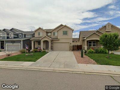
6638 Stingray Ln Colorado Springs, CO 80925
Lorson Ranch NeighborhoodEstimated Value: $499,000 - $511,000
4
Beds
4
Baths
2,304
Sq Ft
$220/Sq Ft
Est. Value
About This Home
This home is located at 6638 Stingray Ln, Colorado Springs, CO 80925 and is currently estimated at $506,197, approximately $219 per square foot. 6638 Stingray Ln is a home with nearby schools including Grand Mountain School, Mesa Ridge High School, and Valley Christian Academy.
Ownership History
Date
Name
Owned For
Owner Type
Purchase Details
Closed on
Aug 17, 2017
Sold by
Carter Brian C and Carter Laura B
Bought by
Arnett Elizabeth Ladd
Current Estimated Value
Home Financials for this Owner
Home Financials are based on the most recent Mortgage that was taken out on this home.
Original Mortgage
$210,000
Outstanding Balance
$178,029
Interest Rate
4.03%
Mortgage Type
New Conventional
Estimated Equity
$327,844
Purchase Details
Closed on
May 22, 2015
Sold by
Windsor Ridge Homes Llc
Bought by
Carter Brian C and Carter Laura B
Home Financials for this Owner
Home Financials are based on the most recent Mortgage that was taken out on this home.
Original Mortgage
$287,450
Interest Rate
3.68%
Mortgage Type
VA
Create a Home Valuation Report for This Property
The Home Valuation Report is an in-depth analysis detailing your home's value as well as a comparison with similar homes in the area
Home Values in the Area
Average Home Value in this Area
Purchase History
| Date | Buyer | Sale Price | Title Company |
|---|---|---|---|
| Arnett Elizabeth Ladd | $310,000 | First American Title | |
| Carter Brian C | $281,400 | Empire Title Co Springs Llc |
Source: Public Records
Mortgage History
| Date | Status | Borrower | Loan Amount |
|---|---|---|---|
| Open | Arnett Elizabeth Ladd | $210,000 | |
| Previous Owner | Carter Brian C | $287,450 | |
| Previous Owner | Windsor Ridge Homes Llc | $205,183 |
Source: Public Records
Tax History Compared to Growth
Tax History
| Year | Tax Paid | Tax Assessment Tax Assessment Total Assessment is a certain percentage of the fair market value that is determined by local assessors to be the total taxable value of land and additions on the property. | Land | Improvement |
|---|---|---|---|---|
| 2024 | $4,842 | $36,120 | $6,040 | $30,080 |
| 2022 | $3,839 | $27,730 | $4,810 | $22,920 |
| 2021 | $3,584 | $25,580 | $4,950 | $20,630 |
| 2020 | $3,444 | $24,320 | $4,330 | $19,990 |
| 2019 | $3,432 | $24,320 | $4,330 | $19,990 |
| 2018 | $3,013 | $21,020 | $4,360 | $16,660 |
| 2017 | $3,076 | $21,020 | $4,360 | $16,660 |
| 2016 | $2,812 | $21,730 | $4,380 | $17,350 |
| 2015 | $1,196 | $8,770 | $8,770 | $0 |
| 2014 | $1,474 | $10,860 | $10,860 | $0 |
Source: Public Records
Map
Nearby Homes
- 6687 Stingray Ln
- 6685 Alliance Loop
- 10670 Abrams Dr
- 10583 Kalama Dr
- 10218 Intrepid Way
- 6558 Alliance Loop
- 10622 Abrams Dr
- 10178 Intrepid Way
- 6878 Alliance Loop
- 10441 Castor Dr
- 6868 Alsea Dr
- 10384 Declaration Dr
- 10251 Intrepid Way
- 10311 Declaration Dr
- 10171 Seawolf Dr
- 10585 Abrams Dr
- 10394 Abrams Dr
- 10340 Abrams Dr
- 6677 Lamine Dr
- 10573 Luneth Dr
- 6638 Stingray Ln
- 6650 Stingray Ln
- 6626 Stingray Ln
- 6662 Stingray Ln
- 6614 Stingray Ln
- 6758 Alliance Loop
- 6766 Alliance Loop
- 6750 Alliance Loop
- 6774 Alliance Loop
- 6674 Stingray Ln
- 6602 Stingray Ln
- 6742 Alliance Loop
- 6639 Stingray Ln
- 6651 Stingray Ln
- 6782 Alliance Loop
- 6663 Stingray Ln
- 6615 Stingray Ln
- 6686 Stingray Ln
- 6734 Alliance Loop
- 6675 Stingray Ln