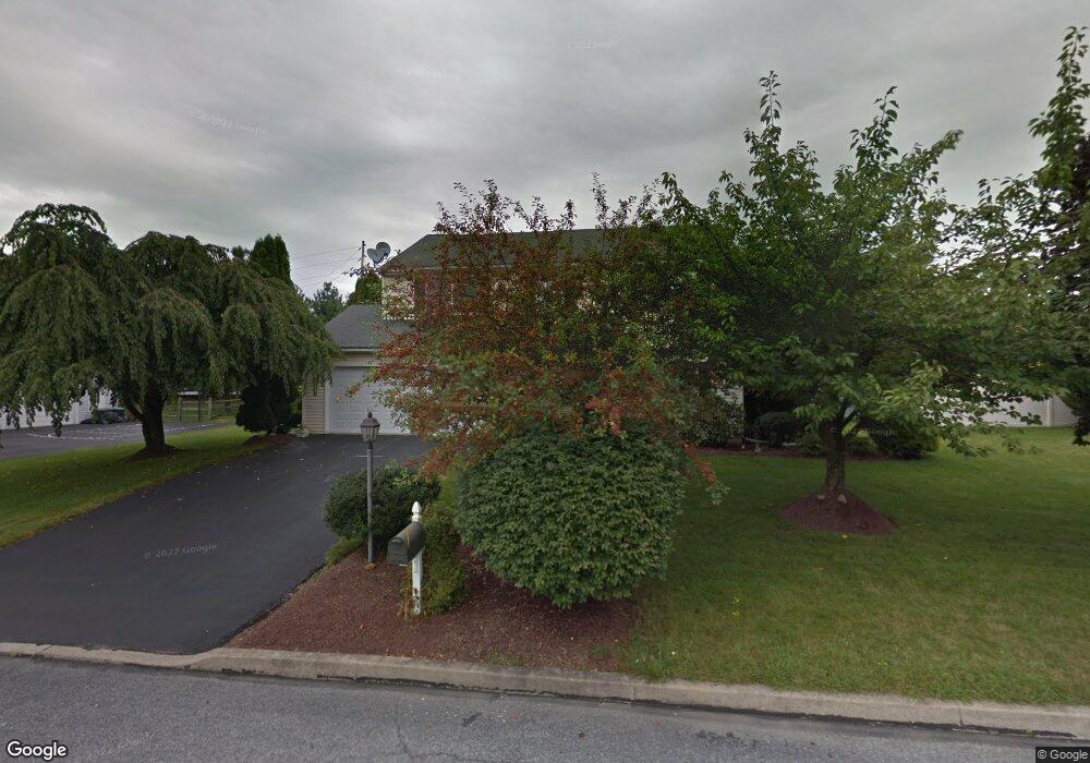
664 Howe St Easton, PA 18040
Estimated Value: $466,000 - $490,000
4
Beds
3
Baths
2,072
Sq Ft
$230/Sq Ft
Est. Value
About This Home
This home is located at 664 Howe St, Easton, PA 18040 and is currently estimated at $475,656, approximately $229 per square foot. 664 Howe St is a home located in Northampton County with nearby schools including Shawnee Elementary School, Easton Area Middle School, and Easton Area High School.
Ownership History
Date
Name
Owned For
Owner Type
Purchase Details
Closed on
Jul 13, 2006
Sold by
Krametz Donald G
Bought by
Perez Moises
Current Estimated Value
Home Financials for this Owner
Home Financials are based on the most recent Mortgage that was taken out on this home.
Original Mortgage
$250,400
Outstanding Balance
$149,884
Interest Rate
6.8%
Mortgage Type
New Conventional
Estimated Equity
$325,772
Purchase Details
Closed on
Dec 17, 2002
Bought by
Krametz Donald G and Krametz Lisa A
Create a Home Valuation Report for This Property
The Home Valuation Report is an in-depth analysis detailing your home's value as well as a comparison with similar homes in the area
Home Values in the Area
Average Home Value in this Area
Purchase History
| Date | Buyer | Sale Price | Title Company |
|---|---|---|---|
| Perez Moises | $313,000 | -- | |
| Krametz Donald G | $205,000 | -- |
Source: Public Records
Mortgage History
| Date | Status | Borrower | Loan Amount |
|---|---|---|---|
| Open | Perez Moises | $250,400 |
Source: Public Records
Tax History Compared to Growth
Tax History
| Year | Tax Paid | Tax Assessment Tax Assessment Total Assessment is a certain percentage of the fair market value that is determined by local assessors to be the total taxable value of land and additions on the property. | Land | Improvement |
|---|---|---|---|---|
| 2025 | $849 | $78,600 | $22,600 | $56,000 |
| 2024 | $6,887 | $78,600 | $22,600 | $56,000 |
| 2023 | $6,782 | $78,600 | $22,600 | $56,000 |
| 2022 | $6,679 | $78,600 | $22,600 | $56,000 |
| 2021 | $6,657 | $78,600 | $22,600 | $56,000 |
| 2020 | $6,653 | $78,600 | $22,600 | $56,000 |
| 2019 | $6,558 | $78,600 | $22,600 | $56,000 |
| 2018 | $6,446 | $78,600 | $22,600 | $56,000 |
| 2017 | $6,253 | $78,600 | $22,600 | $56,000 |
| 2016 | -- | $78,600 | $22,600 | $56,000 |
| 2015 | -- | $78,600 | $22,600 | $56,000 |
| 2014 | -- | $78,600 | $22,600 | $56,000 |
Source: Public Records
Map
Nearby Homes
- 2755 Destiny Ln
- 286 Park Ridge Dr
- 311 Knollwood Dr
- 329 Knollwood Dr
- 257 Park Ridge Dr
- 104 Winding Rd
- 195 Park Ridge Dr
- 226 Winding Rd
- REGENT Plan at Lafayette Hills - Twins
- Derby Duplex Plan at Lafayette Hills - Twins
- PENWELL Plan at Lafayette Hills
- GALEN Plan at Lafayette Hills
- 107 Winding Rd
- 2194 Steuben Ln
- 202 Park Ridge Dr
- 2665 Pond Dr
- 2201 Huntington Ln
- 228 Winding Rd
- 223 Winding Rd
- 224 Winding Rd
- 668 Howe St
- 660 Howe St
- 667 Howe St
- 661 Howe St
- 673 Howe St
- 672 Howe St
- 433 Freedom Ct
- 433 Freedom Ct Unit Lot 15
- 433 Freedom Ct Unit Lt 15
- 2503 Kesslerville Rd
- 2405 Sullivan Trail
- 679 Howe St
- 2500 Clark Place
- 2500 Clark Place
- 676 Howe St
- 685 Gates St
- 696 Kesslersville Rd
- 2505 Clark Place
- 2289 Lee Ln
- 688 Gates St