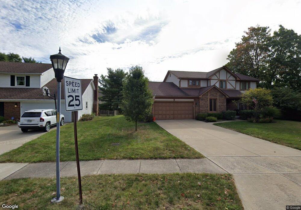
664 Ipswich St Westerville, OH 43081
Estimated Value: $476,884 - $491,000
4
Beds
3
Baths
2,479
Sq Ft
$195/Sq Ft
Est. Value
About This Home
This home is located at 664 Ipswich St, Westerville, OH 43081 and is currently estimated at $484,471, approximately $195 per square foot. 664 Ipswich St is a home located in Franklin County with nearby schools including Mcvay Elementary School, Walnut Springs Middle School, and Westerville-North High School.
Ownership History
Date
Name
Owned For
Owner Type
Purchase Details
Closed on
Jul 3, 2008
Sold by
Frindell Wayne E and Frindell Margaret O
Bought by
Wallace Christopher L and Wallace Shannon M
Current Estimated Value
Home Financials for this Owner
Home Financials are based on the most recent Mortgage that was taken out on this home.
Original Mortgage
$219,500
Outstanding Balance
$142,179
Interest Rate
6.15%
Mortgage Type
VA
Estimated Equity
$342,292
Purchase Details
Closed on
May 1, 1990
Bought by
Frindell Wayne E
Purchase Details
Closed on
Mar 1, 1980
Create a Home Valuation Report for This Property
The Home Valuation Report is an in-depth analysis detailing your home's value as well as a comparison with similar homes in the area
Home Values in the Area
Average Home Value in this Area
Purchase History
| Date | Buyer | Sale Price | Title Company |
|---|---|---|---|
| Wallace Christopher L | $219,500 | Talon Group | |
| Frindell Wayne E | $159,000 | -- | |
| -- | $105,000 | -- |
Source: Public Records
Mortgage History
| Date | Status | Borrower | Loan Amount |
|---|---|---|---|
| Open | Wallace Christopher L | $219,500 |
Source: Public Records
Tax History Compared to Growth
Tax History
| Year | Tax Paid | Tax Assessment Tax Assessment Total Assessment is a certain percentage of the fair market value that is determined by local assessors to be the total taxable value of land and additions on the property. | Land | Improvement |
|---|---|---|---|---|
| 2024 | $7,698 | $135,450 | $33,250 | $102,200 |
| 2023 | $7,535 | $135,450 | $33,250 | $102,200 |
| 2022 | $7,056 | $96,850 | $22,230 | $74,620 |
| 2021 | $7,115 | $96,850 | $22,230 | $74,620 |
| 2020 | $7,095 | $96,850 | $22,230 | $74,620 |
| 2019 | $6,193 | $79,810 | $18,520 | $61,290 |
| 2018 | $6,024 | $79,810 | $18,520 | $61,290 |
| 2017 | $6,131 | $79,810 | $18,520 | $61,290 |
| 2016 | $6,172 | $73,610 | $20,650 | $52,960 |
| 2015 | $5,977 | $73,610 | $20,650 | $52,960 |
| 2014 | $5,982 | $73,610 | $20,650 | $52,960 |
| 2013 | $2,845 | $70,105 | $19,670 | $50,435 |
Source: Public Records
Map
Nearby Homes
- 1209 Chatham Ridge Rd
- 1368 Nutmeg Ct
- 1146 Forest Rise Dr
- 750 Autumn Branch Rd
- 737 Autumn Branch Rd
- 613 Valley Wood Ct
- 1003 Autumn Meadows Dr
- 994 Autumn Lake Ct
- 969 Farrington Dr
- 1201 Wallean Dr
- 640 Brook Run Dr
- 5769 Burntwood Way
- 800 S Spring Rd
- 90 Spring Creek Dr
- 4540 Central College Rd
- 806 Watten Ln
- 6452 Rockhold Dr
- 5518 Seclusion Dr
- 810 Applewood Ln
- 5807 Parchment Dr
- 1300 Scituate Ct
- 1293 Scituate Ct
- 1294 NE Scituate
- 1294 Scituate Ct
- 1285 Scituate Ct
- 483 S Sunbury Rd
- 1289 Smoke Burr Dr
- 1284 Scituate Ct
- 1275 Scituate Ct
- 497 S Sunbury Rd
- 1279 Smoke Burr Dr
- 1278 Scituate Ct
- 1273 Smoke Burr Dr
- 1292 Chatham Ridge Rd
- 658 Ipswich St
- 1265 Scituate Ct
- 1282 Chatham Ridge Rd
- 1270 Scituate Ct
- 1274 Chatham Ridge Rd
- 1267 Smoke Burr Dr