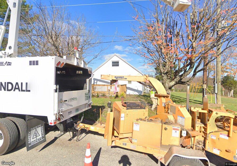
664 Messing Rd Jackson, OH 45640
Estimated Value: $56,000 - $206,000
2
Beds
1
Bath
1,037
Sq Ft
$134/Sq Ft
Est. Value
About This Home
This home is located at 664 Messing Rd, Jackson, OH 45640 and is currently estimated at $138,810, approximately $133 per square foot. 664 Messing Rd is a home located in Jackson County with nearby schools including Jackson High School.
Ownership History
Date
Name
Owned For
Owner Type
Purchase Details
Closed on
Oct 27, 2022
Sold by
Ronson Rentals Llc
Bought by
Misty L Davis and Bobby J Davis
Current Estimated Value
Home Financials for this Owner
Home Financials are based on the most recent Mortgage that was taken out on this home.
Interest Rate
7.08%
Purchase Details
Closed on
Oct 26, 2022
Sold by
Ronson Rentals Llc
Bought by
Davis Misty L and Davis Bobby J
Home Financials for this Owner
Home Financials are based on the most recent Mortgage that was taken out on this home.
Interest Rate
7.08%
Purchase Details
Closed on
Aug 17, 2021
Sold by
Camp David
Bought by
Ronson Rentals Llc
Purchase Details
Closed on
Oct 1, 2019
Sold by
Brown Construction Services Llc
Bought by
Camp David
Purchase Details
Closed on
May 7, 2010
Sold by
Wolford Ted and Wolford Cathy E
Bought by
Brown Construction Services Llc
Purchase Details
Closed on
Oct 13, 2004
Sold by
Rossi Thelma
Bought by
Wolford Ted
Create a Home Valuation Report for This Property
The Home Valuation Report is an in-depth analysis detailing your home's value as well as a comparison with similar homes in the area
Purchase History
| Date | Buyer | Sale Price | Title Company |
|---|---|---|---|
| Misty L Davis | $120,750 | -- | |
| Davis Misty L | $125 | -- | |
| Ronson Rentals Llc | $35,000 | None Available | |
| Camp David | $20,000 | Bestitle | |
| Brown Construction Services Llc | $30,000 | Attorney | |
| Wolford Ted | $35,000 | -- |
Source: Public Records
Mortgage History
| Date | Status | Borrower | Loan Amount |
|---|---|---|---|
| Closed | Misty L Davis | -- | |
| Open | Davis Misty L | $122,222 |
Source: Public Records
Tax History
| Year | Tax Paid | Tax Assessment Tax Assessment Total Assessment is a certain percentage of the fair market value that is determined by local assessors to be the total taxable value of land and additions on the property. | Land | Improvement |
|---|---|---|---|---|
| 2024 | $676 | $18,520 | $6,600 | $11,920 |
| 2023 | $687 | $18,520 | $6,600 | $11,920 |
| 2022 | $754 | $14,810 | $5,840 | $8,970 |
| 2021 | $613 | $14,810 | $5,840 | $8,970 |
| 2020 | $616 | $14,810 | $5,840 | $8,970 |
| 2019 | $546 | $12,880 | $5,080 | $7,800 |
| 2018 | $527 | $12,880 | $5,080 | $7,800 |
| 2017 | $506 | $12,880 | $5,080 | $7,800 |
| 2016 | $415 | $10,520 | $5,060 | $5,460 |
| 2015 | $417 | $10,520 | $5,060 | $5,460 |
| 2013 | $402 | $10,260 | $5,060 | $5,200 |
| 2012 | $408 | $10,260 | $5,060 | $5,200 |
Source: Public Records
Map
Nearby Homes
- 627 Russ Rd
- 0 5 Points Rd
- 216 Patrick Ave
- 1656 Dever Rd
- 788 Red Brush Rd
- 0 Four Mile Rd Unit 226002566
- 0 Four Mile Rd Unit 2434442
- 142 Petersburg Rd
- 10057 Ohio 776
- 816 Cove Rd
- 1951 Mayhew Rd
- 129 Florence Ave
- 66 Grandview Ave
- 225 S David Ave
- 0 Main and Ballard St
- 75 W Huron St
- 8 Fleetwood Ave
- 4202 Jisco West Rd
- 38 S High St
- 31 S Bennett Ave
- 816 Messing Rd
- 858 Messing Rd
- 448 Messing Rd
- 431 Messing Rd
- 446 Messing Rd
- 181 Messing Rd
- 181 Messing Rd
- 1747 Bert Harrold Rd
- 1967 Bert Harrold Rd
- 1511 Messing Rd
- 1964 Bert Harrold Rd
- 1510 Bert Harrold Rd
- 1997 Bert Harrold Rd
- 4068 Bert Harrold Rd
- 4140 Bert Harrold Rd
- 0 Bert Harrold Rd
- 2500 Five Points Rd
- 1368 Bert Harrold Rd
- 1323 Bert Harrold Rd
- 1666 Messing Rd
Your Personal Tour Guide
Ask me questions while you tour the home.
