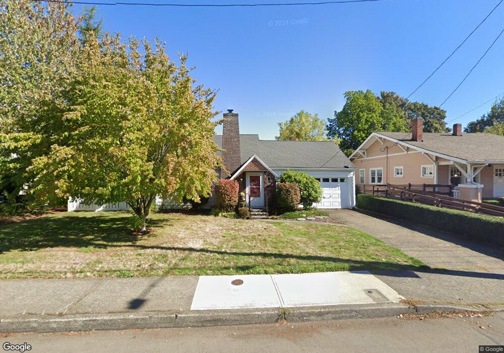
664 N Main Ave Gresham, OR 97030
Downtown Gresham NeighborhoodEstimated Value: $353,719 - $559,000
3
Beds
1
Bath
1,250
Sq Ft
$339/Sq Ft
Est. Value
About This Home
This home is located at 664 N Main Ave, Gresham, OR 97030 and is currently estimated at $424,180, approximately $339 per square foot. 664 N Main Ave is a home located in Multnomah County with nearby schools including Highland Elementary School, Clear Creek Middle School, and Gresham High School.
Ownership History
Date
Name
Owned For
Owner Type
Purchase Details
Closed on
Nov 22, 2024
Sold by
V Lael Hays Trust and Harry Jenell R
Bought by
Jjk Property Management Llc
Current Estimated Value
Purchase Details
Closed on
Mar 10, 2009
Sold by
Hays V Lael
Bought by
Hays V Lael and V Lael Hays Trust
Purchase Details
Closed on
Nov 8, 2000
Sold by
Tillstrom Roxy L
Bought by
Hays Robert L and Lael Hays V
Home Financials for this Owner
Home Financials are based on the most recent Mortgage that was taken out on this home.
Original Mortgage
$100,000
Interest Rate
7.88%
Mortgage Type
Seller Take Back
Create a Home Valuation Report for This Property
The Home Valuation Report is an in-depth analysis detailing your home's value as well as a comparison with similar homes in the area
Home Values in the Area
Average Home Value in this Area
Purchase History
| Date | Buyer | Sale Price | Title Company |
|---|---|---|---|
| Jjk Property Management Llc | -- | None Listed On Document | |
| Jjk Property Management Llc | -- | None Listed On Document | |
| Hays V Lael | -- | None Available | |
| Hays Robert L | $150,000 | Oregon Title Insurance Co |
Source: Public Records
Mortgage History
| Date | Status | Borrower | Loan Amount |
|---|---|---|---|
| Previous Owner | Hays Robert L | $100,000 |
Source: Public Records
Tax History
| Year | Tax Paid | Tax Assessment Tax Assessment Total Assessment is a certain percentage of the fair market value that is determined by local assessors to be the total taxable value of land and additions on the property. | Land | Improvement |
|---|---|---|---|---|
| 2025 | $3,922 | $192,710 | -- | -- |
| 2024 | $3,754 | $187,100 | -- | -- |
| 2023 | $3,420 | $181,660 | $0 | $0 |
| 2022 | $3,325 | $176,370 | $0 | $0 |
| 2021 | $3,241 | $171,240 | $0 | $0 |
| 2020 | $3,050 | $166,260 | $0 | $0 |
| 2019 | $3,062 | $161,420 | $0 | $0 |
| 2018 | $2,832 | $156,720 | $0 | $0 |
| 2017 | $2,717 | $152,160 | $0 | $0 |
| 2016 | $2,395 | $147,730 | $0 | $0 |
Source: Public Records
Map
Nearby Homes
- 0 NE 5th St
- 318 NE Roberts Ave Unit 308
- 318 NE Roberts Ave Unit 203
- 54 NW 13th St
- 491 NE Elliott Ave
- 660 NE 9th St
- 894 NE Linden Ave
- 234 NE Cleveland Ave
- 645 W Powell Blvd
- 1783 1791 NE Beech Place
- 349 NE 18th St
- 415 SE Roberts Ave
- 417 SE Roberts Ave
- 0 NE 6th St
- 450 NE 22nd St
- 994 NW Wallula Ave
- 1113 W Powell Blvd
- 159 SW Florence Ave Unit 64
- 159 SW Florence Ave
- 638 SW 7th St
- 638 N Main Ave
- 713 NE Roberts Ave
- 703 NE Roberts Ave
- 622 N Main Ave
- 722 N Main Ave Unit 1
- 722 N Main Ave
- 647 NE Roberts Ave
- 645 NE Roberts Ave
- 723 NE Roberts Ave Unit 743
- 610 N Main Ave
- 780 N Main Ave
- 0 Dylans Place Lot 8 Unit 8
- 605 NE Roberts Ave
- 745 NE Roberts Ave Unit 747
- 601 NE Roberts Ave
- 583 NE Roberts Ave Unit 601
- 577 NE Roberts Ave
- 571 NE Roberts Ave
- 532 N Main Ave
- 579 NE Roberts Ave
Your Personal Tour Guide
Ask me questions while you tour the home.