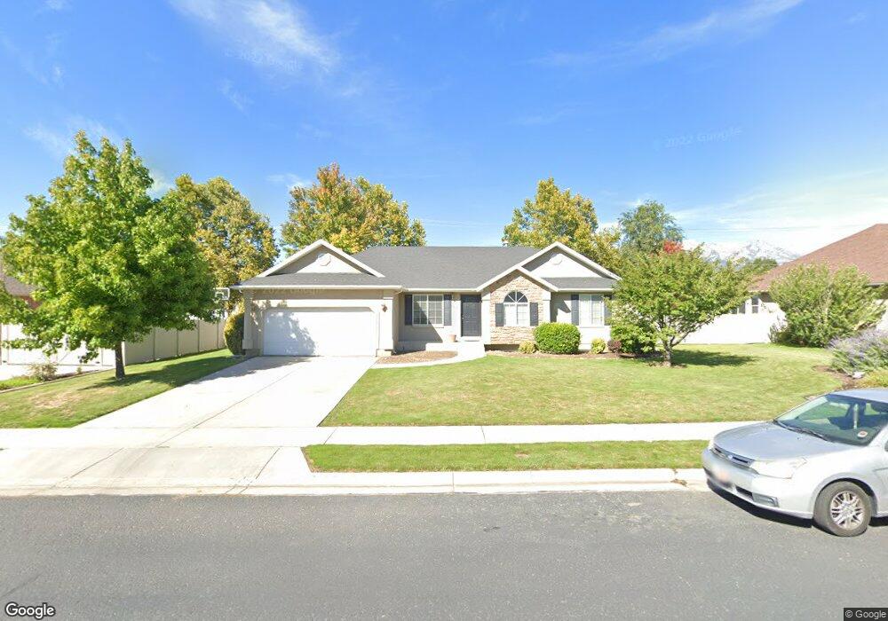
6642 W 10380 N Highland, UT 84003
Estimated Value: $716,000 - $775,000
3
Beds
3
Baths
1,394
Sq Ft
$536/Sq Ft
Est. Value
About This Home
This home is located at 6642 W 10380 N, Highland, UT 84003 and is currently estimated at $747,426, approximately $536 per square foot. 6642 W 10380 N is a home located in Utah County with nearby schools including Freedom Elementary School, Mountain Ridge Junior High School, and American Fork High School.
Ownership History
Date
Name
Owned For
Owner Type
Purchase Details
Closed on
Jul 10, 2020
Sold by
Rice Family Rental Llc
Bought by
Rice Loretta C and Rice R
Current Estimated Value
Purchase Details
Closed on
Apr 26, 2017
Sold by
Eckery Robert B and Eckery Kimberly R
Bought by
Rice Family Rental Lc
Purchase Details
Closed on
May 21, 2004
Sold by
Patterson Construction
Bought by
Eckery Robert B and Eckery Kimberly R
Create a Home Valuation Report for This Property
The Home Valuation Report is an in-depth analysis detailing your home's value as well as a comparison with similar homes in the area
Home Values in the Area
Average Home Value in this Area
Purchase History
| Date | Buyer | Sale Price | Title Company |
|---|---|---|---|
| Rice Loretta C | -- | United West Title | |
| Rice Family Rental Lc | -- | United West Title | |
| Eckery Robert B | -- | Signature Title Insurance A | |
| Patterson Construction | -- | -- |
Source: Public Records
Tax History Compared to Growth
Tax History
| Year | Tax Paid | Tax Assessment Tax Assessment Total Assessment is a certain percentage of the fair market value that is determined by local assessors to be the total taxable value of land and additions on the property. | Land | Improvement |
|---|---|---|---|---|
| 2025 | $2,914 | $389,620 | $342,200 | $366,200 |
| 2024 | $2,914 | $359,920 | $0 | $0 |
| 2023 | $2,712 | $361,405 | $0 | $0 |
| 2022 | $2,830 | $365,695 | $0 | $0 |
| 2021 | $2,471 | $475,500 | $182,700 | $292,800 |
| 2020 | $2,348 | $443,200 | $158,900 | $284,300 |
| 2019 | $2,057 | $406,100 | $158,900 | $247,200 |
| 2018 | $2,129 | $399,500 | $152,300 | $247,200 |
| 2017 | $2,085 | $208,780 | $0 | $0 |
| 2016 | $2,033 | $190,300 | $0 | $0 |
| 2015 | $1,921 | $170,390 | $0 | $0 |
| 2014 | -- | $154,880 | $0 | $0 |
Source: Public Records
Map
Nearby Homes
- 10434 N 6400 W
- 6372 W 10400 N
- 6373 W 10500 N
- 6399 W 10150 N
- 9967 N 6670 W
- 9924 N 6630 W Unit 9
- 1602 E Center Pointe Dr
- 1602 E Center Pointe Dr Unit 1
- 1610 E Center Pointe Dr
- 6190 W 10050 N
- 6692 W 9770 N
- 6271 W 10830 St N
- 975 E 2850 N
- 975 E 2125 N
- 11337 N 5950 W Unit 7
- 2208 N 825 E
- 859 E 2125 N
- 10818 N 6000 W
- 5973 W 9960 N
- 9780 N 6000 W
- 6654 W 10380 N
- 6624 W 10380 N
- 6637 W 10380 N
- 6653 W 10380 N
- 6623 W 10380 N
- 6672 W 10380 N
- 10393 N 6580 W
- 6653 Canterbury Way
- 6653 Canterbury Way Unit 43
- 6637 W Canterbury Way Unit 44
- 6637 W Canterbury Way
- 6637 Canterbury Way
- 6667 Canterbury Way
- 6667 W Canterbury Way Unit 42
- 6667 W Canterbury Way
- 6667 W 10380 N
- 10321 N 6630 W
- 6623 W Canterbury Way
- 6623 Canterbury Way
- 6623 Canterbury Way Unit 45