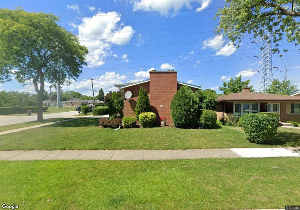
6644 Hazel St Unit 1 Morton Grove, IL 60053
Estimated Value: $427,000 - $480,000
3
Beds
3
Baths
1,397
Sq Ft
$328/Sq Ft
Est. Value
About This Home
This home is located at 6644 Hazel St Unit 1, Morton Grove, IL 60053 and is currently estimated at $457,667, approximately $327 per square foot. 6644 Hazel St Unit 1 is a home located in Cook County with nearby schools including Hynes Elementary School, Golf Middle School, and St John Brebeuf School.
Ownership History
Date
Name
Owned For
Owner Type
Purchase Details
Closed on
Apr 25, 1996
Sold by
Genualdi Castrenze and Genualdi Laura
Bought by
Nadirsha George and Nadirsha Shameran
Current Estimated Value
Home Financials for this Owner
Home Financials are based on the most recent Mortgage that was taken out on this home.
Original Mortgage
$130,000
Interest Rate
7.78%
Mortgage Type
Balloon
Create a Home Valuation Report for This Property
The Home Valuation Report is an in-depth analysis detailing your home's value as well as a comparison with similar homes in the area
Home Values in the Area
Average Home Value in this Area
Purchase History
| Date | Buyer | Sale Price | Title Company |
|---|---|---|---|
| Nadirsha George | $216,000 | Attorneys Natl Title Network |
Source: Public Records
Mortgage History
| Date | Status | Borrower | Loan Amount |
|---|---|---|---|
| Closed | Nadirsha George | $130,000 |
Source: Public Records
Tax History Compared to Growth
Tax History
| Year | Tax Paid | Tax Assessment Tax Assessment Total Assessment is a certain percentage of the fair market value that is determined by local assessors to be the total taxable value of land and additions on the property. | Land | Improvement |
|---|---|---|---|---|
| 2024 | $4,544 | $39,000 | $7,540 | $31,460 |
| 2023 | $8,536 | $39,000 | $7,540 | $31,460 |
| 2022 | $8,536 | $39,000 | $7,540 | $31,460 |
| 2021 | $4,969 | $33,513 | $4,640 | $28,873 |
| 2020 | $4,546 | $33,513 | $4,640 | $28,873 |
| 2019 | $4,514 | $37,656 | $4,640 | $33,016 |
| 2018 | $5,035 | $30,515 | $4,205 | $26,310 |
| 2017 | $4,965 | $30,515 | $4,205 | $26,310 |
| 2016 | $8,426 | $30,515 | $4,205 | $26,310 |
| 2015 | $6,397 | $25,627 | $3,625 | $22,002 |
| 2014 | $6,302 | $25,627 | $3,625 | $22,002 |
| 2013 | $7,479 | $25,627 | $3,625 | $22,002 |
Source: Public Records
Map
Nearby Homes
- 9133 Oak Park Ave
- 9131 Newcastle Ave
- 6901 Church St
- 9244 Newcastle Ave
- 6909 Beckwith Rd
- 8927 Belleforte Ave
- 6346 Hennings Ct
- 6344 Hennings Ct
- 6342 Hennings Ct
- 6340 Hennings Ct
- 6336 Hennings Ct
- 6334 Hennings Ct
- 6338 Hennings Ct
- 8725 N National Ave
- 6332 Hennings Ct
- 6330 Hennings Ct
- 8620 Waukegan Rd Unit 308
- 8650 Ferris Ave Unit 203
- 7002 W Carol Ave
- 8661 N National Ave
- 6634 Hazel St
- 6708 Hazel St
- 8953 Cherry Ave
- 6630 Hazel St
- 6712 Hazel St
- 8952 Natoma Ave
- 8947 Cherry Ave Unit 1
- 8952 Cherry Ave
- 8948 Natoma Ave
- 6718 Hazel St Unit 2
- 6626 Hazel St Unit 1
- 8941 Cherry Ave Unit 1
- 8948 Cherry Ave
- 9037 Cherry Ave
- 8942 Natoma Ave
- 6722 Hazel St
- 6620 Hazel St
- 9036 Cherry Ave
- 8942 Cherry Ave Unit 2
- 8953 Birch Ave Unit 2