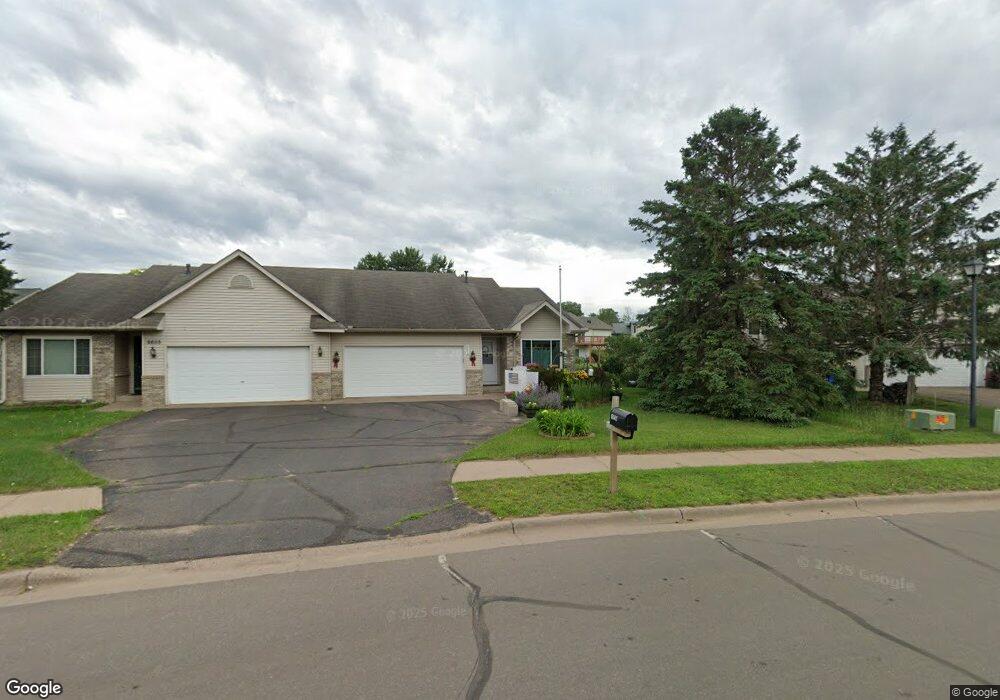
6645 381st St North Branch, MN 55056
Estimated Value: $243,000 - $306,000
3
Beds
3
Baths
1,220
Sq Ft
$222/Sq Ft
Est. Value
About This Home
This home is located at 6645 381st St, North Branch, MN 55056 and is currently estimated at $270,370, approximately $221 per square foot. 6645 381st St is a home located in Chisago County with nearby schools including Sunrise River Elementary School, North Branch Middle School, and North Branch Senior High School.
Ownership History
Date
Name
Owned For
Owner Type
Purchase Details
Closed on
Jan 26, 2016
Sold by
Bierl Maureen A
Bought by
Paynter James E and Paynter Darlene L
Current Estimated Value
Home Financials for this Owner
Home Financials are based on the most recent Mortgage that was taken out on this home.
Original Mortgage
$112,410
Outstanding Balance
$89,281
Interest Rate
4%
Mortgage Type
New Conventional
Estimated Equity
$181,089
Purchase Details
Closed on
Jul 29, 2011
Sold by
Hanson Robert D
Bought by
Bierl Maureen A
Purchase Details
Closed on
Jun 25, 1999
Sold by
American Dream Development
Bought by
Hanson Robert D and Hanson Alice L
Create a Home Valuation Report for This Property
The Home Valuation Report is an in-depth analysis detailing your home's value as well as a comparison with similar homes in the area
Home Values in the Area
Average Home Value in this Area
Purchase History
| Date | Buyer | Sale Price | Title Company |
|---|---|---|---|
| Paynter James E | $125,061 | Home Title Inc | |
| Bierl Maureen A | $99,900 | -- | |
| Hanson Robert D | $112,900 | -- |
Source: Public Records
Mortgage History
| Date | Status | Borrower | Loan Amount |
|---|---|---|---|
| Open | Paynter James E | $112,410 |
Source: Public Records
Tax History Compared to Growth
Tax History
| Year | Tax Paid | Tax Assessment Tax Assessment Total Assessment is a certain percentage of the fair market value that is determined by local assessors to be the total taxable value of land and additions on the property. | Land | Improvement |
|---|---|---|---|---|
| 2024 | $2,250 | $170,000 | $0 | $0 |
| 2023 | $2,250 | $192,600 | $0 | $0 |
| 2022 | $2,354 | $163,000 | $0 | $0 |
| 2021 | $2,190 | $135,000 | $0 | $0 |
| 2020 | $2,070 | $159,800 | $22,000 | $137,800 |
| 2019 | $1,988 | $0 | $0 | $0 |
| 2018 | $1,696 | $0 | $0 | $0 |
| 2017 | $1,668 | $0 | $0 | $0 |
| 2016 | $2,024 | $0 | $0 | $0 |
| 2015 | $2,120 | $0 | $0 | $0 |
| 2014 | -- | $103,200 | $0 | $0 |
Source: Public Records
Map
Nearby Homes
- 6640 Granby St
- 6684 Granby St
- 6643 Granby St
- 6708 Granby St
- 6701 Granby St
- 6711 Granby St
- 6818 376th St
- 37830 Harvester Ave
- 6944 376th St
- 6956 376th St
- 38280 Great Oaks Ct
- 38558 Grand Ave
- 37569 Greenwich Ct
- 37583 Greenwich Ct
- 37621 Hawthorne Ave
- 38470 Glacier Dr
- XXXXX Maple St
- 7246 385th St
- 38578 Hawthorne Ave
- 7255 Hawthorne Ct