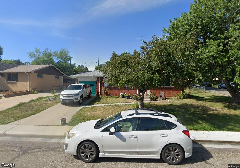
6649 Depew Ct Arvada, CO 80003
Lamar Heights NeighborhoodEstimated Value: $481,000 - $523,000
4
Beds
2
Baths
1,700
Sq Ft
$293/Sq Ft
Est. Value
About This Home
This home is located at 6649 Depew Ct, Arvada, CO 80003 and is currently estimated at $498,242, approximately $293 per square foot. 6649 Depew Ct is a home located in Jefferson County with nearby schools including Swanson Elementary School, Chester W. Nimitz Middle School, and North Arvada Middle School.
Ownership History
Date
Name
Owned For
Owner Type
Purchase Details
Closed on
May 24, 2021
Sold by
Scott Stephen Stanek and Scott Nicole Stanek
Bought by
Stanekscott Stephen and Stanekscott Nicole
Current Estimated Value
Home Financials for this Owner
Home Financials are based on the most recent Mortgage that was taken out on this home.
Original Mortgage
$356,000
Outstanding Balance
$321,611
Interest Rate
2.9%
Mortgage Type
New Conventional
Estimated Equity
$176,631
Purchase Details
Closed on
Apr 1, 2015
Sold by
Bowers Evalyn L
Bought by
Mullings Michael L
Home Financials for this Owner
Home Financials are based on the most recent Mortgage that was taken out on this home.
Original Mortgage
$6,936
Interest Rate
3.82%
Mortgage Type
Stand Alone Second
Purchase Details
Closed on
Jul 27, 2004
Sold by
Bowers Robert E and Bowers Evalyn L
Bought by
Bowers Evalyn L
Create a Home Valuation Report for This Property
The Home Valuation Report is an in-depth analysis detailing your home's value as well as a comparison with similar homes in the area
Home Values in the Area
Average Home Value in this Area
Purchase History
| Date | Buyer | Sale Price | Title Company |
|---|---|---|---|
| Stanekscott Stephen | $445,000 | Homestead Title & Escrow | |
| Scott Stephen Stanek | $445,000 | Homestead Title & Escrow | |
| Mullings Michael L | $231,200 | Land Title Guarantee Company | |
| Bowers Evalyn L | -- | -- |
Source: Public Records
Mortgage History
| Date | Status | Borrower | Loan Amount |
|---|---|---|---|
| Open | Scott Stephen Stanek | $356,000 | |
| Previous Owner | Mullings Michael L | $6,936 |
Source: Public Records
Tax History Compared to Growth
Tax History
| Year | Tax Paid | Tax Assessment Tax Assessment Total Assessment is a certain percentage of the fair market value that is determined by local assessors to be the total taxable value of land and additions on the property. | Land | Improvement |
|---|---|---|---|---|
| 2024 | $2,926 | $30,168 | $14,595 | $15,573 |
| 2023 | $2,926 | $30,168 | $14,595 | $15,573 |
| 2022 | $2,533 | $25,869 | $12,482 | $13,387 |
| 2021 | $2,575 | $26,614 | $12,841 | $13,773 |
| 2020 | $2,327 | $24,118 | $8,740 | $15,378 |
| 2019 | $2,296 | $24,118 | $8,740 | $15,378 |
| 2018 | $1,953 | $19,944 | $5,592 | $14,352 |
| 2017 | $1,788 | $19,944 | $5,592 | $14,352 |
| 2016 | $857 | $16,861 | $5,645 | $11,216 |
| 2015 | $671 | $16,861 | $5,645 | $11,216 |
| 2014 | $671 | $13,254 | $4,872 | $8,382 |
Source: Public Records
Map
Nearby Homes
- 6639 Depew Ct
- 6650 Depew Ct
- 6728 Depew St
- 6656 Benton St
- 6552 Harlan St
- 6581 Harlan St
- 5320 W 66th Ave
- 6503 Gray St
- 6761 Harlan St
- 6373 Depew St
- 5135 W 68th Ave Unit 1
- 5155 W 68th Ave Unit 5
- 5804 W 64th Ave
- 6809 Zenobia St Unit 1
- 6818 Zenobia St Unit 2
- 6828 Zenobia St Unit 2
- 6349 Ingalls St
- 5724 W 71st Ave
- 5721 W 71st Ave
- 6840 Xavier Cir Unit 3