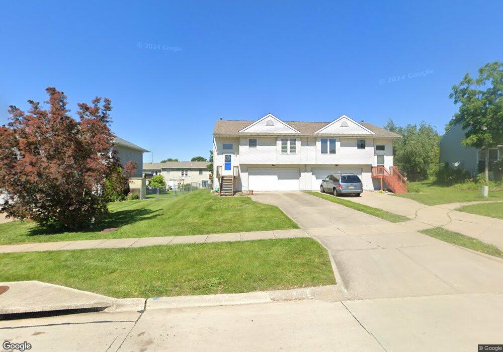
665 Emily St North Liberty, IA 52317
Estimated Value: $226,000 - $300,464
2
Beds
1
Bath
1,450
Sq Ft
$176/Sq Ft
Est. Value
About This Home
This home is located at 665 Emily St, North Liberty, IA 52317 and is currently estimated at $255,616, approximately $176 per square foot. 665 Emily St is a home located in Johnson County with nearby schools including Penn Elementary School, North Central Junior High School, and Liberty High School.
Ownership History
Date
Name
Owned For
Owner Type
Purchase Details
Closed on
Dec 18, 2010
Sold by
Pinette Jack C and Winn Holly M
Bought by
Ward Melissa Ann
Current Estimated Value
Home Financials for this Owner
Home Financials are based on the most recent Mortgage that was taken out on this home.
Original Mortgage
$19,275
Interest Rate
4.53%
Mortgage Type
Stand Alone Second
Create a Home Valuation Report for This Property
The Home Valuation Report is an in-depth analysis detailing your home's value as well as a comparison with similar homes in the area
Home Values in the Area
Average Home Value in this Area
Purchase History
| Date | Buyer | Sale Price | Title Company |
|---|---|---|---|
| Ward Melissa Ann | $128,500 | None Available |
Source: Public Records
Mortgage History
| Date | Status | Borrower | Loan Amount |
|---|---|---|---|
| Closed | Ward Melissa Ann | $19,275 | |
| Open | Ward Melissa Ann | $109,225 |
Source: Public Records
Tax History Compared to Growth
Tax History
| Year | Tax Paid | Tax Assessment Tax Assessment Total Assessment is a certain percentage of the fair market value that is determined by local assessors to be the total taxable value of land and additions on the property. | Land | Improvement |
|---|---|---|---|---|
| 2025 | $3,354 | $217,100 | $33,800 | $183,300 |
| 2024 | $3,282 | $195,000 | $33,800 | $161,200 |
| 2023 | $3,256 | $195,000 | $33,800 | $161,200 |
| 2022 | $3,086 | $167,800 | $16,900 | $150,900 |
| 2021 | $2,972 | $167,800 | $16,900 | $150,900 |
| 2020 | $2,972 | $154,100 | $16,900 | $137,200 |
| 2019 | $2,972 | $154,100 | $16,900 | $137,200 |
| 2018 | $2,916 | $154,100 | $16,900 | $137,200 |
| 2017 | $2,572 | $154,100 | $16,900 | $137,200 |
| 2016 | $2,504 | $135,400 | $16,900 | $118,500 |
| 2015 | $2,504 | $135,400 | $16,900 | $118,500 |
| 2014 | $2,572 | $138,600 | $24,400 | $114,200 |
Source: Public Records
Map
Nearby Homes
- 70 Jefferson Ln Unit 70
- 740 Molly Dr
- Mehaffey Mehaffey Bridge Rd NE Unit Mehaffey Bridge Road
- 320 E Jefferson St
- 667 Andy Ct
- 435 E Jefferson St
- 110 Whitman Ave
- 20 E Zeller St
- 25 Ash Ct
- 1105 Millie Ln
- 1103 Millie Ln
- 1101 Millie Ln
- 1165 Edward Dr
- 280 N Juniper St
- 420 W Zeller St
- 270 & 280 Chestnut St
- 355 Fox Run
- 200 Juniper Ct
- 2550 N Liberty Rd NE
- 415 Heritage Place Unit 417
- 667 Emily St Unit B
- 667 Emily St
- 647 Emily St Unit B
- 645 Emily St
- 685 Emily St
- 627 Emily St
- 670 Jules Ct Unit 670
- 687 Emily St
- 680 Jules Ct
- 690 Jules Ct Unit 690
- 625 Emily St
- 640 Jules Ct Unit 640
- 630 Jules Ct
- 660 Emily St
- 642 Emily St
- 700 Jules Ct
- 620 Jules Ct Unit 620
- 620 Jules Ct
- 662 Emily St Unit 7B
- 665 Jules Ct