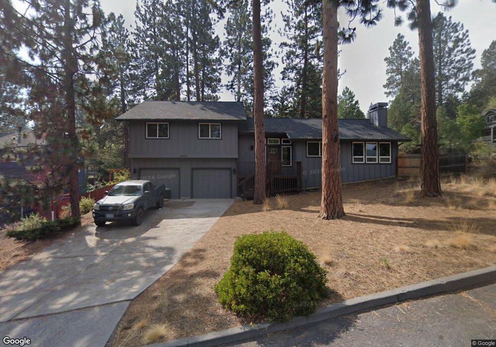
665 NW Sean Ct Bend, OR 97701
Summit West NeighborhoodEstimated Value: $870,000 - $951,366
3
Beds
2
Baths
1,601
Sq Ft
$571/Sq Ft
Est. Value
About This Home
This home is located at 665 NW Sean Ct, Bend, OR 97701 and is currently estimated at $914,092, approximately $570 per square foot. 665 NW Sean Ct is a home located in Deschutes County with nearby schools including High Lakes Elementary School, Pacific Crest Middle School, and Summit High School.
Ownership History
Date
Name
Owned For
Owner Type
Purchase Details
Closed on
Jan 5, 2011
Sold by
Frazier Heather and Villareal Mary Elizabeth
Bought by
Karn James M
Current Estimated Value
Home Financials for this Owner
Home Financials are based on the most recent Mortgage that was taken out on this home.
Original Mortgage
$150,000
Outstanding Balance
$2,260
Interest Rate
4.35%
Mortgage Type
New Conventional
Estimated Equity
$911,832
Purchase Details
Closed on
Nov 5, 2010
Sold by
Miller Linda A
Bought by
Miller Linda A and The Linda A Miller Living Trust
Purchase Details
Closed on
Jan 14, 2008
Sold by
Tyner Eric
Bought by
Tyner Eric and Miller Linda
Create a Home Valuation Report for This Property
The Home Valuation Report is an in-depth analysis detailing your home's value as well as a comparison with similar homes in the area
Home Values in the Area
Average Home Value in this Area
Purchase History
| Date | Buyer | Sale Price | Title Company |
|---|---|---|---|
| Karn James M | $243,000 | Amerititle | |
| Miller Linda A | -- | None Available | |
| Tyner Eric | -- | Accommodation | |
| Tyner Eric | $341,000 | Western Title & Escrow Co |
Source: Public Records
Mortgage History
| Date | Status | Borrower | Loan Amount |
|---|---|---|---|
| Open | Karn James M | $150,000 |
Source: Public Records
Tax History Compared to Growth
Tax History
| Year | Tax Paid | Tax Assessment Tax Assessment Total Assessment is a certain percentage of the fair market value that is determined by local assessors to be the total taxable value of land and additions on the property. | Land | Improvement |
|---|---|---|---|---|
| 2025 | $4,978 | $294,600 | -- | -- |
| 2024 | $4,789 | $286,020 | -- | -- |
| 2023 | $4,439 | $277,690 | $0 | $0 |
| 2022 | $4,142 | $261,760 | $0 | $0 |
| 2021 | $4,148 | $254,140 | $0 | $0 |
| 2020 | $3,935 | $254,140 | $0 | $0 |
| 2019 | $3,826 | $246,740 | $0 | $0 |
| 2018 | $3,718 | $239,560 | $0 | $0 |
| 2017 | $3,609 | $232,590 | $0 | $0 |
| 2016 | $3,442 | $225,820 | $0 | $0 |
| 2015 | $3,346 | $219,250 | $0 | $0 |
| 2014 | $3,248 | $212,870 | $0 | $0 |
Source: Public Records
Map
Nearby Homes
- 2379 NW Drouillard Ave
- 1834 SW Turnberry Place
- 1872 NW Hill Point Dr
- 1122 NW Stannium Rd
- 505 NW Flagline Dr
- 1772 SW Troon Ave
- 1829 SW Turnberry Place
- 1603 NW Milwaukee Ave
- 1828 SW Troon Ave
- 1785 SW Troon Ave
- 1710 SW Knoll Ave
- 15 SW Quail Butte Place
- 400 NW Flagline Dr
- 1345 NW Milwaukee Ave
- 319 NW Flagline Dr
- 19490 Green Lakes Loop
- 1597 NW Portland Ave
- 2511 NW Crossing Dr
- 1925 NW Monterey Pines Dr Unit 5
- 2409 NW Quinn Creek Loop
- 629 NW Sean Ct
- 656 NW Sean Ct
- 634 NW Sean Ct
- 672 NW Sean Ct
- 626 NW Lindsay Ct
- 593 NW Sean Ct
- 661 NW Lindsay Ct
- 618 NW Sean Ct
- 590 NW Lindsay Ct
- 635 NW Lindsay Ct
- 596 NW Sean Ct
- 571 NW Sean Ct
- 617 NW Lindsay Ct
- 576 NW Lindsay Ct
- 685 NW Lindsay Ct
- 574 NW Sean Ct
- 599 NW Lindsay Ct
- 1710 NW Galveston Ave
- 554 NW Lindsay Ct
- 583 NW Lindsay Ct