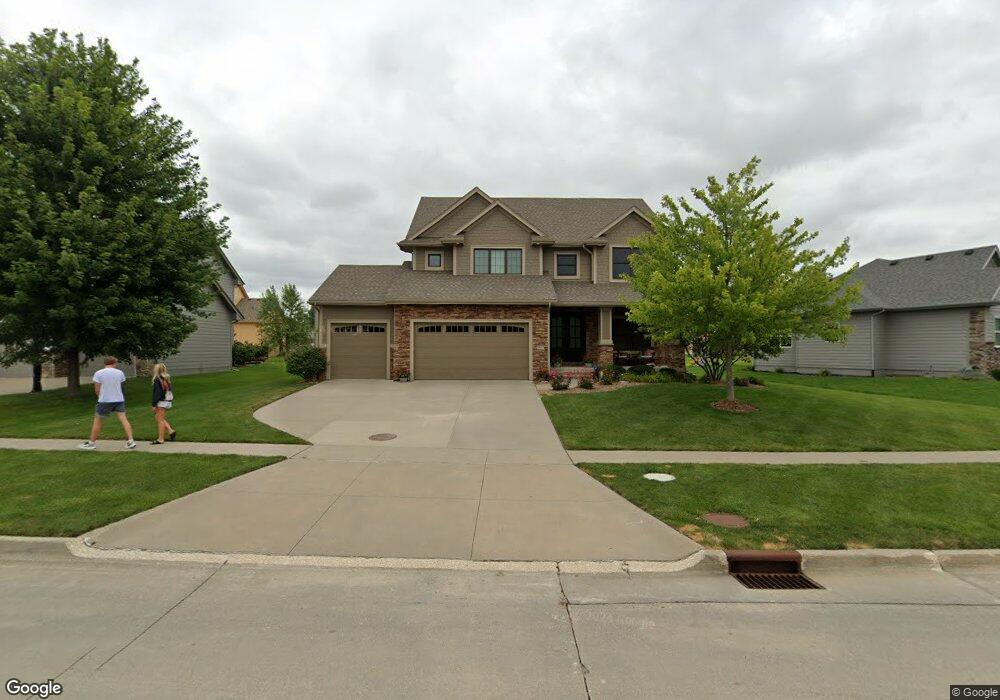
6651 Cody Dr West Des Moines, IA 50266
Estimated Value: $610,000 - $705,000
4
Beds
4
Baths
2,756
Sq Ft
$230/Sq Ft
Est. Value
About This Home
This home is located at 6651 Cody Dr, West Des Moines, IA 50266 and is currently estimated at $634,772, approximately $230 per square foot. 6651 Cody Dr is a home located in Dallas County with nearby schools including Brookview Elementary School, South Middle School, and Prairieview Middle School.
Ownership History
Date
Name
Owned For
Owner Type
Purchase Details
Closed on
Dec 19, 2018
Sold by
Hinkle Preston and Hinkle Kellie
Bought by
Crispin Joseph and Crispin Mallory L
Current Estimated Value
Home Financials for this Owner
Home Financials are based on the most recent Mortgage that was taken out on this home.
Original Mortgage
$415,000
Outstanding Balance
$366,354
Interest Rate
4.9%
Mortgage Type
New Conventional
Estimated Equity
$268,418
Purchase Details
Closed on
Feb 11, 2012
Sold by
Mickelsen Kraig R and Micklesen Debra M
Bought by
Hinkle Preston W and Hinkle Kellie
Home Financials for this Owner
Home Financials are based on the most recent Mortgage that was taken out on this home.
Original Mortgage
$417,000
Interest Rate
3.87%
Mortgage Type
New Conventional
Create a Home Valuation Report for This Property
The Home Valuation Report is an in-depth analysis detailing your home's value as well as a comparison with similar homes in the area
Home Values in the Area
Average Home Value in this Area
Purchase History
| Date | Buyer | Sale Price | Title Company |
|---|---|---|---|
| Crispin Joseph | $470,000 | None Available | |
| Hinkle Preston W | $440,000 | None Available |
Source: Public Records
Mortgage History
| Date | Status | Borrower | Loan Amount |
|---|---|---|---|
| Open | Crispin Joseph | $415,000 | |
| Previous Owner | Hinkle Preston W | $417,000 |
Source: Public Records
Tax History Compared to Growth
Tax History
| Year | Tax Paid | Tax Assessment Tax Assessment Total Assessment is a certain percentage of the fair market value that is determined by local assessors to be the total taxable value of land and additions on the property. | Land | Improvement |
|---|---|---|---|---|
| 2024 | $8,926 | $552,340 | $80,000 | $472,340 |
| 2023 | $8,926 | $552,340 | $80,000 | $472,340 |
| 2022 | $8,868 | $485,610 | $80,000 | $405,610 |
| 2021 | $8,868 | $488,160 | $60,000 | $428,160 |
| 2020 | $8,704 | $464,280 | $60,000 | $404,280 |
| 2019 | $9,090 | $464,280 | $60,000 | $404,280 |
| 2018 | $9,090 | $462,030 | $60,000 | $402,030 |
| 2017 | $8,702 | $462,030 | $60,000 | $402,030 |
| 2016 | $8,492 | $431,800 | $60,000 | $371,800 |
| 2015 | $8,238 | $431,800 | $0 | $0 |
| 2014 | $8,238 | $431,800 | $0 | $0 |
Source: Public Records
Map
Nearby Homes
- 900 67th St Unit 805
- 6440 Ep True Pkwy Unit 3205
- 6440 Ep True Pkwy Unit 2205
- 6440 Ep True Pkwy Unit 1108
- 6980 Cody Dr Unit 43
- 6980 Cody Dr Unit 17
- 681 63rd St
- 6800 Ashworth Rd Unit 306
- 6255 Beechtree Dr Unit 5302
- 6255 Beechtree Dr Unit 4302
- 6255 Beechtree Dr Unit 4203
- 7126 Aspen Dr
- 7143 Dakota Dr
- 950 67th St Unit 412
- 950 67th St Unit 321
- 7153 Cody Dr
- 6374 Beechtree Dr
- 6204 Aspen Dr
- 980 65th St
- 6178 Aspen Dr