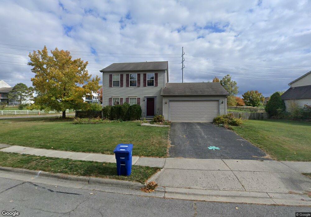
6656 Delburn Ct Dublin, OH 43017
Riverside NeighborhoodEstimated Value: $360,019 - $393,000
3
Beds
3
Baths
1,250
Sq Ft
$299/Sq Ft
Est. Value
About This Home
This home is located at 6656 Delburn Ct, Dublin, OH 43017 and is currently estimated at $374,255, approximately $299 per square foot. 6656 Delburn Ct is a home located in Franklin County with nearby schools including Riverside Elementary School, Ann Simpson Davis Middle School, and Dublin Scioto High School.
Ownership History
Date
Name
Owned For
Owner Type
Purchase Details
Closed on
Apr 20, 2022
Sold by
Mike Lapinskas
Bought by
Lapinskas Laurie
Current Estimated Value
Purchase Details
Closed on
May 4, 1995
Sold by
Borror Corp
Bought by
Hawley Robert B and Hawley Karen M
Home Financials for this Owner
Home Financials are based on the most recent Mortgage that was taken out on this home.
Original Mortgage
$114,550
Interest Rate
8.43%
Mortgage Type
VA
Create a Home Valuation Report for This Property
The Home Valuation Report is an in-depth analysis detailing your home's value as well as a comparison with similar homes in the area
Home Values in the Area
Average Home Value in this Area
Purchase History
| Date | Buyer | Sale Price | Title Company |
|---|---|---|---|
| Lapinskas Laurie | -- | Rich Linda M | |
| Hawley Robert B | $112,375 | -- |
Source: Public Records
Mortgage History
| Date | Status | Borrower | Loan Amount |
|---|---|---|---|
| Previous Owner | Hawley Robert B | $114,550 |
Source: Public Records
Tax History
| Year | Tax Paid | Tax Assessment Tax Assessment Total Assessment is a certain percentage of the fair market value that is determined by local assessors to be the total taxable value of land and additions on the property. | Land | Improvement |
|---|---|---|---|---|
| 2025 | $6,192 | $102,380 | $35,810 | $66,570 |
| 2024 | $6,192 | $102,380 | $35,810 | $66,570 |
| 2023 | $6,105 | $102,375 | $35,805 | $66,570 |
| 2022 | $4,669 | $72,770 | $26,250 | $46,520 |
| 2021 | $4,859 | $72,770 | $26,250 | $46,520 |
| 2020 | $4,831 | $72,770 | $26,250 | $46,520 |
| 2019 | $4,366 | $58,210 | $21,000 | $37,210 |
| 2018 | $4,138 | $58,210 | $21,000 | $37,210 |
| 2017 | $3,956 | $58,210 | $21,000 | $37,210 |
| 2016 | $3,866 | $52,230 | $15,300 | $36,930 |
| 2015 | $3,890 | $52,230 | $15,300 | $36,930 |
| 2014 | $3,894 | $52,230 | $15,300 | $36,930 |
| 2013 | $1,977 | $52,220 | $15,295 | $36,925 |
Source: Public Records
Map
Nearby Homes
- 6628 Brock St
- 6841 Riverside Glen Ct
- 6802 Chesley Rd
- 2960 Sawdust Ln Unit 2960
- 3223 Banting St
- 3118 Baffin Ct
- 2942 Sawdust Ln Unit 2942
- 3002 Glenloch Cir Unit 3002
- 3107 Hamden Ct
- 6418 Reflections Dr Unit A
- 2985 Grandwoods Cir
- 6550 Reflections Dr Unit C
- 6546 Reflections Dr Unit D
- 6486 Reflections Dr Unit A
- 6478 Reflections Dr Unit C
- 3263 Scioto Ridge Rd
- 180 S Riverview St
- 5622 Riverside Dr
- 6187 Water Bank St
- 6171 Water Bank St
- 6648 Delburn Ct
- 6640 Delburn Ct
- 3089 Delburn Ave
- 6632 Delburn Ct
- 6657 Delburn Ct
- 6665 Delburn Ct
- 6649 Delburn Ct
- 3097 Delburn Ave
- 6641 Delburn Ct
- 6624 Delburn Ct
- 6728 Riverside Glen Ct
- 6633 Delburn Ct
- 6616 Delburn Ct
- 6625 Delburn Ct
- 6658 Strathcona Ave
- 6646 Strathcona Ave
- 3113 Delburn Ave
- 6638 Strathcona Ave
- 6608 Delburn Ct
- 6617 Delburn Ct
Your Personal Tour Guide
Ask me questions while you tour the home.