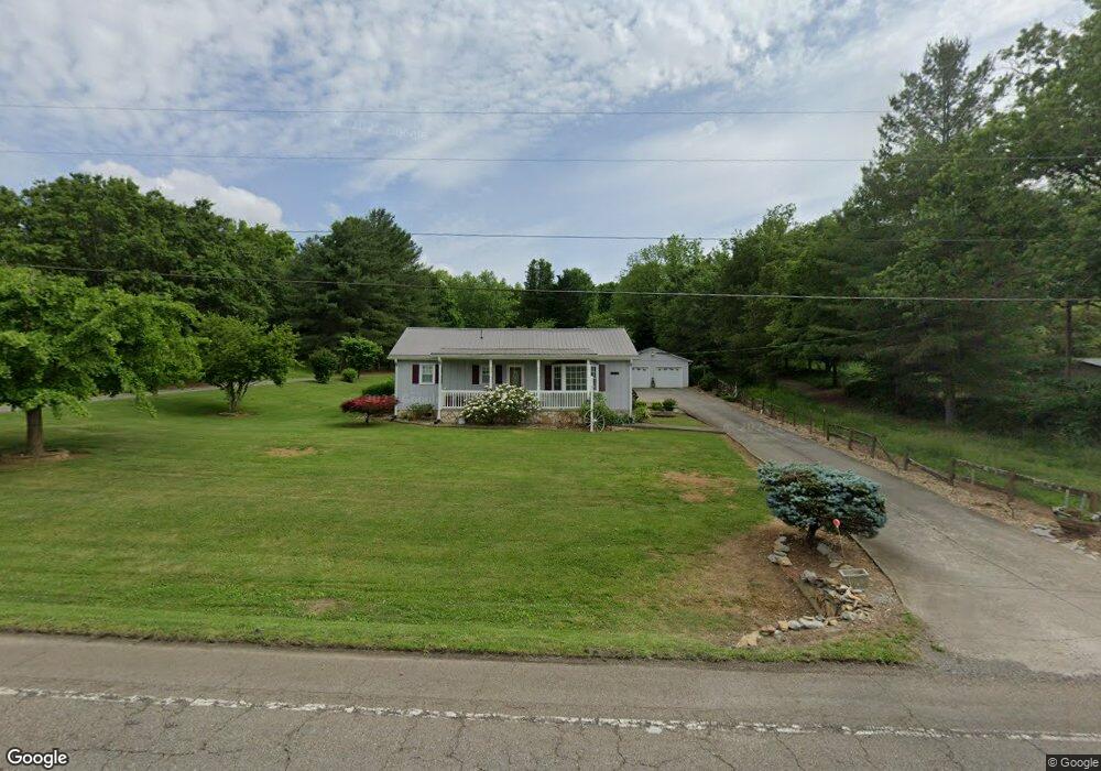
6656 E Andrew Johnson Hwy Whitesburg, TN 37891
Estimated Value: $144,752 - $239,000
--
Bed
1
Bath
1,238
Sq Ft
$162/Sq Ft
Est. Value
About This Home
This home is located at 6656 E Andrew Johnson Hwy, Whitesburg, TN 37891 and is currently estimated at $199,938, approximately $161 per square foot. 6656 E Andrew Johnson Hwy is a home located in Hamblen County with nearby schools including Russellville Elementary School, East Ridge Middle School, and Morristown East High School.
Ownership History
Date
Name
Owned For
Owner Type
Purchase Details
Closed on
Sep 18, 1993
Bought by
Owens Ii Arlie and Owens Carla L
Current Estimated Value
Purchase Details
Closed on
Apr 2, 1993
Bought by
Majors Wayne K and Majors Carolyn E
Purchase Details
Closed on
Jan 23, 1989
Bought by
Shiflet Sarah M L and Shiflet E
Purchase Details
Closed on
Nov 28, 1986
Purchase Details
Closed on
Oct 22, 1986
Bought by
Shiflet Sarah M L and Shiflet E
Purchase Details
Closed on
Jan 1, 1984
Purchase Details
Closed on
Jan 1, 1983
Purchase Details
Closed on
May 19, 1961
Create a Home Valuation Report for This Property
The Home Valuation Report is an in-depth analysis detailing your home's value as well as a comparison with similar homes in the area
Home Values in the Area
Average Home Value in this Area
Purchase History
| Date | Buyer | Sale Price | Title Company |
|---|---|---|---|
| Owens Ii Arlie | $46,500 | -- | |
| Majors Wayne K | -- | -- | |
| Shiflet Sarah M L | $10,000 | -- | |
| -- | $5,800 | -- | |
| Shiflet Sarah M L | -- | -- | |
| -- | -- | -- | |
| -- | -- | -- | |
| -- | -- | -- |
Source: Public Records
Mortgage History
| Date | Status | Borrower | Loan Amount |
|---|---|---|---|
| Closed | Not Available | $54,800 |
Source: Public Records
Tax History Compared to Growth
Tax History
| Year | Tax Paid | Tax Assessment Tax Assessment Total Assessment is a certain percentage of the fair market value that is determined by local assessors to be the total taxable value of land and additions on the property. | Land | Improvement |
|---|---|---|---|---|
| 2024 | $442 | $22,450 | $3,375 | $19,075 |
| 2023 | $442 | $22,450 | $0 | $0 |
| 2022 | $442 | $22,450 | $3,375 | $19,075 |
| 2021 | $442 | $22,450 | $3,375 | $19,075 |
| 2020 | $442 | $22,450 | $3,375 | $19,075 |
| 2019 | $420 | $19,700 | $3,375 | $16,325 |
| 2018 | $420 | $19,700 | $3,375 | $16,325 |
| 2017 | $420 | $19,700 | $3,375 | $16,325 |
| 2016 | $392 | $19,700 | $3,375 | $16,325 |
| 2015 | $364 | $19,700 | $3,375 | $16,325 |
| 2014 | -- | $19,700 | $3,375 | $16,325 |
| 2013 | -- | $22,650 | $0 | $0 |
Source: Public Records
Map
Nearby Homes
- 6650 E Andrew Johnson Hwy
- 6563 E Andrew Johnson Hwy
- 6421 Old Russellville Pike
- 6284 Old Russellville Pike
- 814 Pullen Rd
- 875 Cain Mill Rd
- 1041 Wilburn Rd
- 5740 Dodson Ferry Rd
- Tbd Saint Clair Rd
- 5751 Charlene Dr
- 1650 Mullins Rd
- 00 Elijah Martin Rd
- 6975 Brookdell Dr
- 7812 Stagecoach Rd
- 6899 Beacon Light Rd
- 505 Mary St
- 1433 Silver City Rd
- 2145 Fall Creek Rd
- 645 Silver City Rd
- 5659 Browning Way
- 6670 E Andrew Johnson Hwy
- 6680 E Andrew Johnson Hwy
- 6654 E Andrew Johnson Hwy
- 6690 E Andrew Johnson Hwy
- 6640 E Andrew Johnson Hwy
- 6705 Old Russellville Pike
- 6658 E Andrew Johnson Hwy
- 6748 E Andrew Johnson Hwy
- 6730 E Andrew Johnson Hwy
- 127 Dennison Dr
- 122 Dennison Dr
- 6596 E Andrew Johnson Hwy
- 6611 Old Russellville Pike
- 126 Dennison Dr
- 132 Dennison Dr
- 251 Jaelyn Ln
- 6590 E Andrew Johnson Hwy
- 136 Dennison Dr
- 145 Dennison Dr
- 144 Dennison Dr