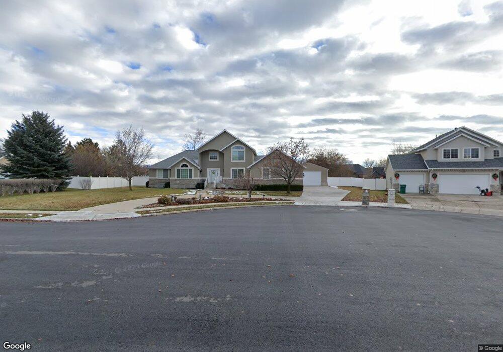
6657 W 10770 N Highland, UT 84003
Estimated Value: $899,000 - $1,155,167
4
Beds
4
Baths
4,436
Sq Ft
$233/Sq Ft
Est. Value
About This Home
This home is located at 6657 W 10770 N, Highland, UT 84003 and is currently estimated at $1,034,042, approximately $233 per square foot. 6657 W 10770 N is a home located in Utah County with nearby schools including Highland Elementary School, Mountain Ridge Junior High School, and Lone Peak High School.
Ownership History
Date
Name
Owned For
Owner Type
Purchase Details
Closed on
Sep 2, 2014
Sold by
Karren Lee Gee Terry Family Protection T and Terry Karren Lee Gee
Bought by
Murdock Aaron N and Murdock Marci
Current Estimated Value
Home Financials for this Owner
Home Financials are based on the most recent Mortgage that was taken out on this home.
Original Mortgage
$170,000
Outstanding Balance
$55,959
Interest Rate
4.1%
Mortgage Type
New Conventional
Estimated Equity
$978,083
Purchase Details
Closed on
Nov 16, 1999
Sold by
Karren Terry Russell and Karren Terry
Bought by
Lynn Terry Karren Lee Gee and Lynn Terry Russell
Purchase Details
Closed on
Oct 10, 1996
Sold by
J D D Investment
Bought by
Terry Russell and Terry Karren
Home Financials for this Owner
Home Financials are based on the most recent Mortgage that was taken out on this home.
Original Mortgage
$135,000
Interest Rate
8.1%
Create a Home Valuation Report for This Property
The Home Valuation Report is an in-depth analysis detailing your home's value as well as a comparison with similar homes in the area
Home Values in the Area
Average Home Value in this Area
Purchase History
| Date | Buyer | Sale Price | Title Company |
|---|---|---|---|
| Murdock Aaron N | -- | First American Title Co Llc | |
| Lynn Terry Karren Lee Gee | -- | -- | |
| Terry Russell | -- | -- |
Source: Public Records
Mortgage History
| Date | Status | Borrower | Loan Amount |
|---|---|---|---|
| Open | Murdock Aaron N | $170,000 | |
| Previous Owner | Terry Russell | $135,000 |
Source: Public Records
Tax History Compared to Growth
Tax History
| Year | Tax Paid | Tax Assessment Tax Assessment Total Assessment is a certain percentage of the fair market value that is determined by local assessors to be the total taxable value of land and additions on the property. | Land | Improvement |
|---|---|---|---|---|
| 2025 | $3,873 | $510,455 | $341,200 | $586,900 |
| 2024 | $3,873 | $478,335 | $0 | $0 |
| 2023 | $3,698 | $492,745 | $0 | $0 |
| 2022 | $3,396 | $438,735 | $0 | $0 |
| 2021 | $3,333 | $641,500 | $238,200 | $403,300 |
| 2020 | $3,172 | $598,700 | $207,100 | $391,600 |
| 2019 | $2,987 | $589,800 | $207,100 | $382,700 |
| 2018 | $2,854 | $535,600 | $198,500 | $337,100 |
| 2017 | $2,463 | $246,620 | $0 | $0 |
| 2016 | $2,500 | $234,025 | $0 | $0 |
| 2015 | $2,638 | $234,025 | $0 | $0 |
| 2014 | $2,495 | $219,395 | $0 | $0 |
Source: Public Records
Map
Nearby Homes
- 1610 E Center Pointe Dr
- 1602 E Center Pointe Dr
- 1602 E Center Pointe Dr Unit 1
- 6271 W 10830 St N
- 6373 W 10500 N
- 10434 N 6400 W
- 6372 W 10400 N
- 6602 W Normandy Way
- 6399 W 10150 N
- 10818 N 6000 W
- 975 E 2850 N
- 11248 Hawkstone Way Unit 109
- 6024 Hawkstone Way Unit 108
- 11228 Hawkstone Way Unit 110
- 11124 N 6000 W
- 9967 N 6670 W
- 11578 N Broadleaf Hollow Ln
- 11572 N Maple Hollow Ct
- 6190 W 10050 N
- 9924 N 6630 W Unit 9
- 6657 W Kaitlyn Cir
- 6645 W Kaitlyn Ln
- 6645 W Kaitlyn Cir
- 6673 W 10770 N
- 6645 W 10770 N
- 6609 W 10760 N
- 6658 W 10770 N
- 6646 W 10770 N
- 6674 W 10770 N
- 6686 W Canterbury Dr
- 6686 Canterbury Dr
- 6698 W Canterbury Dr
- 6698 Canterbury Dr
- 6616 W 10760 N
- 6645 W 10760 N
- 6666 Canterbury Dr
- 6589 W 10760 N
- 6626 W Stevens Ln
- 6712 W Canterbury Dr
- 6712 Canterbury Dr