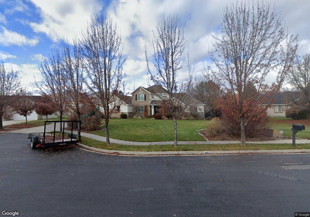
6658 W 10770 N Highland, UT 84003
Estimated Value: $951,369 - $1,029,000
4
Beds
3
Baths
4,454
Sq Ft
$221/Sq Ft
Est. Value
About This Home
This home is located at 6658 W 10770 N, Highland, UT 84003 and is currently estimated at $984,092, approximately $220 per square foot. 6658 W 10770 N is a home located in Utah County with nearby schools including Highland Elementary School, Mountain Ridge Junior High School, and Lone Peak High School.
Ownership History
Date
Name
Owned For
Owner Type
Purchase Details
Closed on
Dec 9, 2016
Sold by
Danis Jared C and Danis Tamsin B
Bought by
Danis Jared and Danis Tamsin
Current Estimated Value
Purchase Details
Closed on
Jan 27, 2011
Sold by
Jones Douglas Stuart and Choules Nancy Carol
Bought by
Danis Jared C and Danis Tamsin B
Purchase Details
Closed on
Nov 2, 2000
Sold by
Jones Douglas Stuart
Bought by
Jones Douglas Stuart and Choules Nancy Carol
Create a Home Valuation Report for This Property
The Home Valuation Report is an in-depth analysis detailing your home's value as well as a comparison with similar homes in the area
Home Values in the Area
Average Home Value in this Area
Purchase History
| Date | Buyer | Sale Price | Title Company |
|---|---|---|---|
| Danis Jared | -- | None Available | |
| Danis Jared C | -- | First American Lenders So | |
| Danis Jared C | -- | First American Lenders So | |
| Jones Douglas Stuart | -- | -- |
Source: Public Records
Tax History Compared to Growth
Tax History
| Year | Tax Paid | Tax Assessment Tax Assessment Total Assessment is a certain percentage of the fair market value that is determined by local assessors to be the total taxable value of land and additions on the property. | Land | Improvement |
|---|---|---|---|---|
| 2025 | $3,439 | $453,805 | $323,000 | $502,100 |
| 2024 | $3,439 | $424,765 | $0 | $0 |
| 2023 | $3,275 | $436,425 | $0 | $0 |
| 2022 | $3,094 | $399,740 | $0 | $0 |
| 2021 | $3,034 | $583,900 | $225,400 | $358,500 |
| 2020 | $2,883 | $544,100 | $196,000 | $348,100 |
| 2019 | $2,713 | $535,700 | $196,000 | $339,700 |
| 2018 | $2,576 | $483,300 | $187,900 | $295,400 |
| 2017 | $2,422 | $242,550 | $0 | $0 |
| 2016 | $2,311 | $216,315 | $0 | $0 |
| 2015 | $2,438 | $216,315 | $0 | $0 |
| 2014 | $2,376 | $208,890 | $0 | $0 |
Source: Public Records
Map
Nearby Homes
- 1610 E Center Pointe Dr
- 1602 E Center Pointe Dr
- 1602 E Center Pointe Dr Unit 1
- 6271 W 10830 St N
- 6373 W 10500 N
- 10434 N 6400 W
- 6372 W 10400 N
- 6602 W Normandy Way
- 10818 N 6000 W
- 975 E 2850 N
- 6399 W 10150 N
- 11248 Hawkstone Way Unit 109
- 6024 Hawkstone Way Unit 108
- 11228 Hawkstone Way Unit 110
- 11124 N 6000 W
- 11578 N Broadleaf Hollow Ln
- 11572 N Maple Hollow Ct
- 9967 N 6670 W
- 3368 N 700 E
- 6447 W Sunrise Dr
- 6646 W 10770 N
- 6674 W 10770 N
- 6626 W Stevens Ln
- 6657 W 10770 N
- 6645 W Kaitlyn Ln
- 6645 W Kaitlyn Cir
- 6645 W 10770 N
- 6673 W 10770 N
- 6657 W Kaitlyn Cir
- 6616 W 10760 N
- 6608 W Stevens Ln
- 6605 W 10900 N
- 6609 W 10760 N
- 6595 W 10900 N
- 6645 W 10760 N
- 6712 W Canterbury Dr
- 6712 Canterbury Dr
- 6589 W 10760 N
- 6698 W Canterbury Dr
- 6698 Canterbury Dr