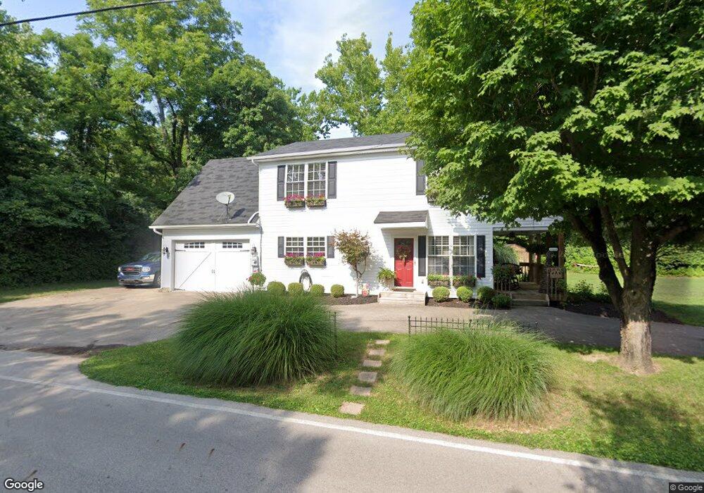
6660 Browns Run Rd Middletown, OH 45042
Madison Township NeighborhoodEstimated Value: $260,403 - $426,000
3
Beds
3
Baths
2,217
Sq Ft
$159/Sq Ft
Est. Value
About This Home
This home is located at 6660 Browns Run Rd, Middletown, OH 45042 and is currently estimated at $352,601, approximately $159 per square foot. 6660 Browns Run Rd is a home located in Butler County with nearby schools including Madison High School.
Ownership History
Date
Name
Owned For
Owner Type
Purchase Details
Closed on
May 8, 2009
Sold by
Watkins Karla
Bought by
Jackson Sarah E and Hancock James T
Current Estimated Value
Home Financials for this Owner
Home Financials are based on the most recent Mortgage that was taken out on this home.
Original Mortgage
$178,398
Outstanding Balance
$112,594
Interest Rate
4.83%
Mortgage Type
Purchase Money Mortgage
Estimated Equity
$240,007
Purchase Details
Closed on
Jul 21, 2006
Sold by
Blevins Linda S
Bought by
Watkins Karla
Purchase Details
Closed on
Sep 1, 2005
Sold by
Gentry Christopher
Bought by
Blevins Linda S
Purchase Details
Closed on
Jun 11, 2003
Sold by
Estate Of Edward Lewis Gentry
Bought by
Gentry Christopher
Create a Home Valuation Report for This Property
The Home Valuation Report is an in-depth analysis detailing your home's value as well as a comparison with similar homes in the area
Home Values in the Area
Average Home Value in this Area
Purchase History
| Date | Buyer | Sale Price | Title Company |
|---|---|---|---|
| Jackson Sarah E | $174,900 | Attorney | |
| Watkins Karla | $32,000 | None Available | |
| Blevins Linda S | -- | -- | |
| Gentry Christopher | -- | -- |
Source: Public Records
Mortgage History
| Date | Status | Borrower | Loan Amount |
|---|---|---|---|
| Open | Jackson Sarah E | $178,398 |
Source: Public Records
Tax History Compared to Growth
Tax History
| Year | Tax Paid | Tax Assessment Tax Assessment Total Assessment is a certain percentage of the fair market value that is determined by local assessors to be the total taxable value of land and additions on the property. | Land | Improvement |
|---|---|---|---|---|
| 2024 | $2,536 | $61,770 | $13,060 | $48,710 |
| 2023 | $2,518 | $64,130 | $13,060 | $51,070 |
| 2022 | $1,704 | $36,130 | $13,060 | $23,070 |
| 2021 | $1,528 | $36,130 | $13,060 | $23,070 |
| 2020 | $1,589 | $36,130 | $13,060 | $23,070 |
| 2019 | $2,373 | $40,990 | $13,060 | $27,930 |
| 2018 | $1,944 | $40,990 | $13,060 | $27,930 |
| 2017 | $1,930 | $40,990 | $13,060 | $27,930 |
| 2016 | $1,834 | $37,460 | $13,060 | $24,400 |
| 2015 | $1,846 | $37,460 | $13,060 | $24,400 |
| 2014 | $2,179 | $37,460 | $13,060 | $24,400 |
| 2013 | $2,179 | $44,570 | $13,060 | $31,510 |
Source: Public Records
Map
Nearby Homes
- 6931 Browns Run Rd
- 7826 Myers Rd
- 6110 Rivers Edge Dr
- 6363 Germantown Rd
- 6339 Germantown Rd
- 5800 Trenton Franklin Rd
- 5750 Trenton Franklin Rd
- 6823 Michael Rd
- 6496 Lorraine Dr
- 1800 Germantown Rd
- 7606 Middletown Germantown Rd
- 7606 Middletown Germantown Rd Unit R
- 1721 Germantown Rd
- 8194 Keister Rd
- 7916 Middletown Germantown Rd
- 1816 Winona Dr
- 8371 Keister Rd
- 2211 Erie Ave
- 1100 Hughes St
- 2985 Wilbraham Rd
- 6658 Browns Run Rd
- 6705 Cloister Cliffs Dr
- 6683 Cloister Cliffs Dr
- 7791 Cedar Glen Way
- 6717 Browns Run Rd
- 6653 Cloister Cliffs Dr
- 7777 Cedar Glen Way
- 7809 Cedar Glen Way
- 6625 Browns Run Rd
- 6698 Cloister Cliffs Dr
- 7767 Cedar Glen Way
- 6611 Cloister Cliffs Dr
- 6734 Cloister Cliffs Dr
- 7757 Cedar Glen Way
- 6773 Cloister Cliffs Dr
- 6742 Cloister Cliffs Dr
- 7762 Cedar Glen Way
- 6575 Sloebig Rd
- 6575 Sloebig Rd
- 6575 Sloebig Rd