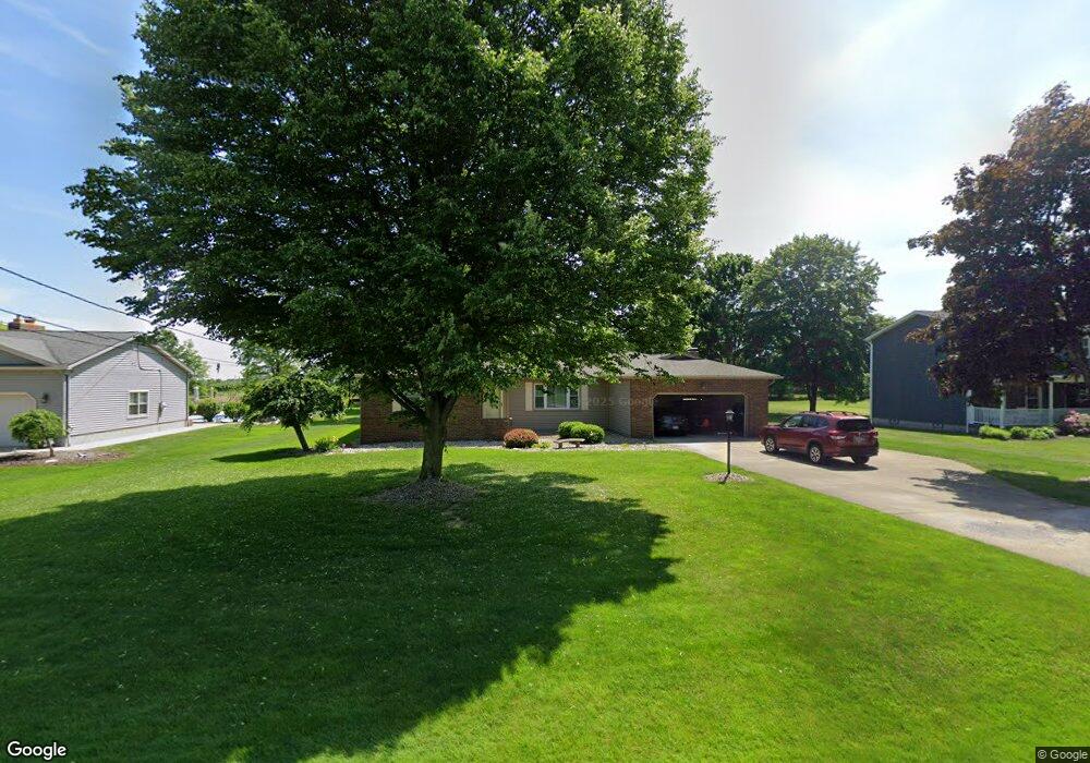
6665 Summit Dr Canfield, OH 44406
Estimated Value: $264,441 - $383,000
3
Beds
2
Baths
1,677
Sq Ft
$185/Sq Ft
Est. Value
About This Home
This home is located at 6665 Summit Dr, Canfield, OH 44406 and is currently estimated at $310,360, approximately $185 per square foot. 6665 Summit Dr is a home located in Mahoning County with nearby schools including Canfield Village Middle School, Canfield High School, and St Charles Elementary School.
Ownership History
Date
Name
Owned For
Owner Type
Purchase Details
Closed on
Feb 12, 2013
Sold by
Clay Ronald E
Bought by
Clay Wanda L
Current Estimated Value
Purchase Details
Closed on
Jul 2, 2001
Sold by
Lewis James C and Lewis Jeanette
Bought by
Clay Ronald E and Clay Wanda L
Home Financials for this Owner
Home Financials are based on the most recent Mortgage that was taken out on this home.
Original Mortgage
$127,800
Outstanding Balance
$49,716
Interest Rate
7.27%
Estimated Equity
$260,644
Purchase Details
Closed on
Jun 28, 1991
Bought by
Lewis Jas and Lewis Jeantette
Create a Home Valuation Report for This Property
The Home Valuation Report is an in-depth analysis detailing your home's value as well as a comparison with similar homes in the area
Home Values in the Area
Average Home Value in this Area
Purchase History
| Date | Buyer | Sale Price | Title Company |
|---|---|---|---|
| Clay Wanda L | -- | Attorney | |
| Clay Ronald E | $142,000 | -- | |
| Lewis Jas | $111,000 | -- |
Source: Public Records
Mortgage History
| Date | Status | Borrower | Loan Amount |
|---|---|---|---|
| Open | Clay Ronald E | $127,800 |
Source: Public Records
Tax History Compared to Growth
Tax History
| Year | Tax Paid | Tax Assessment Tax Assessment Total Assessment is a certain percentage of the fair market value that is determined by local assessors to be the total taxable value of land and additions on the property. | Land | Improvement |
|---|---|---|---|---|
| 2024 | $2,886 | $70,340 | $11,110 | $59,230 |
| 2023 | $2,838 | $70,340 | $11,110 | $59,230 |
| 2022 | $2,920 | $57,850 | $10,190 | $47,660 |
| 2021 | $2,829 | $57,850 | $10,190 | $47,660 |
| 2020 | $2,841 | $57,850 | $10,190 | $47,660 |
| 2019 | $2,848 | $51,990 | $10,190 | $41,800 |
| 2018 | $2,736 | $51,990 | $10,190 | $41,800 |
| 2017 | $2,733 | $51,990 | $10,190 | $41,800 |
| 2016 | $2,572 | $46,580 | $10,650 | $35,930 |
| 2015 | $2,515 | $46,580 | $10,650 | $35,930 |
| 2014 | -- | $46,580 | $10,650 | $35,930 |
| 2013 | $2,433 | $46,580 | $10,650 | $35,930 |
Source: Public Records
Map
Nearby Homes
- 6645 Summit Dr
- 6670 Summit Dr
- 4300 Westford Place Unit 13D
- 6850 Abbey Rd N
- 6845 Abbey Rd
- 6843 Abbey Rd
- 6837 Abbey Rd S
- 6839 Abbey Rd S
- 5034 Macy Ln
- 5025 Macy Ln
- 4032 Saint Andrews Ct Unit 1
- 100 Talsman Dr
- 120 Talsman Dr Unit 4
- 7245 Hanbury Close
- 201 Talsman Dr Unit 1
- 211 Talsman Dr Unit 1
- 473 Carriage Hill Dr
- 419 Carriage Hill Dr
- 6857 Kyle Ridge Pointe
- 321 Hilltop Blvd
- 6685 Summit Dr
- 6625 Summit Dr
- 6705 Summit Dr
- 6605 Summit Dr
- 6725 Summit Dr
- 6690 Summit Dr
- 6712 Summit Dr
- 6745 Summit Dr
- 6765 Summit Dr
- 6580 Abbey Rd N
- 6565 Abbey Rd N
- 6781 Summit Dr
- 6776 Summit Dr
- 0 Abbey Rd Unit 4252621
- 6801 Summit Dr
- 6640 Abbey Rd N
- 6703 Abbey Rd S
- 4300 Westford Place
- 4300 Westford Place
- 4300 Westford Place