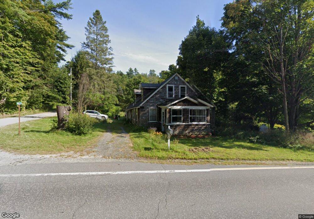
667 Nh Route 120 Unit 83 Cornish, NH 03745
Estimated Value: $296,000 - $464,000
2
Beds
2
Baths
2,022
Sq Ft
$182/Sq Ft
Est. Value
About This Home
This home is located at 667 Nh Route 120 Unit 83, Cornish, NH 03745 and is currently estimated at $367,313, approximately $181 per square foot. 667 Nh Route 120 Unit 83 is a home located in Sullivan County with nearby schools including Cornish Elementary School.
Ownership History
Date
Name
Owned For
Owner Type
Purchase Details
Closed on
Aug 3, 2022
Sold by
Rhoades Lorina and Rhoades John C
Bought by
Butler Nicole and Kaz James
Current Estimated Value
Home Financials for this Owner
Home Financials are based on the most recent Mortgage that was taken out on this home.
Original Mortgage
$256,690
Outstanding Balance
$245,982
Interest Rate
5.81%
Mortgage Type
Purchase Money Mortgage
Estimated Equity
$121,331
Purchase Details
Closed on
Jun 4, 2021
Sold by
Kousman Constance B
Bought by
Rhoades Lorina
Home Financials for this Owner
Home Financials are based on the most recent Mortgage that was taken out on this home.
Original Mortgage
$158,100
Interest Rate
2.9%
Mortgage Type
Purchase Money Mortgage
Create a Home Valuation Report for This Property
The Home Valuation Report is an in-depth analysis detailing your home's value as well as a comparison with similar homes in the area
Home Values in the Area
Average Home Value in this Area
Purchase History
| Date | Buyer | Sale Price | Title Company |
|---|---|---|---|
| Butler Nicole | $256,733 | None Available | |
| Rhoades Lorina | $186,000 | None Available | |
| Rhoades Lorina | $186,000 | None Available |
Source: Public Records
Mortgage History
| Date | Status | Borrower | Loan Amount |
|---|---|---|---|
| Open | Butler Nicole | $256,690 | |
| Previous Owner | Rhoades Lorina | $158,100 |
Source: Public Records
Tax History Compared to Growth
Tax History
| Year | Tax Paid | Tax Assessment Tax Assessment Total Assessment is a certain percentage of the fair market value that is determined by local assessors to be the total taxable value of land and additions on the property. | Land | Improvement |
|---|---|---|---|---|
| 2024 | $5,064 | $312,800 | $146,500 | $166,300 |
| 2023 | $4,742 | $180,800 | $91,300 | $89,500 |
| 2022 | $3,831 | $161,861 | $72,361 | $89,500 |
| 2021 | $3,678 | $161,940 | $72,440 | $89,500 |
| 2020 | $3,448 | $161,939 | $72,439 | $89,500 |
| 2019 | $3,161 | $161,929 | $72,429 | $89,500 |
| 2018 | $3,310 | $150,523 | $65,723 | $84,800 |
| 2017 | $3,239 | $150,496 | $65,696 | $84,800 |
| 2016 | $3,220 | $150,483 | $65,683 | $84,800 |
| 2015 | $3,459 | $150,449 | $65,649 | $84,800 |
| 2014 | $3,418 | $150,454 | $67,154 | $83,300 |
| 2013 | $3,569 | $170,192 | $76,392 | $93,800 |
Source: Public Records
Map
Nearby Homes
- 0 Route 120 Route Unit 48
- 672 New Hampshire 120
- Lot 73A & 74A East Rd
- 45 East Rd
- 466 Parsonage Rd
- 282 Penniman Rd
- 00 Tandy Brook Rd Unit 12
- 614 Redwater Brook Rd
- 161 Saint Gaudens Rd
- 68 Jarvis St Unit 70
- 22 King Dr
- 1041 Stage Rd
- 992 Route 120
- 70-74 State St
- 0 Cat Hole Rd Unit 5052634
- 5 Clough Ave
- 0 Camp Rd Unit 7
- 1118 New Hampshire 12a
- 1 Dorrance St
- 16 Day St
- 667 Nh Route 120
- 667 Nh Route 120 Unit 83
- 00 Route 120
- 00 Nh Route 120 Route
- 0 Route 120 Route Unit 5045664
- 0 Route 120 Route Unit 4822090
- 0 Route 120 Route Unit 4812965
- 0 Route 120 Route Unit 4459968
- 0 Route 120 Route Unit 4459965
- 0 Route 120 Route Unit 4768533
- 653 Nh Route 120
- 653 Nh Route 120
- 653 Nh Route 120
- 653 Nh Route 120
- 691 Nh Route 120
- 650 Nh Route 120
- 694 Nh Route 120
- 699 Nh Route 120
- 634 Nh Route 120
- 35 Mace Rd