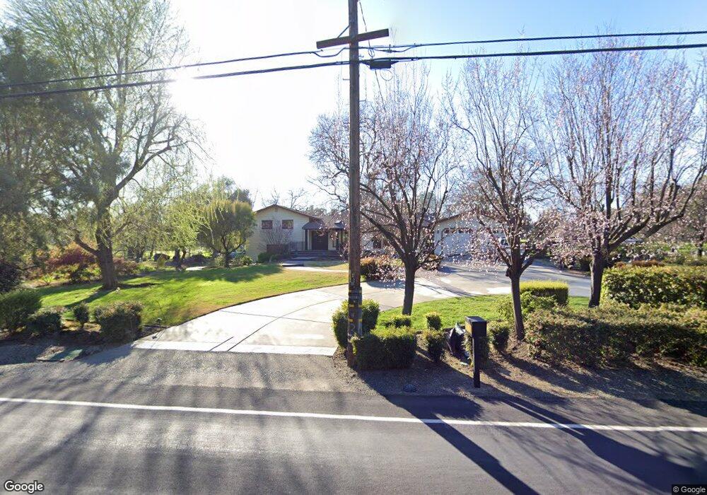
6672 Laird Rd Loomis, CA 95650
Estimated Value: $844,331 - $1,580,000
7
Beds
4
Baths
3,172
Sq Ft
$359/Sq Ft
Est. Value
About This Home
This home is located at 6672 Laird Rd, Loomis, CA 95650 and is currently estimated at $1,137,833, approximately $358 per square foot. 6672 Laird Rd is a home located in Placer County with nearby schools including Del Oro High School and Loomis Basin Charter School.
Ownership History
Date
Name
Owned For
Owner Type
Purchase Details
Closed on
Jun 27, 2022
Sold by
Cohen Leslie K
Bought by
Cohen Edward R
Current Estimated Value
Purchase Details
Closed on
Jun 9, 2022
Sold by
Cohen Edward R
Bought by
Edward Richard Cohen Trust
Purchase Details
Closed on
Jul 30, 2003
Sold by
Cohen Leslie K
Bought by
Cohen Edward R
Home Financials for this Owner
Home Financials are based on the most recent Mortgage that was taken out on this home.
Original Mortgage
$300,000
Interest Rate
5.13%
Mortgage Type
Purchase Money Mortgage
Create a Home Valuation Report for This Property
The Home Valuation Report is an in-depth analysis detailing your home's value as well as a comparison with similar homes in the area
Home Values in the Area
Average Home Value in this Area
Purchase History
| Date | Buyer | Sale Price | Title Company |
|---|---|---|---|
| Cohen Edward R | -- | None Listed On Document | |
| Edward Richard Cohen Trust | -- | None Listed On Document | |
| Cohen Edward R | -- | Old Republic Title |
Source: Public Records
Mortgage History
| Date | Status | Borrower | Loan Amount |
|---|---|---|---|
| Previous Owner | Cohen Edward R | $300,000 |
Source: Public Records
Tax History
| Year | Tax Paid | Tax Assessment Tax Assessment Total Assessment is a certain percentage of the fair market value that is determined by local assessors to be the total taxable value of land and additions on the property. | Land | Improvement |
|---|---|---|---|---|
| 2025 | $3,030 | $280,353 | $24,017 | $256,336 |
| 2023 | $3,030 | $269,469 | $23,086 | $246,383 |
| 2022 | $2,980 | $264,186 | $22,634 | $241,552 |
| 2021 | $2,906 | $259,007 | $22,191 | $236,816 |
| 2020 | $2,870 | $256,352 | $21,964 | $234,388 |
| 2019 | $2,820 | $251,327 | $21,534 | $229,793 |
| 2018 | $2,676 | $246,400 | $21,112 | $225,288 |
| 2017 | $2,630 | $241,570 | $20,699 | $220,871 |
| 2016 | $2,575 | $236,835 | $20,294 | $216,541 |
| 2015 | $2,522 | $233,279 | $19,990 | $213,289 |
Source: Public Records
Map
Nearby Homes
- 7032 West Ln
- 7027 Pine Gate Way
- 6620 Auburn Folsom Rd
- 8177 N Lake Cir
- 8187 N Lake Cir
- 7370 Shelborne Dr
- 6330 Auburn Folsom Rd
- 6333 Indian Springs Rd
- 7475 Shelborne Dr
- 7500 Shelborne Dr
- 5900 Morgan Place
- 6272 Calle Montalvo Cir
- 8520 Nob Hill Ln
- 6760 Douglas Blvd
- 6115 Cavitt Stallman Rd
- 7170 Wildwood Place
- 6520 Carolinda Dr
- 5935 Via Madrid
- 7804 Kirk Ct
- 7053 Cedar Oaks Dr
- 6652 Laird Rd
- 6797 Laird Rd
- 7415 Rockcrest Place
- 6658 Laird Rd
- 7480 Rockcrest Place
- 6542 Laird Rd
- 6802 Laird Rd
- 7485 Rockcrest Place
- 6567 Laird Rd
- 1 Sierra Ponds Ln
- 6577 Laird Rd
- 7520 Rockcrest Place
- 7535 Rockcrest Place
- 7243 Sierra View Place
- 6922 Laird Rd
- 7420 Gold Dr
- 7120 Sierra View Place
- 7570 Rockcrest Place
- 7580 Rockcrest Place
- 7575 Rockcrest Place
Your Personal Tour Guide
Ask me questions while you tour the home.