Estimated Value: $375,810 - $439,000
About This Home
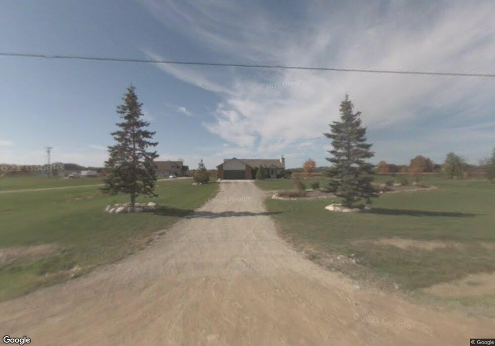
This home is located at 66721 Place Rd, Lenox, MI 48050 and is currently estimated at $411,203, approximately $272 per square foot. 66721 Place Rd is a home located in Macomb County with nearby schools including Orville C. Krause Elementary School, Armada Middle School, and Armada High School.
Ownership History
We collect this data history from publicly available records. To have your information removed, we recommend requesting removal directly through your county’s website.
Purchase Details
Purchase Details
Purchase Details
Home Values in the Area
Average Home Value in this Area
Purchase History
We collect this data history from publicly available records. To have your information removed, we recommend requesting removal directly through your county’s website.
| Date | Buyer | Sale Price | Title Company |
|---|---|---|---|
| $121,000 | Attorneys Title Agency Llc | ||
| -- | None Available | ||
| $160,831 | None Available |
Tax History
We collect this data history from publicly available records. To have your information removed, we recommend requesting removal directly through your county’s website.
| Year | Tax Paid | Tax Assessment Tax Assessment Total Assessment is a certain percentage of the fair market value that is determined by local assessors to be the total taxable value of land and additions on the property. | Land | Improvement |
|---|---|---|---|---|
| 2025 | $1,940 | $175,800 | $0 | $0 |
| 2024 | $19 | $162,900 | $0 | $0 |
| 2023 | $1,788 | $153,400 | $0 | $0 |
| 2022 | $2,702 | $127,600 | $0 | $0 |
| 2021 | $2,583 | $120,500 | $0 | $0 |
| 2020 | $1,644 | $121,700 | $0 | $0 |
| 2019 | $2,389 | $113,000 | $0 | $0 |
| 2018 | $0 | $108,400 | $0 | $0 |
| 2017 | $2,292 | $98,700 | $24,200 | $74,500 |
| 2016 | $2,276 | $98,700 | $0 | $0 |
| 2015 | -- | $102,100 | $0 | $0 |
| 2012 | $301 | $73,795 | $0 | $0 |
| 2011 | $301 | $70,990 | $0 | $0 |
Map
- 65201 Place Rd
- 31 Mile Rd
- 68788 Place Rd
- VAC 32 Mile
- 63835 Bates Rd
- 64135 Omo Rd
- 25260 32 Mile Rd
- 32 Mile Rd
- 00 S Forest
- Vacant Land 30 Mile Rd
- 28444 29 Mile Rd
- 65690 North Ave
- 29940 29 Mile Rd
- 23233 30 Mile Rd
- 29988 Armada Ridge Rd
- 0 Welding Armada Ridge Rd
- 30100 Armada Ridge Rd
- 70336 Welding Rd
- 62333 John Henry Dr
- 21901 31 Mile Rd
- 66651 Place Rd
- 66583 Place Rd
- 66855 Place Rd
- 66517 Place Rd
- 66820 Place Rd
- 66481 Place Rd
- 66630 Place Rd
- 00 Place Rd
- 000 Place Rd
- 27786 31 Mile Rd
- 66970 Place Rd
- 66405 Place Rd
- 28200 31 Mile Rd
- 66345 Place Rd
- 66283 Place Rd
- 27755 31 Mile Rd
- 67171 Place Rd
- 66286 Place Rd
- 27585 31 Mile Rd
- 27417 31 Mile Rd
Ask me questions while you tour the home.