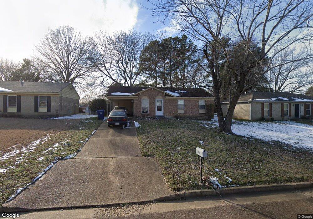
6675 Embassy Cir Horn Lake, MS 38637
Estimated Value: $139,000 - $163,000
3
Beds
2
Baths
1,000
Sq Ft
$153/Sq Ft
Est. Value
About This Home
This home is located at 6675 Embassy Cir, Horn Lake, MS 38637 and is currently estimated at $153,340, approximately $153 per square foot. 6675 Embassy Cir is a home located in DeSoto County with nearby schools including Horn Lake Elementary School, Horn Lake Intermediate School, and Horn Lake Middle School.
Ownership History
Date
Name
Owned For
Owner Type
Purchase Details
Closed on
Jan 14, 2010
Sold by
Kisner George B
Bought by
Mcgee Mark Allen
Current Estimated Value
Home Financials for this Owner
Home Financials are based on the most recent Mortgage that was taken out on this home.
Original Mortgage
$18,854
Interest Rate
4.92%
Mortgage Type
Future Advance Clause Open End Mortgage
Purchase Details
Closed on
Dec 17, 2009
Sold by
Mcgee Mark Allen
Bought by
Kisner George B
Home Financials for this Owner
Home Financials are based on the most recent Mortgage that was taken out on this home.
Original Mortgage
$18,854
Interest Rate
4.92%
Mortgage Type
Future Advance Clause Open End Mortgage
Purchase Details
Closed on
Jan 17, 2008
Sold by
Mcgee Jonathan Allen and Mcgee Mavis A
Bought by
Mcgee Mark Allen
Create a Home Valuation Report for This Property
The Home Valuation Report is an in-depth analysis detailing your home's value as well as a comparison with similar homes in the area
Home Values in the Area
Average Home Value in this Area
Purchase History
| Date | Buyer | Sale Price | Title Company |
|---|---|---|---|
| Mcgee Mark Allen | -- | None Available | |
| Kisner George B | -- | None Available | |
| Mcgee Mark Allen | -- | None Available |
Source: Public Records
Mortgage History
| Date | Status | Borrower | Loan Amount |
|---|---|---|---|
| Closed | Kisner George B | $18,854 |
Source: Public Records
Tax History Compared to Growth
Tax History
| Year | Tax Paid | Tax Assessment Tax Assessment Total Assessment is a certain percentage of the fair market value that is determined by local assessors to be the total taxable value of land and additions on the property. | Land | Improvement |
|---|---|---|---|---|
| 2024 | $1,191 | $7,996 | $2,250 | $5,746 |
| 2023 | $1,191 | $7,996 | $0 | $0 |
| 2022 | $1,191 | $7,996 | $2,250 | $5,746 |
| 2021 | $1,190 | $7,986 | $2,250 | $5,736 |
| 2020 | $1,122 | $7,527 | $2,250 | $5,277 |
| 2019 | $1,122 | $7,527 | $2,250 | $5,277 |
| 2017 | $1,089 | $12,294 | $7,272 | $5,022 |
| 2016 | $1,060 | $7,272 | $2,250 | $5,022 |
| 2015 | $1,052 | $12,294 | $7,272 | $5,022 |
| 2014 | $1,060 | $7,272 | $0 | $0 |
| 2013 | $1,031 | $7,272 | $0 | $0 |
Source: Public Records
Map
Nearby Homes
- 6670 Embassy Cir
- 2848 Normandy Dr
- 2919 Normandy Dr
- 2880 Briarwood Dr
- 2950 Briarwood Dr
- 2388 Pappy Ln
- 6265 Foxbriar Dr
- 2605 Valleybrook Rd
- 2895 Valleybrook Rd
- 3305 Tulane Rd W
- 2920 Devon Cir
- 7135 Hampton Dr
- 3350 Tulane Rd W
- 7088 Foxhall Dr
- 3430 Mayfair Dr
- 6505 Riverdale Rd
- 3530 Woodmont Cove
- 7429 Perrin Ln
- 3031 Caitlynn Cir S
- 3405 Woodbine Cove
- 6685 Embassy Cir
- 6665 Embassy Cir
- 2535 Fairbrook Cove
- 6695 Embassy Cir
- 6655 Embassy Cir
- 2545 Fairbrook Cove
- 2540 Fairbrook Cove
- 6680 Embassy Cir
- 6660 Embassy Cir
- 6645 Embassy Cir
- 2515 Eastbrook Dr
- 2525 Eastbrook Dr
- 6650 Embassy Cir
- 6690 Embassy Cir
- 2555 Fairbrook Cove
- 2550 Fairbrook Cove
- 2535 Eastbrook Dr
- 6640 Embassy Cir
- 6700 Embassy Cir
- 6585 Embassy Cir