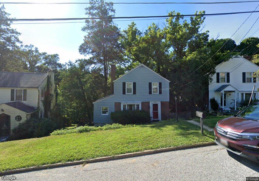
6679 Loch Hill Baltimore, MD 21239
Estimated Value: $392,231 - $437,000
--
Bed
2
Baths
1,292
Sq Ft
$317/Sq Ft
Est. Value
About This Home
This home is located at 6679 Loch Hill, Baltimore, MD 21239 and is currently estimated at $410,058, approximately $317 per square foot. 6679 Loch Hill is a home located in Baltimore County with nearby schools including Stoneleigh Elementary School, Dumbarton Middle School, and Towson High Law & Public Policy.
Ownership History
Date
Name
Owned For
Owner Type
Purchase Details
Closed on
Mar 13, 2020
Sold by
Byro Erik L and Byro Alison Marie
Bought by
Tuckere Sean T A and Tuckere Kara N
Current Estimated Value
Home Financials for this Owner
Home Financials are based on the most recent Mortgage that was taken out on this home.
Original Mortgage
$298,886
Outstanding Balance
$265,305
Interest Rate
3.62%
Mortgage Type
FHA
Estimated Equity
$144,753
Purchase Details
Closed on
Aug 14, 2014
Sold by
Matsumoto Ann M
Bought by
Byro Erik L and Byro Alison Marie
Home Financials for this Owner
Home Financials are based on the most recent Mortgage that was taken out on this home.
Original Mortgage
$258,400
Interest Rate
4.14%
Mortgage Type
New Conventional
Purchase Details
Closed on
Jun 9, 1998
Sold by
Matsumoto Kent K
Bought by
Matsumoto Ann M
Purchase Details
Closed on
Feb 4, 1987
Sold by
Dixon John C
Bought by
Matsumoto Kent K
Create a Home Valuation Report for This Property
The Home Valuation Report is an in-depth analysis detailing your home's value as well as a comparison with similar homes in the area
Home Values in the Area
Average Home Value in this Area
Purchase History
| Date | Buyer | Sale Price | Title Company |
|---|---|---|---|
| Tuckere Sean T A | $304,400 | Sage Title Group Llc | |
| Byro Erik L | $272,000 | Sage Title Group Llc | |
| Matsumoto Ann M | -- | -- | |
| Matsumoto Kent K | $100,000 | -- |
Source: Public Records
Mortgage History
| Date | Status | Borrower | Loan Amount |
|---|---|---|---|
| Open | Tuckere Sean T A | $298,886 | |
| Previous Owner | Byro Erik L | $258,400 |
Source: Public Records
Tax History Compared to Growth
Tax History
| Year | Tax Paid | Tax Assessment Tax Assessment Total Assessment is a certain percentage of the fair market value that is determined by local assessors to be the total taxable value of land and additions on the property. | Land | Improvement |
|---|---|---|---|---|
| 2025 | $4,373 | $285,600 | $88,600 | $197,000 |
| 2024 | $4,373 | $268,900 | $0 | $0 |
| 2023 | $2,068 | $252,200 | $0 | $0 |
| 2022 | $3,689 | $235,500 | $85,000 | $150,500 |
| 2021 | $3,243 | $223,167 | $0 | $0 |
| 2020 | $3,184 | $210,833 | $0 | $0 |
| 2019 | $2,406 | $198,500 | $85,000 | $113,500 |
| 2018 | $2,990 | $198,500 | $85,000 | $113,500 |
| 2017 | $2,907 | $198,500 | $0 | $0 |
| 2016 | $2,322 | $201,400 | $0 | $0 |
| 2015 | $2,322 | $201,400 | $0 | $0 |
| 2014 | $2,322 | $201,400 | $0 | $0 |
Source: Public Records
Map
Nearby Homes
- 6702 Queens Ferry Rd
- 1120 Litchfield Rd
- 1108 Litchfield Rd
- 6415 Falkirk Rd
- 1117 Overbrook Rd
- 1440 Walker Ave
- 1377 Walker Ave
- 6216 Falkirk Rd
- 1420 Cedarcroft Rd
- 6204 Falkirk Rd
- 89 Ashlar Hill Ct
- 1283 Gittings Ave
- 1444 Meridene Dr
- 6923 Summit Cir
- 1233 Knightswood Rd
- 6931 Summit Cir
- 6416 Sherwood Rd
- 1212 Cedarcroft Rd
- 1206 Cedarcroft Rd
- 1117 Walker Ave
- 6679 Loch Hill Rd
- 6677 Loch Hill Rd
- 6681 Loch Hill Rd
- 6683 Loch Hill Rd
- 6675 Loch Hill Rd
- 6685 Loch Hill Rd
- 6672 Loch Hill Rd
- 6673 Loch Hill Rd
- 6674 Loch Hill Rd
- 6687 Loch Hill Rd
- 6671 Loch Hill
- 6617 Raven Hill Rd
- 6676 Loch Hill Rd
- 6676 Loch Hill Rd
- 6671 Loch Hill Rd
- 6689 Loch Hill Rd
- 6669 Loch Hill Rd
- 6678 Loch Hill Rd
- 6621 Queens Ferry Rd
- 6612 Raven Hill Rd