Estimated Value: $298,898 - $353,000
3
Beds
2
Baths
1,475
Sq Ft
$214/Sq Ft
Est. Value
About This Home
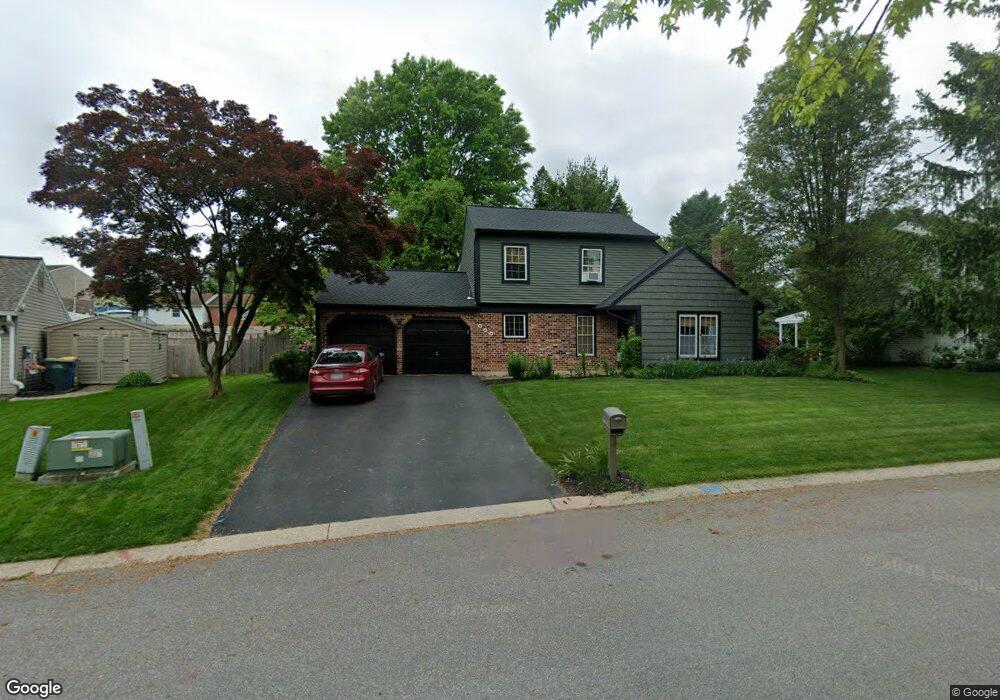
This home is located at 668 Cortland Dr, York, PA 17403 and is currently estimated at $314,975, approximately $213 per square foot. 668 Cortland Dr is a home located in York County with nearby schools including York Township Elementary School, Dallastown Area Middle School, and Dallastown Area High School.
Ownership History
Date
Name
Owned For
Owner Type
Purchase Details
Closed on
Dec 17, 1999
Sold by
Greiss Gregory W and Greiss Jane Black
Bought by
Spahr Todd M and Spahr Susan J
Current Estimated Value
Home Financials for this Owner
Home Financials are based on the most recent Mortgage that was taken out on this home.
Original Mortgage
$119,238
Outstanding Balance
$36,623
Interest Rate
7.61%
Mortgage Type
VA
Estimated Equity
$278,352
Purchase Details
Closed on
Oct 26, 1993
Bought by
Greiss Gregory W and Greiss Jane B
Create a Home Valuation Report for This Property
The Home Valuation Report is an in-depth analysis detailing your home's value as well as a comparison with similar homes in the area
Home Values in the Area
Average Home Value in this Area
Purchase History
| Date | Buyer | Sale Price | Title Company |
|---|---|---|---|
| Spahr Todd M | $116,900 | -- | |
| Greiss Gregory W | -- | -- |
Source: Public Records
Mortgage History
| Date | Status | Borrower | Loan Amount |
|---|---|---|---|
| Open | Spahr Todd M | $119,238 |
Source: Public Records
Tax History Compared to Growth
Tax History
| Year | Tax Paid | Tax Assessment Tax Assessment Total Assessment is a certain percentage of the fair market value that is determined by local assessors to be the total taxable value of land and additions on the property. | Land | Improvement |
|---|---|---|---|---|
| 2025 | $4,848 | $141,230 | $30,860 | $110,370 |
| 2024 | $4,777 | $141,230 | $30,860 | $110,370 |
| 2023 | $4,777 | $141,230 | $30,860 | $110,370 |
| 2022 | $4,621 | $141,230 | $30,860 | $110,370 |
| 2021 | $4,402 | $141,230 | $30,860 | $110,370 |
| 2020 | $4,402 | $141,230 | $30,860 | $110,370 |
| 2019 | $4,388 | $141,230 | $30,860 | $110,370 |
| 2018 | $4,358 | $141,230 | $30,860 | $110,370 |
| 2017 | $4,185 | $141,230 | $30,860 | $110,370 |
| 2016 | $0 | $141,230 | $30,860 | $110,370 |
| 2015 | -- | $141,230 | $30,860 | $110,370 |
| 2014 | -- | $133,630 | $30,860 | $102,770 |
Source: Public Records
Map
Nearby Homes
- 680 Hampstead Ct
- 2960 Starfire Dr
- 55 Belmar Dr
- 195 Coventry Rd
- 2723 S Queen St Unit 96
- 2900 Ironstone Hill Rd
- 519 Middleview Dr
- 2981 Sunset Dr
- 417 Rushmore Dr
- 0 Lot 15 Gary Dr
- 379 Holyoke Dr
- 79 S Franklin St
- 362 Allegheny Dr
- 59 E Crestlyn Dr
- 53 S Franklin St
- 138 W Crestlyn Dr
- 263 W Main St
- 189 Tuscarora Dr
- 18 E Howard St
- 114 Lexington Rd
- 664 Cortland Dr
- 672 Cortland Dr
- 629 Annette Dr
- 660 Cortland Dr
- 665 Cortland Dr
- 625 Annette Dr
- 676 Cortland Dr
- 669 Cortland Dr
- 633 Annette Dr
- 661 Cortland Dr
- 2860 Travis Ct
- 656 Cortland Dr
- 657 Cortland Dr
- 637 Annette Dr
- 673 Cortland Dr
- 653 Cortland Dr
- 655 Hampstead Ct
- 652 Cortland Dr
- 645 Hampstead Ct
- 2863 Travis Ct