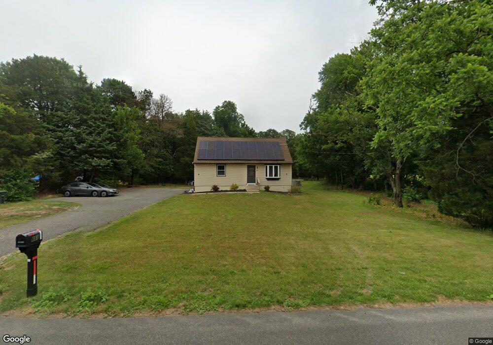
668 Main Rd Vineland, NJ 08360
Franklin Township NeighborhoodEstimated Value: $318,000 - $351,272
--
Bed
--
Bath
1,185
Sq Ft
$287/Sq Ft
Est. Value
About This Home
This home is located at 668 Main Rd, Vineland, NJ 08360 and is currently estimated at $340,068, approximately $286 per square foot. 668 Main Rd is a home located in Gloucester County with nearby schools including Delsea Regional Middle School, Delsea Regional High School, and Edgarton Christian Academy.
Ownership History
Date
Name
Owned For
Owner Type
Purchase Details
Closed on
Jul 14, 2022
Sold by
Landicini Joseph B
Bought by
Murphy Shannon
Current Estimated Value
Home Financials for this Owner
Home Financials are based on the most recent Mortgage that was taken out on this home.
Original Mortgage
$270,019
Outstanding Balance
$257,201
Interest Rate
5.23%
Mortgage Type
FHA
Estimated Equity
$82,867
Purchase Details
Closed on
Dec 20, 2021
Sold by
Desimone Dorothy H and Desimone James
Bought by
Landicini Joseph B
Home Financials for this Owner
Home Financials are based on the most recent Mortgage that was taken out on this home.
Original Mortgage
$93,750
Interest Rate
2.27%
Mortgage Type
New Conventional
Create a Home Valuation Report for This Property
The Home Valuation Report is an in-depth analysis detailing your home's value as well as a comparison with similar homes in the area
Home Values in the Area
Average Home Value in this Area
Purchase History
| Date | Buyer | Sale Price | Title Company |
|---|---|---|---|
| Murphy Shannon | $275,000 | Saul Victor M | |
| Murphy Shannon | $275,000 | Saul Victor M | |
| Landicini Joseph B | $125,000 | Omega Settlement Sln Llc |
Source: Public Records
Mortgage History
| Date | Status | Borrower | Loan Amount |
|---|---|---|---|
| Open | Murphy Shannon | $270,019 | |
| Closed | Murphy Shannon | $270,019 | |
| Previous Owner | Landicini Joseph B | $93,750 |
Source: Public Records
Tax History Compared to Growth
Tax History
| Year | Tax Paid | Tax Assessment Tax Assessment Total Assessment is a certain percentage of the fair market value that is determined by local assessors to be the total taxable value of land and additions on the property. | Land | Improvement |
|---|---|---|---|---|
| 2025 | $6,166 | $159,700 | $31,500 | $128,200 |
| 2024 | $6,021 | $159,700 | $31,500 | $128,200 |
| 2023 | $6,021 | $159,700 | $31,500 | $128,200 |
| 2022 | $4,611 | $125,600 | $31,500 | $94,100 |
| 2021 | $4,295 | $125,600 | $31,500 | $94,100 |
| 2020 | $4,498 | $125,600 | $31,500 | $94,100 |
| 2019 | $4,435 | $125,600 | $31,500 | $94,100 |
| 2018 | $4,378 | $125,600 | $31,500 | $94,100 |
| 2017 | $4,291 | $125,600 | $31,500 | $94,100 |
| 2016 | $4,018 | $125,600 | $31,500 | $94,100 |
| 2015 | $3,851 | $125,600 | $31,500 | $94,100 |
| 2014 | $3,698 | $125,600 | $31,500 | $94,100 |
Source: Public Records
Map
Nearby Homes
- 1445 Catawba Ave
- 2810 Friendship St
- 1686 Catawba Ave
- 752 Harding Hwy
- 106 Nottingham Ln
- 3 Hunter Dr
- 108 Nottingham Ln
- 0 Main Ave Unit NJAC2014732
- 2281 N Main Rd
- 1355 Harding Hwy
- 768 E Garden Rd Unit 9
- 768 E Garden Rd Unit 7
- 269 E Garden Rd
- 330 E Forest Grove Rd
- 311 Catawba Ave
- 1510 E Wheat Rd
- 329 Stotesbury Ave
- Block 173 Lot 40 03
- 1547 E Wheat Rd
- 3431 N East Blvd
- 668 Main Rd
- 680 Main Rd
- 1264 Weymouth Rd
- 696 Main Rd
- 636 Main Rd
- 0 Weymouth Rd Unit 1000120262
- 0 Weymouth Rd Unit 363721
- 0 Weymouth Rd Unit 7123485
- 0 Weymouth Rd Unit 7123482
- 0 Weymouth Rd Unit 1005266020
- 655 Main Rd
- 697 Main Rd
- 1231 Weymouth Rd
- 1194 Weymouth Rd
- 614 Main Rd
- 1231 Weymouth Rd
- 1209 Weymouth Rd
- 1261 Weymouth Rd
- 1293 Weymouth Rd
- 1180 Weymouth Rd