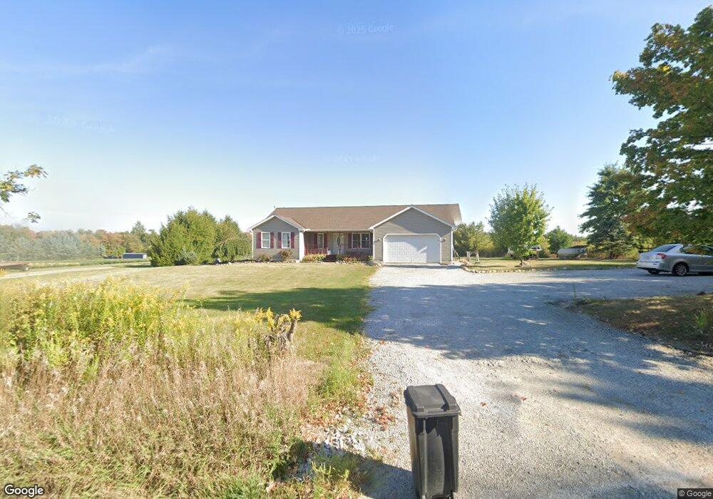
668 State Route 302 Ashland, OH 44805
Estimated Value: $290,583 - $348,000
3
Beds
2
Baths
1,588
Sq Ft
$201/Sq Ft
Est. Value
About This Home
This home is located at 668 State Route 302, Ashland, OH 44805 and is currently estimated at $319,896, approximately $201 per square foot. 668 State Route 302 is a home located in Ashland County with nearby schools including Mapleton Elementary School, Mapleton Middle School, and Mapleton High School.
Ownership History
Date
Name
Owned For
Owner Type
Purchase Details
Closed on
Dec 23, 2016
Sold by
Gary Fortney
Bought by
Kramer Reid J
Current Estimated Value
Purchase Details
Closed on
Mar 29, 2006
Sold by
Fortney Gary
Bought by
Kramer Reid J
Purchase Details
Closed on
Jul 14, 2005
Bought by
Fortney Gary
Create a Home Valuation Report for This Property
The Home Valuation Report is an in-depth analysis detailing your home's value as well as a comparison with similar homes in the area
Home Values in the Area
Average Home Value in this Area
Purchase History
| Date | Buyer | Sale Price | Title Company |
|---|---|---|---|
| Kramer Reid J | -- | -- | |
| Kramer Reid J | $142,000 | -- | |
| Fortney Gary | -- | -- |
Source: Public Records
Tax History Compared to Growth
Tax History
| Year | Tax Paid | Tax Assessment Tax Assessment Total Assessment is a certain percentage of the fair market value that is determined by local assessors to be the total taxable value of land and additions on the property. | Land | Improvement |
|---|---|---|---|---|
| 2024 | $2,279 | $69,000 | $7,540 | $61,460 |
| 2023 | $2,279 | $69,000 | $7,540 | $61,460 |
| 2022 | $2,050 | $55,200 | $6,030 | $49,170 |
| 2021 | $2,054 | $55,200 | $6,030 | $49,170 |
| 2020 | $1,908 | $55,200 | $6,030 | $49,170 |
| 2019 | $1,600 | $44,930 | $5,990 | $38,940 |
| 2018 | $1,678 | $44,930 | $5,990 | $38,940 |
| 2017 | $1,533 | $44,930 | $5,990 | $38,940 |
| 2016 | $1,533 | $40,840 | $5,440 | $35,400 |
| 2015 | $1,476 | $40,840 | $5,440 | $35,400 |
| 2013 | $1,618 | $42,930 | $5,440 | $37,490 |
Source: Public Records
Map
Nearby Homes
- 885 State Route 58
- 900 County Road 801
- 829 County Road 801
- 1173 Township Road 753
- 0 Township Road 1275
- 686 County Road 1302
- 486 Township Road 1275
- 99 Harold Dr
- 32 Terrace Dr
- 95 Harold Dr
- 16 Terrace Dr
- 67 Harold Dr
- 3 Terrace Dr
- 1520 Orange Rd Unit 22
- 1520 Orange Rd
- 582 County Road 801
- 1191 State Route 511
- 1438 Peachtree Dr
- 945 Virginia Ave
- 0 Westlake Dr
- 668 Ohio 302
- 662 State Route 302
- 662 Ohio 302
- 672 Ohio 302
- 671 State Route 302
- 676 State Route 302
- 670 State Route 302
- 670 Ohio 302
- 659 State Route 302
- 657 State Route 302
- 650 Ohio 302
- 648 Ohio 302
- 648 State Route 302
- 675 State Route 302
- 675 State Route 302
- 675 Ohio 302
- 636 State Route 302
- 629 State Route 302
- 969 Township Road 713
- 705 State Route 302