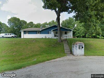
6682 State Road 45 Unionville, IN 47468
Estimated Value: $320,000 - $585,000
2
Beds
4
Baths
3,220
Sq Ft
$150/Sq Ft
Est. Value
About This Home
This home is located at 6682 State Road 45, Unionville, IN 47468 and is currently estimated at $481,903, approximately $149 per square foot. 6682 State Road 45 is a home with nearby schools including Brown County High School.
Ownership History
Date
Name
Owned For
Owner Type
Purchase Details
Closed on
Jan 31, 2018
Sold by
Penny Sue Scroggins Llc
Bought by
Gordon Raymn D
Current Estimated Value
Purchase Details
Closed on
Aug 19, 2016
Sold by
Sheriff Of Brown County
Bought by
Cupe Llc
Purchase Details
Closed on
Mar 9, 2015
Sold by
George Dalton R
Bought by
White Denton Wayne
Home Financials for this Owner
Home Financials are based on the most recent Mortgage that was taken out on this home.
Original Mortgage
$150,000
Interest Rate
3.56%
Mortgage Type
VA
Create a Home Valuation Report for This Property
The Home Valuation Report is an in-depth analysis detailing your home's value as well as a comparison with similar homes in the area
Home Values in the Area
Average Home Value in this Area
Purchase History
| Date | Buyer | Sale Price | Title Company |
|---|---|---|---|
| Gordon Raymn D | $230,000 | -- | |
| Cupe Llc | $142,886 | Attorney | |
| White Denton Wayne | -- | Attorney |
Source: Public Records
Mortgage History
| Date | Status | Borrower | Loan Amount |
|---|---|---|---|
| Previous Owner | White Denton Wayne | $150,000 | |
| Previous Owner | Green Farms Llc | $385,200 | |
| Closed | Cupe Llc | $0 |
Source: Public Records
Tax History Compared to Growth
Tax History
| Year | Tax Paid | Tax Assessment Tax Assessment Total Assessment is a certain percentage of the fair market value that is determined by local assessors to be the total taxable value of land and additions on the property. | Land | Improvement |
|---|---|---|---|---|
| 2024 | $950 | $336,500 | $35,800 | $300,700 |
| 2023 | $1,091 | $314,000 | $35,800 | $278,200 |
| 2022 | $1,135 | $289,900 | $30,800 | $259,100 |
| 2021 | $991 | $256,600 | $25,800 | $230,800 |
| 2020 | $856 | $245,400 | $20,800 | $224,600 |
| 2019 | $625 | $189,700 | $20,800 | $168,900 |
| 2018 | $748 | $182,600 | $20,800 | $161,800 |
| 2017 | $1,959 | $157,600 | $20,800 | $136,800 |
| 2016 | $2,454 | $204,500 | $32,100 | $172,400 |
| 2014 | $2,133 | $205,100 | $32,100 | $173,000 |
| 2013 | $2,133 | $201,500 | $32,100 | $169,400 |
Source: Public Records
Map
Nearby Homes
- 9578 E State Road 45
- 6517 Snug Harbour Ln
- 5557 Lanam Ridge Rd
- 4047 N Salmon Harbor Rd
- 4047 Salmon Harbor Rd
- 2558 Yellowwood Lake Rd
- 4184 Walker Ln
- 5374 State Road 45
- 7550 N Lakewood Dr
- 7600 N Blue Heron Dr
- 6900 N Richardson Rd
- 8899 E Southshore Dr
- 8781 E Southshore Dr
- 9550 E Northshore Dr
- 5288 E Northshore Dr
- 8713 Midview Dr
- 9548 E Northshore Dr
- 9504 E Northshore Dr
- 9494 E Northshore Dr
- 9235 Gray Ave
- 6682 State Road 45
- 6682 State Road 45
- 6682 State Road 45
- 6682 State Road 45
- 6682 State Road 45
- 6682 State Road 45
- 6682 State Road 45
- 6682 Indiana 45
- 6739 Indiana 45
- 6739 State Road 45
- 6619 State Road 45
- 6611 State Road 45
- 6611 State Road 45
- 6611 State Road 45
- 6822 State Road 45
- 6931 State Road 45
- 6986 State Road 45
- 6965 State Road 45
- 3184 County Line Rd
- 0000 County Line Rd