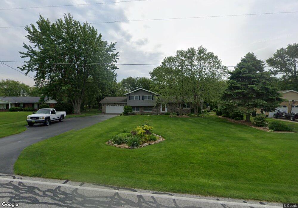
669 Baums Bridge Rd Kouts, IN 46347
Porter County NeighborhoodEstimated Value: $295,000 - $311,000
3
Beds
2
Baths
1,376
Sq Ft
$220/Sq Ft
Est. Value
About This Home
This home is located at 669 Baums Bridge Rd, Kouts, IN 46347 and is currently estimated at $302,116, approximately $219 per square foot. 669 Baums Bridge Rd is a home located in Porter County with nearby schools including Kouts Elementary School, Kouts Middle/High School, and Midwest Academy.
Ownership History
Date
Name
Owned For
Owner Type
Purchase Details
Closed on
Mar 26, 2025
Sold by
Dorothy A Mast Revocable Living Trust and Haines Donna Rea
Bought by
Muha Connor Stephen and Garcia Estefania Nicole
Current Estimated Value
Home Financials for this Owner
Home Financials are based on the most recent Mortgage that was taken out on this home.
Original Mortgage
$292,111
Outstanding Balance
$290,869
Interest Rate
6.87%
Mortgage Type
FHA
Estimated Equity
$11,247
Create a Home Valuation Report for This Property
The Home Valuation Report is an in-depth analysis detailing your home's value as well as a comparison with similar homes in the area
Home Values in the Area
Average Home Value in this Area
Purchase History
| Date | Buyer | Sale Price | Title Company |
|---|---|---|---|
| Muha Connor Stephen | $297,500 | Chicago Title |
Source: Public Records
Mortgage History
| Date | Status | Borrower | Loan Amount |
|---|---|---|---|
| Open | Muha Connor Stephen | $292,111 |
Source: Public Records
Tax History
| Year | Tax Paid | Tax Assessment Tax Assessment Total Assessment is a certain percentage of the fair market value that is determined by local assessors to be the total taxable value of land and additions on the property. | Land | Improvement |
|---|---|---|---|---|
| 2024 | $3,531 | $233,800 | $30,600 | $203,200 |
| 2023 | $3,391 | $229,200 | $29,400 | $199,800 |
| 2022 | $3,122 | $210,000 | $29,400 | $180,600 |
| 2021 | $2,990 | $182,700 | $29,400 | $153,300 |
| 2020 | $2,955 | $178,900 | $25,600 | $153,300 |
| 2019 | $2,786 | $163,100 | $25,600 | $137,500 |
| 2018 | $2,522 | $152,400 | $25,600 | $126,800 |
| 2017 | $2,537 | $152,300 | $25,600 | $126,700 |
| 2016 | $2,394 | $149,600 | $25,900 | $123,700 |
| 2014 | $2,397 | $142,000 | $25,300 | $116,700 |
| 2013 | -- | $138,200 | $26,300 | $111,900 |
Source: Public Records
Map
Nearby Homes
- 645 S 150 E
- 181 E 600 S
- 829 S Baums Bridge Rd
- 103 Mckinley St
- 204 N Main St
- Lot B4-5 St Road 8
- 401 Sutton Ave
- 401 S Sutton Ave
- 702 W Jefferson St
- 0 Vanessa Way Unit GNR544729
- 0 Sharyn St Unit GNR544743
- 0 Sharyn St Unit GNR544737
- 0 Sharyn St Unit GNR544741
- B1-3 State Road 8
- 0-Lot B6-7 State Road 8
- 1 E Jeflynn Ct
- 0 E 995 S
- 296 S 150 E
- 456 E 400 S
- 355 E 300 S
- 669 Baums Bridge Rd
- 671 S Baums Bridge Rd
- 671 Baums Bridge Rd
- 673 Baums Bridge Rd
- 667 Baums Bridge Rd
- 675 Baums Bridge Rd
- 669-1 Baums Bridge Rd
- 674 Baums Bridge Rd
- 665 Baums Bridge Rd
- 665 Baums Bridge Rd
- 670 Baums Bridge Rd
- 677 S Baums Bridge Rd
- 677 Baums Bridge Rd
- 662 Baums Bridge Rd
- 683 Baums Bridge Rd
- 662 S Baums Bridge Rd
- 659 S Baums Bridge Rd
- 659 Baums Bridge Rd
- 673 S 150 E
- 671 S 150 E
Your Personal Tour Guide
Ask me questions while you tour the home.