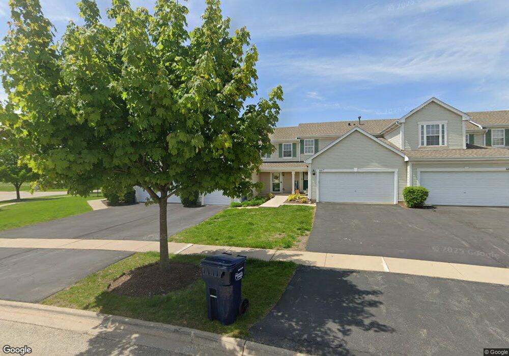
669 Chestnut Ridge Unit 10 Minooka, IL 60447
Estimated Value: $231,000 - $256,000
2
Beds
2
Baths
1,142
Sq Ft
$213/Sq Ft
Est. Value
About This Home
This home is located at 669 Chestnut Ridge Unit 10, Minooka, IL 60447 and is currently estimated at $242,805, approximately $212 per square foot. 669 Chestnut Ridge Unit 10 is a home located in Grundy County with nearby schools including Minooka Primary Center, Aux Sable Elementary School, and Minooka Junior High School.
Ownership History
Date
Name
Owned For
Owner Type
Purchase Details
Closed on
Jul 17, 2020
Sold by
Prieboy Harriet A
Bought by
Mcclintock Melissa
Current Estimated Value
Home Financials for this Owner
Home Financials are based on the most recent Mortgage that was taken out on this home.
Original Mortgage
$148,300
Interest Rate
3%
Mortgage Type
Construction
Create a Home Valuation Report for This Property
The Home Valuation Report is an in-depth analysis detailing your home's value as well as a comparison with similar homes in the area
Home Values in the Area
Average Home Value in this Area
Purchase History
| Date | Buyer | Sale Price | Title Company |
|---|---|---|---|
| Mcclintock Melissa | $165,000 | Citywide Title |
Source: Public Records
Mortgage History
| Date | Status | Borrower | Loan Amount |
|---|---|---|---|
| Previous Owner | Mcclintock Melissa | $148,300 |
Source: Public Records
Tax History Compared to Growth
Tax History
| Year | Tax Paid | Tax Assessment Tax Assessment Total Assessment is a certain percentage of the fair market value that is determined by local assessors to be the total taxable value of land and additions on the property. | Land | Improvement |
|---|---|---|---|---|
| 2024 | $4,885 | $60,897 | $7,752 | $53,145 |
| 2023 | $4,452 | $55,507 | $7,066 | $48,441 |
| 2022 | $3,659 | $51,610 | $6,570 | $45,040 |
| 2021 | $3,491 | $48,854 | $6,219 | $42,635 |
| 2020 | $3,666 | $46,733 | $5,949 | $40,784 |
| 2019 | $3,701 | $43,271 | $5,508 | $37,763 |
| 2018 | $3,795 | $43,305 | $5,446 | $37,859 |
| 2017 | $3,700 | $41,354 | $5,201 | $36,153 |
| 2016 | $3,476 | $38,819 | $4,882 | $33,937 |
| 2015 | $3,025 | $35,287 | $4,438 | $30,849 |
| 2014 | $2,757 | $33,340 | $4,193 | $29,147 |
| 2013 | $2,829 | $33,790 | $4,250 | $29,540 |
Source: Public Records
Map
Nearby Homes
- 1935 Waters Edge Dr
- 1941 Waters Edge Dr
- 825 Grant Dr
- 1404 Plantain Dr
- 1468 Sedge Pass
- 2080 Waters Edge Dr
- 1448 Sedge Pass
- 1413 Sedge Pass
- The Rosewood Plan at The Preserve At Heritage Woods - The Preserve at Heritage Woods
- The Lakewood Plan at The Preserve At Heritage Woods - The Preserve at Heritage Woods
- The Cedarwood Plan at The Preserve At Heritage Woods - The Preserve at Heritage Woods
- The Beechwood Plan at The Preserve At Heritage Woods - The Preserve at Heritage Woods
- 1420 Marigold Ln
- 324 Wabena Ct
- 25226 S Mallard Dr
- 1118 Burns Ln
- 27410 W Porto Ln
- 27357 W Porto Ln
- 25441 S Mallard Dr
- 1224 Burns Ln
- 669 Chestnut Ridge
- 671 Chestnut Ridge
- 667 Chestnut Ridge Unit 667
- 665 Chestnut Ridge
- 663 Chestnut Ridge Unit 663
- 663 Chestnut Ridge
- 601 Prairie View Dr
- 661 Chestnut Ridge
- 603 Prairie View Dr
- 605 Prairie View Dr
- 657 Chestnut Ridge
- 607 Prairie View Dr Unit 607
- 607 Prairie View Dr
- 655 Chestnut Ridge
- 609 Prairie View Dr Unit 1
- 530 Prairie View Dr
- 651 Chestnut Ridge
- 648 Chestnut Ridge Unit 648
- 528 Prairie View Dr